
More details
Collapse details
Date Published:
- January 1, 2008
- 3,049.26 KB
Song fragments recorded on a tagged juvenile humpback whale (Megaptera novaeangliae) on a winter feeding ground at the mouth of the Chesapeake Bay, Virginia, USA.
Marine Mammal Science. 2023.
40:e13110
More details
Collapse details
Date Published:
- January 27, 2023
- 2,300.13 KB
More details
Collapse details
Date Published:
Filesize:
- April 1, 2024
This report describes results from vessel surveys and visual species-verification trials conducted at the Jacksonville Shallow Water Training Range (JSWTR) in the Jacksonville Operating Area (OPAREA). This work continues from a multi-institutional monitoring program intended to provide information on the species composition, population identity, density, and baseline behavior of marine mammals and sea turtles present in United States (U.S.) Navy range complexes along the U.S. Atlantic Coast.
- 17,443.07 KB
More details
Collapse details
Date Published:
Filesize:
- March 1, 2019
This proof-of-concept study was undertaken to establish whether wild seals could be successfully captured and tagged in coastal Virginia, because this has not been previously attempted in this area. Further, the study sought to establish the feasibility of using satellite tags to better understand seals’ residency time in Virginia waters, their local habitat utilization patterns, and where they migrate to in the spring. The information gathered from this effort will provide valuable baseline data needed for the future assessment of harbor seal movements and site fidelity along the U.S. Eastern Seaboard.
- 8,747.20 KB
More details
Collapse details
Date Published:
Filesize:
- February 1, 2021
Since 2017, the Navy has undertaken telemetry (tagging) studies in order to characterize seals’ at-sea movements, habitat use, dive behavior, and the environmental variables that may influence their distribution and haul-out patterns. Location-only and depth-sensing tags, which track seals’ movements via satellite transmission, were deployed on seven harbor seals in 2018 and two in 2020 (no tags have been deployed to date on gray seals as part of this study).
- 7,852.03 KB
More details
Collapse details
Date Published:
Filesize:
- March 1, 2023
Key results from the 2018 and 2020 tags, detailed methods and results from the 2022 tagging efforts, and where appropriate, cumulative analyses of all 14 satellite-tracked tags deployed to date.
- 9,590.17 KB
More details
Collapse details
Date Published:
Filesize:
- June 1, 2022
Primary objectives of this project have included the following: Collect baseline occurrence data (location, sex, group size, behavior) of humpback whales (and other species of baleen whales, opportunistically), Obtain identification photographs of humpback whales for inclusion in regional and local catalogs, Collect biopsy samples of humpback whales for sex determination, mitochondrial control region sequencing and microsatellite genotyping of tissue samples, and stable isotope analysis to assess foraging related to prey consumption • Conduct satellite tagging to document seasonal humpback whale movement patterns in the nearshore waters off Virginia Beach, specifically whether the whales spend significant time in areas of high shipping traffic and/or areas of U.S. Navy training exercises
- 9,540.30 KB
More details
Collapse details
Date Published:
Filesize:
- May 1, 2025
A total of 23 nearshore and mid-shelf vessel surveys were completed during the 2023/24 field season. In total, 43 baleen whale sightings, including 33 sightings of humpback whales (Megaptera novaeangliae) composed of 43 individuals, 6 sightings of North Atlantic right whales (Eubalaena glacialis) composed of 9 individuals (1 deceased), 3 sightings of minke whales (Balaenoptera acutorostrata) composed of 3 individuals, and 1 sighting of a fin whale (Balaenoptera physalus) composed of 1 individual occurred during the 2023/24 field season.
- 3,198.45 KB
More details
Collapse details
Date Published:
Filesize:
- June 1, 2018
The objective of this multi-year project under the U.S. Navy’s Marine Species Monitoring Program has been to establish baseline information on occurrence and behavior of humpback whales near Naval Station Norfolk and within the Virginia Capes (VACAPES) Operating Area
- 6,005.42 KB
More details
Collapse details
Date Published:
Filesize:
- May 1, 2021
The objective of this multi-year project under the U.S. Navy’s Marine Species Monitoring Program has been to establish baseline information on occurrence and behavior of humpback whales near Naval Station Norfolk and within the Virginia Capes (VACAPES) Operating Area (OPAREA)
- 8,725.95 KB
More details
Collapse details
Date Published:
Filesize:
- August 1, 2017
The objective of this multi-year project under the U.S. Navy’s Marine Species Monitoring Program has been to establish baseline information on occurrence and behavior of humpback whales near Naval Station Norfolk and within the Virginia Capes (VACAPES) Operating Area by addressing the following questions: What age classes (juveniles, sub-adults, adults) are utilizing the waters within and adjacent to the mouth of the Chesapeake Bay? Do humpback whales exhibit site fidelity over periods of days to years? Do humpback whales congregate in specific high-traffic and/or high-use U.S. Navy training areas? Do humpback whales spend significant time within or move through areas of U.S. Navy live-fire and mine neutralization exercise (MINEX) training?
- 20,099.67 KB
More details
Collapse details
Date Published:
Filesize:
- July 1, 2019
The objective of this multi-year project under the U.S. Navy’s Marine Species Monitoring Program has been to establish baseline information on occurrence and behavior of humpback whales near Naval Station Norfolk and within the Virginia Capes (VACAPES) Operating Area by addressing the following questions: What age classes (juveniles, sub-adults, adults) are utilizing the waters within and adjacent to the mouth of the Chesapeake Bay? Do humpback whales exhibit site fidelity over periods of days to years? Do humpback whales congregate in specific high-traffic and/or high-use U.S. Navy training areas? Do humpback whales spend significant time within or move through areas of U.S. Navy live-fire and mine neutralization exercise (MINEX) training?
- 8,603.37 KB
More details
Collapse details
Date Published:
Filesize:
- May 1, 2020
The objective of this multi-year project under the U.S. Navy’s Marine Species Monitoring Program has been to establish baseline information on occurrence and behavior of humpback whales near Naval Station Norfolk and within the Virginia Capes (VACAPES) Operating Area by addressing the following questions: What age classes (juveniles, sub-adults, adults) are utilizing the waters within and adjacent to the mouth of the Chesapeake Bay? Do humpback whales exhibit site fidelity over periods of days to years? Do humpback whales congregate in specific high-traffic and/or high-use U.S. Navy training areas? Do humpback whales spend significant time within or move through areas of U.S. Navy live-fire and mine neutralization exercise (MINEX) training?
- 8,657.33 KB
Humpback whale affinity for shipping channels near the mouth of the Chesapeake Bay can prove fatal.
6th International Bio-logging Science Symposium .
More details
Collapse details
Date Published:
- September 25, 2017
- 5,778.32 KB
More details
Collapse details
Date Published:
Filesize:
- July 7, 2026
A total of 22 nearshore and mid-shelf vessel surveys were completed during the 2024/25 field season. In total, 60 baleen whale sightings, including 40 sightings of humpback whales (Megaptera novaeangliae) totaling 59 individuals, 10 sightings of North Atlantic right whales (NARWs; Eubalaena glacialis) totaling 22 individuals, 7 sightings of fin whales (Balaenoptera physalus) totaling 14 individuals, and 3 sightings of individual minke whales (Balaenoptera acutorostrata), occurred during the 2024/25 field season. A total of 24 aerial surveys were flown during the 2024/25 field season in association with this effort and the Offshore Cetacean Study (OCS) (A. Engelhaupt et al. 2026); see Ozog and Engelhaupt 2026 for additional details regarding the aerial surveys. Baleen whale sightings from the aerial surveys included humpback (n=45), NARWs (n=8), fin (n=11), and minke (n=3) whales (Ozog and Engelhaupt 2026). During the OCS surveys, baleen whale sightings included fin whales (n=12), humpback whales (n=7), a blue whale (Balaenoptera musculus; n=1), a minke whale (n=1), and an NARW (n=1) (A. Engelhaupt et al. 2026). Across this project and the OCS effort, satellite-linked telemetry tags were deployed on one humpback whale, one fin whale, and one NARW. Customized Animal Tracking Solution tags were deployed on two NARWs and two humpback whales. One biopsy sample was collected from the satellite-tagged humpback whale.
- 9,528.24 KB
A closer look at an unusual late-spring aggregation of North Atlantic right whales off Virginia using tag and environmental data.
North Atlantic Right Whale Consortium Annual Meeting, Providence, Rhode Island, 23–24 October 2024 .
More details
Collapse details
Date Published:
- February 13, 2026
More details
Collapse details
Date Published:
Filesize:
- February 1, 2024
Since January 2015, HDR Inc. has been monitoring humpback whales (Megaptera novaeangliae) to assess their occurrence, habitat use, and behavior within and near United States (U.S.) Navy training and testing areas off Virginia via the Mid-Atlantic Humpback Whale Monitoring Project.
- 4,043.06 KB
More details
Collapse details
Date Published:
Filesize:
- July 1, 2023
Since January 2015, HDR Inc. has been monitoring humpback whales (Megaptera novaeangliae) to assess their occurrence, habitat use, and behavior within and near United States (U.S.) Navy training and testing areas off Virginia via the Mid-Atlantic Humpback Whale Monitoring Project.
- 8,609.08 KB
Satellite telemetry reveals spatial overlap between vessel high-traffic areas and humpback whales (Megaptera novaeanglia) near the mouth of the Chesapeake Bay.
Frontiers in Marine Science. 2025.
7:121
More details
Collapse details
Date Published:
Publication:Ocean:Region:Species:Methods:
- March 11, 2025
From December 2015 to February 2017, 35 satellite tags were deployed on humpback whales to gain a better understanding on the occurrence, movements, site-fidelity, and overall behavior of this species within this high-traffic region.
Accounting for sampling bias reveals a decline in abundance of endangered false killer whales in the main Hawaiian Islands.
Endangered Species Research. 2025.
57:325–340
More details
Collapse details
Date Published:
Publication:Ocean:Region:Species:Methods:
- January 1, 2025
Volume contents Endang Species Res 57:325-340 (2025) DOI: https://doi.org/10.3354/esr01423 copied Accounting for sampling bias reveals a decline in abundance of endangered false killer whales in the main Hawaiian Islands Janelle J. Badger Robin W. Baird Devin S. Johnson Amanda L. Bradford Sabre D. Mahaffy Michaela A. Kratofil Tori Cullins Jens J. Currie Stephanie H. Stack Erin M. Oleson ABSTRACT: We estimated abundance of the endangered main Hawaiian Islands (MHI) insular population of false killer whales Pseudorca crassidens from 1999-2022 using a modeling technique that incorporates animal availability in a capture-recapture analysis. The population was sampled using different sampling methods, resulting in yearly encounter histories of 265 individuals and 53 satellite-tagged whales. Survey effort and animal location data were separately analyzed using kernel density estimators, and the degree of overlap between these 2 processes was used to model detection probability in a Bayesian Jolly-Seber population model. This approach better addresses spatiotemporally variable sampling effort than traditional capture-recapture methods, improving the estimation of reliable abundance trends. Using simulated data, the model was robust to many sampling and ecological complications, such as variable low detectability, unequal tag deployment lengths, and variable social group sizes. Fitting the model to the MHI false killer whale data set, we found that the insular population of false killer whales remains small, with an estimated 139 individuals (95% credible interval, CRI = [114, 162]) in 2022. The population appears to be in decline throughout the study period, with a mean annual percent change of -1.09 (95% CRI = [-2.11, -0.023]) over the entire time series and -3.51 (95% CRI = [-5.08, -1.88]) since 2013, when the population was listed as endangered. Given the magnitude of the decline, identifying which of the many factors affecting this population is most responsible is key in order to guide potential management responses.
More details
Collapse details
Date Published:
Filesize:
- November 1, 2018
In August 2017, a marine mammal monitoring project was carried out combining boat-based field efforts and passive acoustic monitoring on and around the Pacific Missile Range Facility (PMRF). Commander, Pacific Fleet (PACFLT) funded five days of small-boat effort and the National Marine Fisheries Service funded an additional six days of effort. Information obtained was compared to previous sightings during small-boat effort by Cascadia Research Collective (CRC) off Kauai and Niihau, during 1,119 hr of effort (19,194 km) over nine different years from 2003 through 2016 (see Baird 2016)
- 2,093.16 KB
More details
Collapse details
Date Published:
Filesize:
- February 13, 2020
As part of the long-term United States (U.S.) Navy-funded Marine Species Monitoring Program, from 16–24 August 2022, Cascadia Research Collective (CRC) carried out a vessel-based field effort in conjunction with passive acoustic monitoring undertaken by U.S. Navy (Navy) scientists on and around the underwater hydrophone ranges of the Pacific Missile Range Facility (PMRF).
- 2,743.90 KB
More details
Collapse details
Date Published:
Filesize:
- November 30, 2023
As part of the long-term United States (U.S.) Navy-funded Marine Species Monitoring Program, from 5-13 August 2023, Cascadia Research Collective (CRC) carried out a vessel-based field effort in conjunction with passive acoustic monitoring undertaken by U.S. Navy (Navy) scientists on and around the underwater hydrophone ranges of the Pacific Missile Range Facility (PMRF).
- 2,846.35 KB
More details
Collapse details
Date Published:
Filesize:
- February 13, 2022
As part of the long-term United States (U.S.) Navy-funded Marine Species Monitoring Program, from 1-14 August 2021, a combination of boat-based field effort and passive acoustic monitoring was carried out on and around the underwater hydrophone ranges of the Pacific Missile Range Facility (PMRF).
- 4,288.46 KB
More details
Collapse details
Date Published:
Filesize:
- July 17, 2015
The purpose of this report is to summarize information obtained through the remote deployment of Low-Impact Minimally-Percutaneous External-electronics Transmitter (LIMPET) satellite tags on odontocete cetaceans off Cape Hatteras, North Carolina, in 2014. This study was undertaken to provide information on spatial use and diving behavior of a number of species of odontocetes, with particular emphasis on Cuvier’s beaked whales (Ziphius cavirostris) and short-finned pilot whales (Globicephala macrorhynchus).
- 2,545.14 KB
More details
Collapse details
Date Published:
Filesize:
- July 28, 2016
The present work is intended to complement ongoing research by Duke University off Cape Hatteras (hereinafter referred to as the Duke program) by providing information on the movement and diving behavior of these species over the medium term (weeks to months). The Duke program is focusing on shorter-term dive behavior (i.e., hours to days) using Digital Acoustic Tags and longer-term movements (i.e., months to years) using photo-identification (photo-ID) techniques
- 5,058.82 KB
More details
Collapse details
Date Published:
Filesize:
- August 1, 2017
. This report summarizes information obtained through additional field efforts undertaken in 2016, while incorporating results from the first two years of effort. The present work is intended to complement ongoing research by Duke University off Cape Hatteras (hereinafter referred to as the Duke program) by providing information on the movement and diving behavior of these species over the medium term (weeks to months)
- 11,433.38 KB
More details
Collapse details
Date Published:
Filesize:
- March 1, 2018
This work builds upon and complements longer-term studies of movements and site fidelity of both Cuvier’s beaked whales (Ziphius cavirostris) and short-finned pilot whales (Globicephala macrorhynchus) off the North Carolina coast using photo-identification (photo-ID)
- 4,344.84 KB
More details
Collapse details
Date Published:
Filesize:
- June 1, 2019
This work builds upon and complements longer-term studies of movements and site fidelity of both Cuvier’s beaked whales (Ziphius cavirostris) and short-finned pilot whales (Globicephala macrorhynchus) off the North Carolina coast using photo-identification (photo-ID)
- 2,642.94 KB
More details
Collapse details
Date Published:
Filesize:
- October 1, 2019
A number of species of resident and non-resident odontocetes use the waters of the Kaulakahi Channel between Kaua‘i and Ni‘ihau, overlapping with the Pacific Missile Range Facility (PMRF). Submarine Command Courses (SCCs) held at PMRF provide an opportunity to assess exposure and measure odontocete reactions to mid-frequency active sonar (MFAS) being used in realistic training scenarios. The primary goal of this assessment was to estimate MFAS received levels (RLs) for satellite tagged odontocetes and determine whether any large-scale movements occurred in response to hull-mounted surface ship MFAS exposure. Two prior reports have used odontocete satellite tag data and information on MFAS use to estimate RLs for animals tagged in 2011 through 2015.
- 2,845.77 KB
More details
Collapse details
Date Published:
Filesize:
- June 1, 2017
The U.S. Navy’s marine species monitoring program addresses four general topics surrounding the impact of midfrequency active sonar (MFAS) on protected species: occurrence, exposure, response, and consequences. Occurrence of odontocete cetaceans on and around the Pacific Missile Range Facility (PMRF) has been studied for several years using a combination of satellite tags and photo-identification, demonstrating the existence of resident populations of several species of odontocetes and resulting in considerable information on diving behavior and movement patterns of these species.
- 5,755.31 KB
More details
Collapse details
Date Published:
Filesize:
- May 30, 2014
The Pacific Missile Range Facility (PMRF) off the island of Kaua‘i is the site of regular United States (U.S.) Navy training, some of which involves mid-frequency active sonar (MFAS) use from different types of military sound sources. PMRF includes acoustic instrumentation which allows for passive acoustic monitoring (PAM) capabilities to detect and localize sounds such as vocalizing marine mammals. Recent boat-based studies at PMRF have utilized real-time PAM (in conjunction with the Marine Mammal Monitoring on Navy Ranges project) to detect odontocetes for vectoring a field tagging boat to groups in order to increase the likelihood of deploying satellite tags. The resulting data have allowed for an assessment of habitat use and range of several different species. Some of these boat-based tagging efforts were timed to occur just before Submarine Commanders Courses (SCCs) occurring on PMRF so that animal movements and diving behavior could be measured both before and during sonar use.
- 1,819.34 KB
More details
Collapse details
Date Published:
Filesize:
- May 1, 2024
As part of the long-term United States (U.S.) Navy-funded Marine Species Monitoring Program, from 11–19 February 2024, Cascadia Research Collective (CRC) carried out a vessel-based field effort in conjunction with passive acoustic monitoring undertaken by the U.S. Navy (Navy) scientists on and around the underwater hydrophone ranges of the Pacific Missile Range Facility (PMRF). The effort was timed to occur immediately prior to the start of a Submarine Command Course (SCC) to allow for collection of movement and dive data that could be used to examine exposure and response of cetaceans to Navy mid-frequency active sonar (MFAS; see Henderson et al. 2021). Eight days of field effort were funded by the Navy, and one day of field work was funded by National Oceanic and Atmospheric Administration (NOAA) Fisheries. Wildlife Computers SPLASH10-F satellite tags were funded by the Navy for deployment on Navypriority species, and additional tags were provided by Wildlife Computers or CRC for deployment on other species (e.g., humpback whales [Megaptera novaeangliae]). Tags were programmed to collect dive behavior and Fastloc®-Global Positioning System (GPS) data from the time deployed until three and a half days after the end of the SCC and continue to transmit the dive and Fastloc®-GPS data for an additional six days. Starting on either May 2nd or May 3rd, the tags were duty cycled to transmit only every second day, to provide longer-term tracks of individual movements. During the period that tags were collecting dive and Fastloc®-GPS data, tags were programmed to try to obtain Fastloc®-GPS locations only for the 12 hours of the day when there were no or limited satellite overpasses. This programming change from previous Kauaʻi field efforts was taken to minimize temporal gaps in location data during the period that overlapped with and immediately followed the SCC. Field efforts were undertaken out of Kikiaola small boat harbor when conditions allowed for working on or near PMRF, or out of Port Allen when conditions on or near PMRF were not workable.
- 4,707.83 KB
More details
Collapse details
Date Published:
Filesize:
- February 1, 2011
Movements and Spatial Use of Satellite‐tagged Odontocetes in the Western Main Hawaiian Islands: Results of Fieldwork Undertaken off O‘ahu in October 2010 and Kaua‘i in February 2011
- 1,236.87 KB
More details
Collapse details
Date Published:
Filesize:
- June 7, 2012
Although considerable information is available on residency patterns and spatial use of odontocetes in the eastern half of the Hawai‘i Range Complex (HRC), much less is known about odontocetes in the western half of the HRC. In the second year of a three-year effort in the western main Hawaiian Islands we undertook surveys off Kaua‘i and Ni‘ihau in July/August 2011, to examine spatial use and residency patterns using satellite tags, to provide visual verification of acoustically-detected odontocetes on the Pacific Missile Range Facility (PMRF), and to obtain individual identification photographs and biopsy samples for assessment of population identity and structure.
- 3,048.07 KB
More details
Collapse details
Date Published:
Filesize:
- August 27, 2012
As part of an assessment of habitat use and movements of odontocetes being undertaken in the western half of the main Hawaiian Islands (see Baird et al. 2011, 2012), field operations funded by Commander, U.S. Navy Pacific Fleet were undertaken off of Kaua‘i in January 2012. There were two primary goals of these operations: 1) providing species verification for acoustic detections by the Marine Mammal Monitoring on Navy Ranges (M3R) project on the Pacific Missile Range Facility (PMRF) hydrophone range (see Moretti et al. 2012); and 2) deploying satellite tags prior to a Submarine Commanders Course (SCC) training event to be undertaken off Kaua‘i in February 2012.
- 2,519.53 KB
More details
Collapse details
Date Published:
Filesize:
- November 8, 2013
Here we combine results of field efforts funded through the U.S. Navy’s Living Marine Resources Program (through a three-year grant from the Naval Postgraduate School) as well as additional field time in the study area in 2011 and 2012 funded through the Pacific Islands Fisheries Science Center and Commander, Pacific Fleet. We also utilize results from research efforts in the eastern main Hawaiian Islands, off Lāna‘i, Maui, and Hawai‘i Island, to help interpret results from photo-identification and satellite tagging.
- 2,159.00 KB
More details
Collapse details
Date Published:
Filesize:
- December 16, 2013
A joint project in February 2013 of the Pacific Missile Range Facility (PMRF) combined passive acoustic monitoring and boat-based field efforts. There were 1,010 kilometers (km) (55.9 hours [hr]) of small-vessel field effort over the course of the 8-day project. Of the 55.9 hr of survey effort, 64.2 percent was spent within the PMRF instrumented hydrophone range boundaries, and 14.8 percent of the effort was in depths greater than 1,000 meters (m).
- 2,028.91 KB
More details
Collapse details
Date Published:
Filesize:
- February 5, 2013
A joint project in July and August 2013 on and around the Pacific Missile Range Facility (PMRF) combined passive acoustic monitoring and boat-based field efforts. There were 671 kilometers (36.6 hours [hr]) of small-vessel survey effort over the course of the 8-day project, with 55.1 percent of time (20.2 hr) spent within the PMRF instrumented hydrophone range boundaries. A total of 33.0 hr of acoustic monitoring coincided with the small-vessel field effort.
- 2,118.63 KB
More details
Collapse details
Date Published:
Filesize:
- April 24, 2015
A joint project in February 2014 on and around the Pacific Missile Range Facility (PMRF) was carried out utilizing combined passive acoustic monitoring and boat-based field efforts. There were 1,287 kilometers (km) (66.3 hours [hr]) of small-vessel survey effort over the course of the 10 day project, with 44.6 percent of search time (29.6 hr) spent within the PMRF instrumented hydrophone range boundaries. A total of 81.7 hr of acoustic monitoring was undertaken during the field effort. There were 26 sightings of five species of odontocetes, six of which were directed by acoustic detections from the Marine Mammal Monitoring on Navy Ranges (M3R) system.
- 6,792.21 KB
More details
Collapse details
Date Published:
Filesize:
- May 2, 2016
A joint project in February 2015 on and around the Pacific Missile Range Facility (PMRF) was carried out utilizing combined boat-based field efforts and passive acoustic monitoring from the Marine Mammal Monitoring on Navy Ranges (M3R) system. There were 1,132 kilometers (63.4 hours [hr]) of small-vessel survey effort over the course of the 13-day project. Weather conditions precluded field operations on 4 days, and strong westerly winds and/or range operations limited access to PMRF on seven additional days, with only 15.1 percent of search time (9.6 hr) spent within the range boundaries.
- 2,992.69 KB
More details
Collapse details
Date Published:
Filesize:
- June 1, 2017
As part of a long-term U.S. Navy-funded marine mammal monitoring program, in February 2016 a combining boat-based field effort and passive acoustic monitoring was carried out on and around the Pacific Missile Range Facility (PMRF). The U.S. Navy funded five days of small-boat effort and the National Marine Fisheries Service funded an additional two days of effort. There were 859 kilometers (49 hours) of small-vessel survey effort over the course of the seven day project.
- 2,847.59 KB
More details
Collapse details
Date Published:
Filesize:
- July 24, 2018
As part of a long-term U.S. Navy-funded marine mammal monitoring program, in August 2017 a combination of boatbased field effort and passive acoustic monitoring was carried out on and around the Pacific Missile Range Facility (PMRF) off Kaua‘i prior to a Submarine Command Course scheduled for mid-August 2017. The U.S. Navy funded five days of small-boat effort and the National Marine Fisheries Service funded an additional six days of effort. There were 1,113 kilometers (77.4 hours) of small-vessel survey effort over the course of the 11 day project.
- 4,400.14 KB
More details
Collapse details
Date Published:
Filesize:
- June 7, 2019
As part of a long-term U.S. Navy-funded marine mammal monitoring program, in August 2018 a combination of vessel-based field effort and passive acoustic monitoring was carried out on and around the Pacific Missile Range Facility (PMRF) Kaua‘i prior to a Submarine Commander Course scheduled for mid-August 2018. The purpose of the monitoring effort was to assess the spatial movement patterns and habitat use of cetaceans that are exposed to mid-frequency active sonar and how those patterns influence exposure and potentially responses.
- 10,036.77 KB
More details
Collapse details
Date Published:
Filesize:
- February 1, 2021
As part of a long-term U.S. Navy-funded marine mammal monitoring program, in February 2020 a combination of vesselbased field effort and passive acoustic monitoring was carried out on and around the Pacific Missile Range Facility (PMRF) off Kaua‘i prior to a Submarine Command Course scheduled for mid-February 2020. The purpose of the monitoring effort was to assess the spatial movement patterns and habitat use of cetaceans that are exposed to midfrequency active sonar and how those patterns influence exposure and potentially responses. Results from this effort were compared with previous Cascadia Research Collective (CRC) survey effort and photo-identification and tag data from Kaua‘i, based on surveys in 11 different years since 2003.
- 4,010.56 KB
Effects of Navy sonar on whales and dolphins in the Hawaiian Islands: some data, some speculation, some gaps..
Presentation to the Hawaiian Islands Humpback Whale National Marine Sanctuary Advisory Council (virtual event) .
More details
Collapse details
Date Published:
- September 15, 2020
- 5,898.74 KB
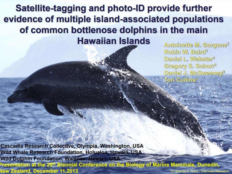
LIMPET tagging of Hawaiian odontocetes: Assessing reproduction and estimating survival of tagged and non-tagged individuals.
20th Biennial Conference on the Biology of Marine Mammals .
More details
Collapse details
Date Published:
- December 9, 2013
- 2,262.75 KB
More details
Collapse details
Date Published:
Ocean:Region:Species:Methods:
- March 1, 2021
We assess spatiotemporal overlap between false killer whales and nearshore fisheries in Hawai‘i to identify fisheries and regions where interactions are most likely to occur. Interactions with fisheries was cited as the greatest threat to this population's viability as a result of growing evidence over recent decades. We used false killer whale location data from 38 satellite tag deployments (2007–2018) and commercial fishery catch logs from a corresponding period to develop fishery overlap indices (FOIs) from a perspective that should reflect the experience of local fishermen
Combining association and movement analyses of short-finned pilot whales in the Hawaiian Islands: evidence for multiple populations within the Hawaiian Archipelago.
20th Biennial Conference on the Biology of Marine Mammals .
More details
Collapse details
Date Published:
Filesize:
- December 9, 2013
Currently a single stock of short-finned pilot whales is recognized in Hawaiian waters, with an estimated abundance of over 12,000 individuals in the EEZ. However, preliminary genetic results suggest that pilot whales around the main Hawaiian Islands are reproductively isolated from those elsewhere in the tropical Pacific. Since the type and extent of anthropogenic interactions varies both among the main Hawaiian Islands and offshore, we test the hypothesis that there is only a single stock of this species in Hawai‘i using a combination of association analyses of photo-identification data and movement/habitat use analyses from satellite tags. Photographs over 13 years included over 6,500 identifications of 868 distinctive individuals. Satellite tag data from 64 deployments averaged 37 days (max=228 days). Combining tag and association analyses indicate individuals do not mix freely among the islands and suggest the existence of three socially isolated but partially overlapping insular communities and an offshore population. The ranges of the three insular communities are from Ni‘ihau to western O‘ahu, from O‘ahu to Lana‘i, and primarily off Hawai‘i Island. Tagged individuals from these insular communities (n=61 deployments) remained an average of 57.5 km from their tagging location, with a grand mean of depth used and distance from shore of 1,564 m and 15.2 km, respectively. Evidence for an offshore population comes from three individuals tagged in two isolated social clusters with mean distances from their tagging locations of 249 km, with a grand mean of depth used and distance from shore of 4,336 m and 81.1 km (max=381 km) respectively. Anthropogenic interactions vary among the population ranges, with long-line fishing in offshore waters, Navy activities primarily off Ni‘ihau, Kaua‘i and O‘ahu, and vessel-based whale watching and swim-with operations primarily off Hawai‘i Island. As each community is exposed to different anthropogenic threats they should be managed independently.
- 5,597.02 KB
Long-term strategies for studying rare species: results and lessons from a multi-species study of odontocetes around the main Hawaiian Islands.
Pacific Conservation Biology. 2023.
30:PC23027
More details
Collapse details
Date Published:
- June 5, 2023
- 3,091.12 KB
More details
Collapse details
Date Published:
Filesize:
- August 1, 2016
The ultimate goal of this study is to provide the United States (U.S.) Navy with the necessary data to help identify seasonal areas where cheloniid sea turtles are likely to occur in order to inform U.S. Navy environmental planning efforts. This project focuses on the three cheloniid sea turtle species commonly seen in Virginia.
- 4,712.58 KB
More details
Collapse details
Date Published:
Filesize:
- June 1, 2017
The goal of this report is to provide the United States (U.S.) Department of the Navy (Navy) with the necessary data to help identify seasonal areas where Kemp’s ridley and green turtles are likely to occur in order to inform Navy environmental planning efforts.
- 1,296.69 KB
More details
Collapse details
Date Published:
Filesize:
- April 1, 2018
Five species of sea turtles occur in Chesapeake Bay and the coastal waters of Virginia with varying regularity. They include the loggerhead turtle (Caretta caretta), Kemp’s ridley turtle (Lepidochelys kempii), green turtle (Chelonia mydas), leatherback turtle (Dermochelys coriacea), and hawksbill turtle (Eretmochelys imbricata) (Musick and Limpus 1997). Loggerhead and Kemp’s ridley turtles are the most abundant and regularly occurring species, and green turtle numbers have increased over the past two decades in Virginia (Barco et al. 2015, Swingle et al. 2014, 2015, 2016).
- 1,259.42 KB
More details
Collapse details
Date Published:
Filesize:
- April 1, 2014
The goal of the project is to assess the occurrence, habitat use, and behavior of loggerhead, green, and Kemp's ridley turtles in the Hampton Roads region to better assess the impacts that U.S. Navy activities may have on these protected species.
- 1,337.08 KB
More details
Collapse details
Date Published:
Filesize:
- February 28, 2015
The ultimate goal of this study is to provide the US NAVY with the necessary data to help identify seasonal areas where cheloniid sea turtles are likely to occur in order to inform DOD sea turtle protection efforts. This project focuses on the three cheloniid sea turtle species commonly seen in Virginia, which are the loggerhead sea turtle, Kemp’s ridley sea turtle, and green sea turtle (Hager 2014).
- 6,910.62 KB
More details
Collapse details
Date Published:
Filesize:
- March 1, 2019
Kemp’s Ridley Tagging and Tracking in Chesapeake Bay and Costal Waters of Virginia: Final Report
- 285.40 KB
Acoustic telemetry with sea turtles in Virginia.
GARSCON 2015 (Greater Atlantic Region Stranding Conference 2015). .
More details
Collapse details
Date Published:
Filesize:
- October 1, 2015
The Virginia Aquarium Foundation (VAQF) and the U.S. Navy have been working together since 2013 to determine the efficacy of using acoustic telemetry for investigating the fine scale movements of sea turtles in the vicinity of Navy facilities in southeastern Virginia. To date, we have deployed 56 acoustic tags (VEMCO V16, V13 and V9 69 kilohertz tags), 14 from Jul-Nov of 2013, 24 in 2014 and 18 May-Jul of 2015. The U.S. Navy maintains an array of 71 acoustic receivers (VEMCO VR2W) in southeastern Virginia and downloads and processes data every other month. There is a four to six month delay from the time of detection to VAQF receiving processed tag detection data. For this reason, we will discuss results for turtles tagged in 2013 and 2014. Of the 38 turtles tagged in 2013-14, five were wild caught (incidentally or directly captured) and 33 were stranded, rehabilitated and released. Of the stranded turtles, 14 were caught on recreational hook and line, 13 were cold-stunned and the rest were boat strikes (n=3), diseased (n=2) or entangled in other gear (n=1). In total we deployed tags on 18 loggerheads, 15 Kemp’s ridleys (one was released twice) and 4 green turtles. Of these 15 (83%) of the loggerheads were detected, 11 (73%) of the Kemp’s ridleys were detected and 3 (75%) of the greens were detected. Seven of the turtles stranded dead since release (3 wild and 4 stranded) and of these one was never detected. Seven turtles were released after mid-Oct south of the Navy receiver array and, of these, four were never detected. For loggerheads, Kemp’s and greens that were detected, mean number of detections were 220, 57, and 187, number of different days detected were 6, 3, and 10, and days post-release were 97, 21, and 53 respectively.
- 9,579.31 KB
Loggerhead turtle Caretta caretta density and abundance in Chesapeake Bay and the temperate ocean waters of the southern portion of the Mid-Atlantic Bight.
Endangered Species Research. 2018.
37: 269-287
More details
Collapse details
Date Published:
Publication:Ocean:Region:Species:Methods:
- December 13, 2018
We conducted aerial surveys of sea turtles in 2011 and 2012, incorporating corrections for perception and availability bias in Chesapeake Bay and near-shore continental shelf waters of the Mid-Atlantic Bight off the US states of Virginia and Maryland. Results of these surveys and ancillary research to determine surface times for loggerhead turtles provide us with a new baseline population estimate for turtles in the region. Prior surveys were conducted in Chesapeake Bay in the mid-1980s and early 2000s, and in ocean waters in the late 1970s and early 1980s. Although comparison of density estimates not corrected for availability between prior surveys and this effort suggests that the population of sea turtles, especially loggerhead turtles, is higher than previous estimates, differences between surveys may be the result of survey methodologies and cannot be assumed to be true changes in density. Surface time for availability corrections was calculated using dive summaries from satellite telemetry on 27 loggerhead turtles tracked between 2011 and 2015. We calculated stratified seasonal availability corrections for bay and ocean waters based on assumed differences in turtle behavior and water clarity between the 2 habitats. For each habitat, we provided seasonal corrections for 3 detection depth bins (shallow, moderate, and deep) to account for differences in sub-surface detection ranges. Differences and trends toward differences among availability corrections underscore the need to better understand the many variables that affect surface time for sea turtles in temperate waters, and the effect that availability has on abundance and density estimates.
A Comparison of Diving Behavior of Goose-beaked Whales and Dense-beaked Whales From Tagging Studies in Multiple Ocean Basins.
Marine Mammal Science. 2025.
mms70070
More details
Collapse details
Date Published:
- September 17, 2025
Variation in dive behavior of Cuvier's beaked whales with seafloor depth, time-of-day, and lunar illumination.
Marine Ecology Progress. 2020.
644:199–214
More details
Collapse details
Date Published:
- January 1, 2020
Beaked whales and El Niño: evidence for ENSO effects on Blainville’s beaked and goose-beaked whale space use in Hawaiian waters.
Marine Ecology Progress. 2024.
751:189–209.
More details
Collapse details
Date Published:
- December 19, 2024
A comparative spatial analysis of location data from satellite-tagged Blainville’s (Mesoplodon densirostris) and Cuvier’s (Ziphius cavirostris) beaked whales off Hawaii Island..
26th Annual Meeting of the Northwest Student Chapter of the Society for Marine Mammalogy, May 6, 2023, Newport, Oregon .
More details
Collapse details
Date Published:
- May 6, 2023
- 5,049.97 KB
More details
Collapse details
Date Published:
Filesize:
- March 6, 2024
For the period of funding, Dr. Will Gough has been working at the Marine Mammal Research Program (MMRP) on a number of goals that will build capacity within Hawaii and advance the Navy’s goals related to the long-term health of protected marine mammal species. These goals relate to Dr. Gough’s expertise working with accelerometry-based biologging tags and include: setting up infrastructure at the MMRP to maintain large quantities of tag data, collecting novel data and expanding existing datasets through field efforts, training members of the Navy and MMRP to work effectively with accelerometry data and biologging devices, develop training materials and short-form workshops to disseminate knowledge of accelerometry data processing and analysis more broadly within the Hawaiian community, and use new and existing datasets to answer questions of relevance to the Navy and other organizations tasked with monitoring and management of protected species.
- 271.70 KB
More details
Collapse details
Date Published:
Filesize:
- January 3, 2023
For the last five months, Dr. Will Gough has been working at the Marine Mammal Research Program (MMRP) on a number of goals that will build capacity within Hawaii and advance the Navy’s goals related to the long-term health of protected marine mammal species. These goals relate to Dr. Gough’s expertise working with accelerometry-based biologging tags and include: setting up infrastructure at the MMRP to maintain large quantities of tag data, collecting novel data and expanding existing datasets through field efforts, training members of the Navy and MMRP to work effectively with accelerometry data and biologging devices, develop training materials and short-form workshops to disseminate knowledge of accelerometry data processing and analysis more broadly within the Hawaiian community, and use new and existing datasets to answer questions of relevance to the Navy and other organizations tasked with monitoring and management of protected species.
- 220.81 KB
More details
Collapse details
Date Published:
Filesize:
- January 1, 2024
Three subsurface passive acoustic moorings were deployed in the western Gulf of Alaska on the EcoFOCI fall mooring cruise onboard the F/V Aquila 15 Aug – 14 Sep 2023; recovery is planned for September 2024, funding permitting. These mooring will allow investigation into the seasonal occurrence of many species of vocalizing marine mammals including North Pacific right (NPRW), blue, fin, humpback, minke, gray, sperm, killer, and beaked whales, Dall’s and harbor porpoise, general pinniped sounds, and anthropogenic noise sources such as vessels and seismic airguns. This is important data that the Navy needs to prepare environmental planning documentation, including those for the National Environmental Policy Act (NEPA), Marine Mammal Protection Act (MMPA), and ESA documents and consultations. It is also needed to inform the National Marine Fisheries Service Alaska Regional Office’s NPRW critical habitat expansion decision. In addition to the field work, processing of existing passive acoustic recordings from three moorings in the WGOA is ongoing, with one site (Barnabus Trough) completed for the high-frequency band. Killer whale vocalizations were detected on 214 of the 358 days with recordings.
- 1,129.99 KB
Vessel strike encounter risk model informs mortality risk for endangered North Atlantic right whales along the United States east coast.
Scientific Reports. 2025.
736 (2025). https://doi.org/10.1038/s41598-024-84886-z
More details
Collapse details
Date Published:
- January 3, 2025
Seasonal changes in physical oceanography modulate cetacean predator-prey dynamics in the San Diego Trough.
Marine Ecology Progress. 2025.
762:111–133
More details
Collapse details
Date Published:
Publication:Ocean:Region:Species:Methods:
- June 12, 2025
In marine ecosystems, cetaceans are large mobile predators that depend on maximizing foraging efficiency. Their presence within a habitat can therefore be strongly related to the modulation of local prey by oceanographic conditions. Understanding how cetaceans are impacted by prey responses to the physical environment is challenging due to the difficulty of collecting presence data of cetaceans and their prey over long, comparable time periods. We used passive and active acoustic recordings collected from moorings within the San Diego Trough, along with physical oceanographic sampling (i.e. in situ, satellite-derived, and ocean general circulation model measurements), to elucidate relationships between cetaceans, their prey, and the physical environment. Our results show that the predator-prey dynamics of some cetaceans within the San Diego Trough are influenced by seasonal changes in the physical oceanographic conditions and processes that shape their prey resources. Specifically, common dolphin Delphinus delphis foraging activity increased during conditions associated with increased presence of diel vertically migrating fish prey. Blue whale Balaenoptera musculus foraging-associated acoustic activity increased during periods with increased presence of mid-water crustacean zooplankton and was replaced with breeding-associated acoustic activity during conditions associated with the waning of mid-water crustacean zooplankton. Fin whale B. physalus foraging-associated calling activity was more complex to model, most likely because these animals have a generalist diet and occupy this area year-round. Our results highlight environmental conditions and features relevant to cetaceans inhabiting this region and may aid in developing better spatially explicit management actions.
Navy collaborates, monitors to better understand sea turtle movements in San Diego Bay.
Currents (Navy's Environmental Magazine). 2015.
Winter 2015/2016:6-13
More details
Collapse details
Date Published:
Filesize:
- December 1, 2015
Since the closure of a power plant in the southern part of San Diego Bay, a collaborative monitoring effort among the Navy, the National Marine Fisheries Service (NMFS) and others has been underway to better understand changes in the movement and behavior of the green sea turtle so that the Navy and this turtle can continue to share the resources in the bay. San Diego Bay is home to one of the largest U.S. Navy complexes in the world and California’s second largest incorporated city. Today, more than 25 percent of the U.S. Navy fleet is homeported in San Diego. Maintaining readiness in this ecosystem without causing harm to the natural resources is an ongoing challenge. There are a variety of threatened and endangered species that rely on the San Diego Bay ecosystem at different stages of their lives. One of these is the East Pacific green sea turtle. The East Pacific green sea turtle is a federally threatened species in San Diego Bay. While the majority of the population has traditionally lived in the quieter south part of the bay, the turtles may be venturing into areas more frequently used for U.S. Navy, recreational, and commercial activities. An increased presence of turtles outside of the southern portion of the bay may have potential implications for management of this species, as there is a higher likelihood of boat strikes and other potentially adverse human interactions.
- 2,037.95 KB
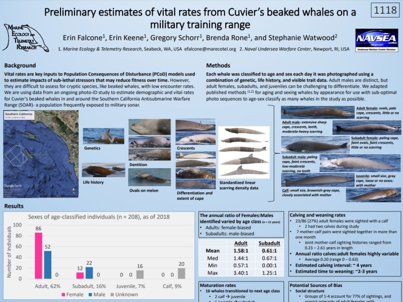
Adult male Cuvier's beaked whales (Ziphius cavirostris) engage in prolonged bouts of synchronous diving.
Marine Mammal Science. 2021.
https://doi.org/10.1111/mms.12799
More details
Collapse details
Date Published:
Publication:Ocean:Region:Species:Methods:
- March 15, 2021
We tested this prediction by evaluating the diving behavior of animals within social groups off Cape Hatteras, North Carolina, considering diving synchrony a proxy for group membership.
Trade-offs in telemetry tag programming for deep-diving cetaceans: data longevity, resolution, and continuity.
Animal Biotelemetry. 2023.
11:23
More details
Collapse details
Date Published:
Publication:Ocean:Region:Species:Methods:
- May 29, 2023
We analyze trade-offs in the longevity, resolution, and continuity of data records from non-recoverable satellite-linked tags on deep-diving Ziphius cavirostris in the context of a behavioral response study of acute noise exposure.
Insights into foraging behavior from multi-day sound recording tags on goose-beaked whales (Ziphius cavirostris) in the Southern California Bight.
Frontiers in Marine Science. 2024.
11:1415602
More details
Collapse details
Date Published:
- September 6, 2024
Virtual Alaska Marine Science Symposium, 24-27 January 2022 .
More details
Collapse details
Habitats occupied by Chinook salmon in the Gulf of Alaska and in the U.S. Navy’s Temporary Maritime Activities Area..
Alaska Marine Science Symposium, Anchorage, Alaska, January 2023 .
More details
Collapse details
Date Published:
- February 1, 2023
- 198.11 KB
More details
Collapse details
Date Published:
Filesize:
- May 29, 2013
NOAA Fisheries’ Hawaiian Monk Seal Research Program (HMSRP) and U.S. Navy Pacific Fleet Environmental initiated a collaborative research effort to investigate potential impacts of naval activities in the HRC. To accomplish this goal, positional data was collected by 13 global positioning system (GPS) telemetry tags deployed over a 2-year period (2010–2011) on 11 individual Hawaiian monk seals, for a total of 38,232 hours (1,593 days).
- 211.44 KB
More details
Collapse details
Date Published:
Filesize:
- April 20, 2015
HDR vessel-based visual monitoring for marine mammals was conducted 1–9 February 2014 in conjunction with Cascadia Research Collective (CRC) satellite-tagging and real time acoustic monitoring by the Marine Mammal Monitoring on Navy Ranges (M3R) team. These efforts were to aid species-validation projects conducted in and around the Pacific Missile Range Facility (PMRF) instrumented range, northwest of Kauai in the Hawaii Range Complex (HRC). The monitoring survey was conducted prior to the commencement of the U.S. Navy’s Submarine Commanders Course (SCC) that took place 17–21 February 2014, which included the use of mid-frequency active sonar.
- 5,095.91 KB
More details
Collapse details
Date Published:
Filesize:
- January 24, 2024
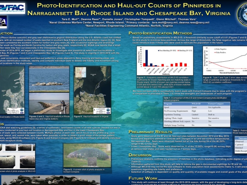
The telemetry and survey studies managed by the Naval Undersea Warfare Center, Division Newport (NUWCDIVNPT) was initiated in winter 2021 to collect data on harbor seals (Phoca vitulina) and gray seals (Halichoerus grypus) along the U.S. East Coast. The purpose of this field season’s research was to collect baseline data to inform a proposed pinniped behavioral response study and continue long-term pinniped surveys, specifically in the Navy OPAREAS along the northwestern Atlantic coast. A summary of the data collected in previous field seasons can be found in DeAngelis (2023).
- 369.36 KB
More details
Collapse details
Date Published:
Filesize:
- January 1, 2023
The aim of the 2021-2022 field season’s research, Phase II of the Pinniped BRS, was to continue to obtain data to measure baseline behavior to understand the physical or biotic factors that influence the movement and foraging tactics of harbor and gray seals; the amount of time seals spend in specific areas, paying particular attention to Navy OPAREAS; and, the anthropogenic risks (e.g., noise-producing military activities) seals potentially encounter in nearshore and offshore areas.
- 2,724.17 KB
More details
Collapse details
Date Published:
Filesize:
- January 1, 2017
To meet information needs of the US Navy, Pacific Fleet Environmental, the National Marine Fisheries Service, Marine Mammal Laboratory in collaboration with Washington Department of Fish and Wildlife conducted a study of adult male California sea lions (Zalophus californianus) with two objectives: 1) to estimate the number of sea lions that use Navy Facilities in Puget Sound, Washington and 2) to describe how adult male sea lions utilize the waters of Washington as marine foraging areas. To accomplish this, weekly counts of sea lions were conducted at four Navy Facilities in Puget Sound, Washington (WA) to estimate abundance and satellite dive recorders were deployed on adult male California sea lions to obtain data on the proportion of time the animals were hauled out and their distribution and diving behavior as they foraged in inland and coastal waters.
- 6,052.67 KB
More details
Collapse details
Date Published:
Filesize:
- January 1, 2011
Navy Research Funded Year Three Project Reports
- 5,699.30 KB
Effects of simulated military sonar on sound production by blue whales, sperm whales, Risso’s dolphin, and Cuvier’s beaked whale.
4th International Science Symposium on Bio-logging .
More details
Collapse details
Date Published:
Filesize:
- March 14, 2011
Whales and dolphins use sound for different functions including echolocation and social communication, and thus changes in sound production patterns are a likely component of any behavioral response to anthropogenic sounds such as military mid-frequency sonar (MFA). To simultaneously log whale and dolphin movements, sound production and reception, and anthropogenic sound exposure levels, we used Dtags (Woods Hole Oceanographic Institution) and bioacoustic probes (Greeneridge Sciences). Tags were deployed on wild, free-ranging cetaceans in Southern California waters. Tagged animals were then exposed to simulated MFA or, as a control, pseudo-random noise (PRN). In total, the August-September 2010 SoCal10 behavioral response study included 28 playbacks: 19 to blue whales (11 MFA, 8 PRN), 5 to fin whales (3 MFA, 2 PRN), 2 to a single sperm whale (1 MFA, 1 PRN), 1 to a Risso’s dolphin (MFA), and 1 to a Cuvier’s beaked whale (MFA). For this analysis we focus first on baleen whale call production and reception rates (particularly blue whale D calls and variable calls) in relation to sound exposure level, dive behavior, and lunge feeding rates. We then examine echolocation-based foraging behavior and social call production by the toothed whales as a function of sound exposure level. This rich dataset, including multiple cetacean species of conservation concern, provides insight into the wide potential range of responses to sound, and the dependence of those responses on ecological, social and behavioral context. Investigations like SoCal10 can help guide inferences for related topics, such as assessment of population effects of anthropogenic noise.
- 22.83 KB
Assessment of goose-beaked whale responses to mid-frequency active sonar using a hierarchical hidden Markov model.
Movement Ecology. 2026.
14 (28)
More details
Collapse details
Date Published:
- April 24, 2026
More details
Collapse details
Date Published:
Filesize:
- September 21, 2012
A marine mammal species verification and satellite tagging test was carried out as part of the Marine Mammal Monitoring on Navy Ranges (M3R) program in collaboration with the Cascadia Research Collective from 11 June to 02 August 2012 at the Pacific Missile Range Facility (PMRF). The primary objective of the test was to acoustically detect marine mammals at PMRF and vector observers to vocalizing animals. This allowed the team to: 1) Visually verify at-sea species acoustically detected on the PMRF undersea range 2) Deploy satellite tags on marine mammals prior to the Rim of the Pacific Exercise (RIMPAC) to monitor animals’ movement before, during and after navy training. 3) Photograph animals to create a photo-ID record for the Hawaii Range Complex 4) Collect biological samples (fecal/biopsy) 5) Document group composition and behavior
- 1,372.72 KB
More details
Collapse details
Date Published:
Filesize:
- August 1, 2020
To better understand the spatial distribution of habitat usage in the Bay by these species, the Navy funded home range analyses of both species based on extant satellite-tagging data for tags deployed from 2014 to 2018.
- 6,723.94 KB
More details
Collapse details
Date Published:
Filesize:
- February 10, 2022
Understanding the spatial distribution of a species is required to enact effective conservation. Complications to effective conservation can arise when the distributions of multiple target species are non-overlapping. Conservation efforts meant to protect one species may shift threats into the distribution of another species. Two species of marine turtle, loggerhead Caretta caretta and Kemp’s ridley Lepidochelys kempii, are common seasonally in Chesapeake Bay, a large estuary on the US east coast. Both species are protected under the US Endangered Species Act and face spatially complex threats in the region. We created habitat suitability models for these 2 species to inform conservation efforts in the region and explore the extent of overlap be - tween their distributions. Argos satellite tags were deployed on 24 Kemp’s ridley and 10 loggerhead turtles to record animal locations within the Bay. Boosted regression tree models were created for each species using presence-only animal locations, predicting suitable habitat within the Bay. Habitat for Kemp’s ridley turtles was predicted in shallow, coastal areas of the southern Bay as well as in brackish areas of rivers. Loggerhead turtle habitat was predicted to extend farther north than Kemp’s ridley habitat and was generally found in deeper areas of the middle Bay. There is some evidence that these 2 species are partitioning habitat. Any conservation measures adopted to conserve marine turtles in the Chesapeake Bay should consider the habitat of both species holistically to avoid shifting impacts from one species to another.
- 733.34 KB
More details
Collapse details
Date Published:
Filesize:
- February 1, 2025
The study team proposed deploying up to 50 Wildlife Computers satellite-linked telemetry tags per year for 3 years, split evenly between Kemp’s ridley and green sea turtles (or as encounters allow), at several sites along the East Coast ranging from Florida (FL) to Massachusetts (MA). In partnership with several rehabilitation and research groups, the study team aims to collect and record sea turtle behavioral data in multiple representative environments and times of year
- 4,815.55 KB
More details
Collapse details
Date Published:
Filesize:
- July 8, 2026
Building on Year 1 deployments, Year 2 moved the study toward providing robust, defensible availability bias models for green and Kemp’s ridley sea turtles on the East Coast. The current study results should be interpreted with caution, given the relatively small number of deployments to date, particularly for Kemp’s ridley turtles (n=10 deployments), which limits the available information both spatially and temporally. Collecting 18 months of data and expanding the analysis, compared to 6 months when the 2024 annual report (DiMatteo and Mansfield 2025) was written, reinforced several findings. Availability bias generally increased as the depth threshold at which animals were assumed to be able to be seen increased. This is to be expected as more of the water column is considered to be visible. The availability bias estimates from the 2-m depth histograms and dive behavior were similar.
- 13,940.82 KB
Habitat models and assessment of habitat partitioning for Kemp's ridley and loggerhead marine turtles foraging in Chesapeake Bay (USA).
Endangered Species Research. 2022.
47:91-107
More details
Collapse details
Date Published:
Publication:Ocean:Region:Species:Methods:
- February 10, 2022
Understanding the spatial distribution of a species is required to enact effective conservation. Complications to effective conservation can arise when the distributions of multiple target species are non-overlapping. Conservation efforts meant to protect one species may shift threats into the distribution of another species. Two species of marine turtle, loggerhead Caretta caretta and Kemp’s ridley Lepidochelys kempii, are common seasonally in Chesapeake Bay, a large estuary on the US east coast. Both species are protected under the US Endangered Species Act and face spatially complex threats in the region. We created habitat suitability models for these 2 species to inform conservation efforts in the region and explore the extent of overlap between their distributions. Argos satellite tags were deployed on 24 Kemp’s ridley and 10 loggerhead turtles to record animal locations within the Bay. Boosted regression tree models were created for each species using presence-only animal locations, predicting suitable habitat within the Bay. Habitat for Kemp’s ridley turtles was predicted in shallow, coastal areas of the southern Bay as well as in brackish areas of rivers. Loggerhead turtle habitat was predicted to extend farther north than Kemp’s ridley habitat and was generally found in deeper areas of the middle Bay. There is some evidence that these 2 species are partitioning habitat. Any conservation measures adopted to conserve marine turtles in the Chesapeake Bay should consider the habitat of both species holistically to avoid shifting impacts from one species to another.
Normalizing home ranges of immature Kemp's ridley turtles (Lepidochelys kempii) in an important estuarine foraging area to better assess their spatial distribution.
2021.
17(1): 57-71
More details
Collapse details
Date Published:
Ocean:Region:Species:Methods:
- January 1, 2021
Kemp's ridley turtles (Lepidochelys kempii) are critically endangered sea turtles that forage seasonally in Chesapeake Bay, a large estuary on the east coast of the United States. Most of the Kemp's ridley turtles foraging in the bay are immature. When tracking these animals, satellite transmitter retention times have been low compared with adult marine turtles of other species. The immature Kemp's ridleys' small size and rapid growth leads to shorter, more variable deployments, limiting the use of data. These limited data leave critical questions remaining about the animals' habitat usage that are difficult to answer without substantially more deployments. A novel sensitivity analysis using simulated deployments indicated that too few animals were tagged with satellite transmitters to identify all possible home-range areas in the Bay.
Sea turtle density surface models along the United States Atlantic coast.
Endangered Species Research. 2024.
53:227–245
More details
Collapse details
Date Published:
Publication:Ocean:Region:Species:Methods:
- February 29, 2024
Spatially explicit estimates of marine species distribution and abundance are required to quantify potential impacts from human activities such as military training and testing, fisheries interactions, and offshore energy development. There are 4 protected species of sea turtle (loggerhead, green, Kemp’s ridley, and leatherback) commonly found along the east coast of the USA, our study area, and which require impact assessments.
More details
Collapse details
Date Published:
Filesize:
- May 3, 2025
In the Pacific, the Marine Mammal Monitoring on Navy Ranges (M3R) program maintains systems that continuously run algorithms to detect, classify and localize marine mammals year-round on the U.S. Navy’s deep-water Southern California Antisubmarine Warfare Range (SOAR) in Southern California and the Pacific Missile Range Facility (PMRF) off Kaua‘i, Hawai‘i. Long-term archive data collected on these ranges allow for numerous types of studies on species inhabiting the ranges, including the monitoring of abundance, behavioral responses to naval activities, and habitat usage. They also provide the opportunity to study ambient sound levels and soundscapes. In FY24 the M3R program had five goals for SOAR and PMRF: Support real-time monitoring of on-water tagging operations Collection and postprocessing of M3R binary archives and periodic broadband recordings Data preservation: conversion of Alesis recordings to M3R packet recorder format SOAR Continuous Active Sonar Behavioral Response Study (CAS BRS) DICASS sonobuoy receiver adaption in preparation for deployment at SOAR.
- 2,014.85 KB
More details
Collapse details
Date Published:
Filesize:
- September 7, 2024
In the Pacific, the Marine Mammal Monitoring on Navy Ranges (M3R) program maintains systems that continuously run algorithms to detect, classify and localize marine mammals year-round on the U.S. Navy’s deep-water Southern California Antisubmarine Warfare Range (SOAR) in Southern California and the Pacific Missile Range Facility (PMRF) off Kaua‘i, Hawai‘i. Long-term archive data collected on these ranges allow for numerous types of studies on species inhabiting the ranges, including the monitoring of abundance, behavioral responses to naval activities, and habitat usage. They also provide the opportunity to study ambient sound levels and soundscapes.
- 8,141.88 KB
More details
Collapse details
Date Published:
Filesize:
- May 23, 2023
In the Pacific the Marine Mammal Monitoring on Navy Ranges (M3R) program maintains systems that continuously run algorithms to detect, classify and localize marine mammals year-round on the U.S. Navy’s deep-water Southern California Antisubmarine Warfare Range (SOAR) in Southern California and Pacific Missile Range Facility (PMRF) off Kauai, Hawai’i. Long-term archive data collected on these ranges allows for numerous types of studies on species inhabiting the ranges, including the monitoring of abundance and distribution, behavioral responses to naval activities, and habitat usage. They also provide the opportunity to study ambient noise and soundscapes.
- 6,319.26 KB
More details
Collapse details
Date Published:
Filesize:
- April 1, 2024
Taking into consideration the multiple intermediate scientific objectives in the U.S. Navy’s Strategic Planning Process (DoN 2013), the goals of this study are to assist the U.S. Navy and regulatory agencies with environmental planning and compliance by addressing the following questions: Which cetacean species occur within the VACAPES OPAREA off Virginia, and how does occurrence fluctuate seasonally? What are the baseline behaviors and ecological relationships of offshore cetaceans within the study area? Do individual cetaceans exhibit site fidelity within specific regions of the study area over periods of weeks, months, or years? What is the seasonal extent of cetacean movements within and around U.S. Navy VACAPES training range boxes? Do cetaceans spend significant time within or primarily move through areas of U.S. Navy live-fire or Anti-Submarine Warfare training events?
- 4,190.34 KB
More details
Collapse details
Date Published:
Filesize:
- August 7, 2017
Taking into consideration the multiple intermediate scientific objectives in the U.S. Navy’s Strategic Planning Process (DoN 2013b), the goals of this study are to assist the U.S. Navy and regulatory agencies with environmental planning and compliance by addressing the following questions: • Which cetacean species occur over the outer continental shelf to the east of NSN, and how does occurrence fluctuate seasonally? • What are the baseline behaviors and ecological relationships of offshore cetaceans within the study area? • Do individual cetaceans exhibit site fidelity within specific regions of the study area over periods of weeks, months, or years? • What is the seasonal extent of cetacean movements within and around U.S. Navy VACAPES training range boxes? • Do cetaceans spend significant time within or primarily move through areas of U.S. Navy live-fire or Anti-Submarine Warfare training events?
- 4,742.41 KB
More details
Collapse details
Date Published:
Filesize:
- May 1, 2018
Taking into consideration the multiple intermediate scientific objectives in the U.S. Navy’s Strategic Planning Process (DoN 2013b), the goals of this study are to assist the U.S. Navy and regulatory agencies with environmental planning and compliance by addressing the following questions: Which cetacean species occur over the outer continental shelf to the east of NSN, and how does occurrence fluctuate seasonally? What are the baseline behaviors and ecological relationships of offshore cetaceans within the study area? Do individual cetaceans exhibit site fidelity within specific regions of the study area over periods of weeks, months, or years? What is the seasonal extent of cetacean movements within and around U.S. Navy VACAPES training range boxes? Do cetaceans spend significant time within or primarily
- 6,780.82 KB
More details
Collapse details
Date Published:
Filesize:
- July 1, 2019
Taking into consideration the multiple intermediate scientific objectives in the U.S. Navy’s Strategic Planning Process (DoN 2013b), the goals of this study are to assist the U.S. Navy and regulatory agencies with environmental planning and compliance by addressing the following questions: Which cetacean species occur over the outer continental shelf to the east of NSN, and how does occurrence fluctuate seasonally? What are the baseline behaviors and ecological relationships of offshore cetaceans within the study area? Do individual cetaceans exhibit site fidelity within specific regions of the study area over periods of weeks, months, or years? What is the seasonal extent of cetacean movements within and around U.S. Navy VACAPES training range boxes? Do cetaceans spend significant time within or primarily
- 6,402.34 KB
More details
Collapse details
Date Published:
Filesize:
- April 1, 2020
Taking into consideration the multiple intermediate scientific objectives in the U.S. Navy’s Strategic Planning Process (DoN 2013b), the goals of this study are to assist the U.S. Navy and regulatory agencies with environmental planning and compliance by addressing the following questions: Which cetacean species occur over the outer continental shelf to the east of NSN, and how does occurrence fluctuate seasonally? What are the baseline behaviors and ecological relationships of offshore cetaceans within the study area? Do individual cetaceans exhibit site fidelity within specific regions of the study area over periods of weeks, months, or years? What is the seasonal extent of cetacean movements within and around U.S. Navy VACAPES training range boxes? Do cetaceans spend significant time within or primarily
- 9,368.29 KB
More details
Collapse details
Date Published:
Filesize:
- May 1, 2021
Taking into consideration the multiple intermediate scientific objectives in the U.S. Navy’s Strategic Planning Process (DoN 2013b), the goals of this study are to assist the U.S. Navy and regulatory agencies with environmental planning and compliance by addressing the following questions: Which cetacean species occur over the outer continental shelf to the east of NSN, and how does occurrence fluctuate seasonally? What are the baseline behaviors and ecological relationships of offshore cetaceans within the study area? Do individual cetaceans exhibit site fidelity within specific regions of the study area over periods of weeks, months, or years? What is the seasonal extent of cetacean movements within and around U.S. Navy VACAPES training range boxes? Do cetaceans spend significant time within or primarily
- 3,862.99 KB
More details
Collapse details
Date Published:
Filesize:
- May 1, 2025
Taking into consideration the multiple intermediate scientific objectives in the U.S. Navy’s Strategic Planning Process (DoN 2013), the goals of this study are to assist the U.S. Navy and regulatory agencies with environmental planning and compliance
- 7,272.43 KB
In the strike zone? Tag data provides a better understanding of dive and surface behavior of North Atlantic right whales in the western Mid-Atlantic.
24-25 October 2023, Halifax, Nova Scotia, Canada. .
More details
Collapse details
Date Published:
- October 24, 2020
- 3,074.71 KB
More details
Collapse details
Date Published:
Filesize:
- July 8, 2026
This progress report summarizes offshore monitoring activities conducted between September 2024 and August 2025. The overarching objectives of the OCS remain focused on addressing key information gaps related to cetacean occurrence, exposure, and response within the conceptual framework for the U.S Navy Marine Species Monitoring Program.
- 5,333.11 KB
More details
Collapse details
Date Published:
Filesize:
- August 29, 2012
Results from the second year of a three-year project investigating the distribution, demographics, and behavior of cetaceans in the US Navy’s Southern California operational area are summarized. Eighteen small vessel surveys for cetaceans, which included species verification tests in conjunction with M3R (Marine Mammal Monitoring on Navy Undersea Ranges) acoustic monitoring at the Southern California Anti-submarine Warfare Range (SOAR), as well as photo-identification, satellite tagging, and biopsy sampling of species of interest, were conducted in July 2011 and January and March 2012. 112 groups of 14 cetacean species were encountered. Twenty-one satellite tags, some depth reporting, were deployed on four species, with an emphasis on Cuvier’s beaked and fin whales. Among other findings, preliminary results of photo-identification studies combined with results from satellite tag data suggest that both Cuvier’s beaked whales and fin whales may have population sub-units with higher than expected residency to the Southern California Bight. Beaked whales particularly show this higher than expected residency to SOAR.
- 3,587.99 KB
More details
Collapse details
Date Published:
Filesize:
- October 1, 2010
In order to train with mid-frequency active sonar (MFAS), the Navy has obtained a permit from the National Marine Fisheries Service (NMFS) under the Marine Mammal Protection Act and Endangered Species Act. The Hawaii Range Complex (HRC) Monitoring Plan, finalized in December 2008 for implementation in January 2009, was developed with NMFS to comply with the requirements under the permit. The monitoring plan and reporting will provide science-based answers to questions regarding whether or not marine mammals are exposed and reacting to Navy MFAS.
- 485.14 KB
More details
Collapse details
Date Published:
Filesize:
- June 1, 2019
This report describes results of vessel surveys from a multi-institutional monitoring project 3 intended to provide information on the species composition, population identity, density, and 4 baseline behavior of marine mammals and sea turtles present in United States (U.S.) Navy 5 range complexes along the U.S. Atlantic Coast.
- 1,872.41 KB
More details
Collapse details
Date Published:
Filesize:
- August 1, 2017
This report forms part of a multi-institutional monitoring project intended to provide information on the species composition, population identity, density, and baseline behavior of marine mammals and sea turtles present in United States (U.S.) Navy range complexes along the U.S. Atlantic coast
- 4,706.18 KB
More details
Collapse details
Date Published:
Filesize:
- August 1, 2017
This report describes results of vessel surveys from a multi-institutional monitoring project intended to provide information on the species composition, population identity, density, and baseline behavior of marine mammals and sea turtles present in United States (U.S.) Navy range complexes along the U.S. Atlantic Coast.
- 9,204.20 KB
More details
Collapse details
Date Published:
Filesize:
- July 21, 2015
This report forms part of a multi-institutional monitoring project intended to provide information on the species composition, population identity, density and baseline behavior of marine mammals and sea turtles present in United States (U.S.) Navy range complexes along the U.S. Atlantic coast. The program began in 2007, with baseline aerial and vessel surveys and a passive acoustic monitoring program in Onslow Bay, North Carolina, and has since expanded to include study areas off Jacksonville, Florida, and Cape Hatteras, North Carolina. Off Cape Hatteras, four years of surveys have provided information on the complex patterns of distribution and diversity of the marine mammals and sea turtles in this highly productive area. The current report builds on this past body of work and describes activities conducted during both the Deep Divers and Satellite Tagging projects conducted off Cape Hatteras between January and December 2014. This constitutes the second year of the Deep Divers project, which focuses on the distribution and ecology of several deep-diving odontocete species, including: beaked whale (Cuvier’s beaked whale: Ziphius cavirostris and Mesoplodon spp.); short-finned pilot whale (Globicephala macrorhynchus); and sperm whale (Physeter macrocephalus). To achieve a more robust picture of the medium-term movement patterns of these and other odontocete cetaceans in the Cape Hatteras survey area, we began a satellite tagging project during the reporting period. Satellite tagging effort and associated sightings are presented here; preliminary analyses of movement data are available in a separate report generated by the Cascadia Research Collective (see Baird et al. 2015). All survey effort in the Cape Hatteras study site this year was dedicated to Deep Divers and Satellite Tagging projects, so we also report ongoing photographic identification work for this area in this report.
- 6,832.28 KB
Should I stay or should I go: Movement and residency patterns of satellite tagged pilot whales offshore of Cape Hatteras, NC.
21st Biennial Conference on the Biology of Marine Mammals .
More details
Collapse details
Date Published:
Filesize:
- December 13, 2015
We deployed 20 Low-Impact Minimally-Percutaneous External-electronics Transmitter (LIMPET) satellite-linked transmitters and dive recorders on short-finned pilot whales (Globicephala macrorhynchus) off Cape Hatteras, NC during the summer of 2014. Our objective was to obtain information on medium-term movement and diving patterns of individual animals to complement existing information on long-term residency patterns derived from photo-identification and shortterm diving behavior from Digital Acoustic Tags. We deployed 14 location-only (SPOT5) tags and six MK 10-A tags, which provided information on depth of dive, as well as location data. We received transmissions and data from these tags for up to 194 days (median=43 days). Tagged individuals ranged from Onslow Bay, NC north to Georges Bank, MA, and east to the New England seamounts. Most tagged individuals showed a very strong affinity for the continental shelf break, but there was wide variation in movement patterns and habitat use at the individual level. Maximum distances from the tagging location ranged from 7 - 1192 km (median=252 km), while cumulative distances traveled spanned 55 - 7564 km (median=2322 km). Despite these long-distance movements, however, we observed a high degree of site fidelity of short-finned pilot whales off Cape Hatteras, with 25 inter-annual and inter-season photographic matches (11%) in a preliminary catalog of 229 individuals. Some individuals have been matched over periods of up to six years. We matched three of the satellite-tagged animals (15%) to our existing photo-identification catalog. One hypothesis for this apparent conundrum is that the shelf break offshore of Cape Hatteras, NC is an important area for this species, to which individuals return frequently. We are conducting additional satellite tagging efforts off Cape Hatteras, NC and continuing to examine photo-identification records and social structure of short-finned pilot whales to further refine patterns of their long-term spatial and habitat use of the species in the Northwest Atlantic.
- 91.96 KB
More details
Collapse details
Date Published:
Ocean:Region:Species:Methods:
- January 1, 2018
Short-finned pilot whales (Globicephala macrorhynchus) and Cuvier’s beaked whales (Ziphius cavirostris) are deep-diving odontocetes with broad distributions, and are of conservation concern given their history of increased injury and mortality resulting from direct interactions with fisheries and mass strandings resulting from mid-frequency active sonar. In the western North Atlantic, basic information on the spatiotemporal distribution, movement patterns, habitat preferences, home ranges, and residency of these highly mobile species are still unknown.
Residency and movement patterns of Cuvier’s beaked whales (Ziphius Cavirostris) off Cape Hatteras, North Carolina, USA.
Marine Ecology Progress. 2021.
660: 203-216. https://doi.org/10.3354/meps13593
More details
Collapse details
Date Published:
Publication:Ocean:Region:Species:Methods:
- January 1, 2021
Here we describe the spatial ecology of 20 Cuvier’s beaked whales equipped with satellite-linked tags off Cape Hatteras, North Carolina, USA, between 2014 and 2017.
Movement and residency patterns of satellite tagged odontocetes offshore of Cape Hatteras, NC.
SEAMAMMS (Southeast and Mid-Atlantic Marine Mammal Symposium) .
More details
Collapse details
Date Published:
Filesize:
- March 27, 2015
We deployed satellite-linked transmitters and dive recorders on several odontocete species off Cape Hatteras, NC as part of a multi-institutional marine protected species monitoring program, involving vessel, aerial, and acoustic survey methods. Our objective was to obtain information on medium-term movement and diving patterns of individual animals to complement existing information on long-term residency patterns derived from photo-identification and short-term dive records obtained from Digital Acoustic Tags (DTags). We deployed 29 Low-Impact Minimally-Percutaneous Externalelectronics Transmitter (LIMPET) tags on individuals of four species during the summer of 2014: 20 Globicephala macrorhynchus, 5 Tursiops truncatus, 3 Ziphius cavirostris, and 1 Delphinus delphis. Nineteen location-only (SPOT5) tags were deployed, while ten tags provided information on depth of dive, as well as location data (MK 10-A). We received data from these tags for up to 193 days. Tagged individuals ranged from Onslow Bay, NC north to Georges Bank, MA, and east to the New England seamounts. Pilot whales in particular showed a very strong affinity for the continental shelf break, but there was variation in movement patterns at both the species and individual levels. Maximum dive depths were 2,800 m for beaked whales (n=2), 1,104 m for pilot whales (n=4) and 944 m for pelagic bottlenose dolphins (n=2). We either re-sighted or matched five of the tagged animals (17%) to our existing photo-identification catalogs. Our results show both strong habitat affinities for these animals and a high and surprising degree of residency, especially for the beaked whales and bottlenose dolphins. We hope to conduct additional tagging efforts off Cape Hatteras, NC and Jacksonville, FL to further refine patterns of long-term spatial and habitat use of odontocetes in the Northwest Atlantic.
- 93.52 KB
More details
Collapse details
Date Published:
Filesize:
- July 8, 2026
During freshwater residency which extends from spring to fall, adult Gulf Sturgeon undergo a prolonged period of fasting before transiting to marine foraging areas (Mason and Clugston 1993). The lack of freshwater foraging focuses the role of marine habitats in subsequent reproductive success and ultimately is key to the recovery of this species. Improving the limited understanding of marine habitat requirements is emphasized in the Gulf Sturgeon Recovery Plan, which highlights the need for multi-year tracking studies and will also assist in the Biological Assessment required under Section 7 of the ESA. This project, which leveraged large numbers of pre-existing transmitters and passive acoustic receivers, provided much needed information to the Naval Sea Systems Command (NAVSEA) on the spatial temporal patterns of occupancy for the ESA listed Gulf Sturgeon in the Naval Surface Warfare Center (NSWC), Panama City Division Testing Range and the Panama City OPAREA. This information can be used to provide a framework for subsequent efforts to examine the exposure and response to Navy activities as well as the consequences of these responses on this imperiled species.
- 1,695.33 KB
More details
Collapse details
Date Published:
Filesize:
- February 1, 2021
The United States Navy developed monitoring questions for the Mariana Islands Training and Testing (MITT) study area under the Mariana Islands Range Complex Monitoring Plan (MIRCMP), including questions specifically related to marine turtles as required under the Endangered Species Act (ESA) of 1973. To support the needs of the U.S. Pacific Fleet Environmental Readiness Office, the Marine Turtle Biology and Assessment Program (MTBAP) of the National Oceanic and Atmospheric Administration (NOAA) has been conducting research on marine turtle abundance and spatial-temporal ecology in the nearshore waters of Saipan, Tinian, and Guam since 2013, under a series of Interagency Agreements (IAA).
- 674.99 KB
More details
Collapse details
Date Published:
Filesize:
- February 1, 2022
In 2013, under an inter-agency agreement (IAA) between the United States Navy and the National Oceanic and Atmospheric Administration (NOAA), NOAA began conducting in-water surveys to record and quantify observations of marine turtles around the Mariana Archipelago. When observed, attempts were made to hand-capture turtles and equipthem with satellite tags in an effort to better understand their spatial ecology.
- 349.81 KB
More details
Collapse details
Date Published:
Filesize:
- January 1, 2024
Understanding the spatio-temporal movements of animals is an integral component of wildlife conservation and management. Sea turtles are species of conservation concern and satellite telemetry is a primary research tool used to study their movements, providing high accuracy location data in near “real time,” thus facilitating rapid identification of movements and key habitats.
- 5,706.75 KB
More details
Collapse details
Date Published:
Filesize:
- January 1, 2020
Understanding the spatio-temporal movements of animals is an integral component of wildlife conservation and management. Marine turtles are species of conservation concern and satellite telemetry is a primary research tool used to study their movements, providing high accuracy location data in near “real time”, thus facilitating rapid identification of movements and key habitats.
- 5,020.67 KB
Fine scale movements and swimming kinematics of blue whales off southern California including reaction to simulated military sonar.
19th Biennial Conference on the Biology of Marine Mammals .
More details
Collapse details
Date Published:
Filesize:
- November 27, 2011
The effects of anthropogenic sound on marine mammal behavior remains poorly understood, particularly with respect to fine-scale movement patterns. We exposed tagged blue whales to simulated navy sonar during the SOCAL10 behavioral response study in Southern California. We used two different high-resolution, suctioncup digital archival tags to examine fine-scale whale movement: DTAGs and Bioacoustic Probes. The Bioacoustic probe, which included a hydrophone, a pressure transducer, and a dual-axis accelerometer, allowed us to estimate speed and pitch. The DTAGs are equipped with stereo hydrophones, a pressure transducer, and three-axis accelerometers and magnetometers. These sensors allowed us to determine fine-scale movement in three dimensions and received levels of sound. Our study included 19 sound exposures, consisting of 11 playbacks of mid-frequency sonar and 8 control playbacks of pseudo-random noise. We analyzed 24 parameters related to dive and body kinematics for each dive before, during and after sound exposure. Statistical models were applied to assess the significance of changes in these parameters in relation to the received sound level and distance from the source to the whale. During some exposures there were increases in speed and changes in ascent behavior as well as an apparent displacement away from the sound source after the onset of exposure. However, no clear responses were seen in these behaviors for other exposures. Given the range of factors that can characterize behavior and the potential for infrequent or subtle reactions, these data highlight the need for sufficient baseline data and a comprehensive understanding of the behavioral (social interactions), ecological (prey distribution), and evolutionary (fight or flight) contexts in which assessments of sound effects are made. Blue whales produce low-frequency calls and have generally not been considered sensitive to mid-frequency sounds, however, the current study indicates they may respond under certain situations.
- 146.02 KB
Satellite-tagging and photo-ID provide further evidence of multiple island-associated populations of common bottlenose dolphins in the main Hawaiian Islands.
20th Biennial Conference on the Biology of Marine Mammals. .
More details
Collapse details
Date Published:
Filesize:
- December 9, 2013
In 2011 the National Marine Fisheries Service recognized four separate island-associated stocks of common bottlenose dolphins within the main Hawaiian Islands, based on photoidentification studies over a 7-year period (2000-2006) as well as genetic analyses of skin biopsy samples. However, uncertainty remains regarding movements outside of the photoID study areas due to spatial biases in sampling effort, particularly the general restriction of small-boat based sampling efforts to the leeward sides of the islands. Since these earlier studies, we have obtained an additional seven years of photoidentification data (2007-2013) from among all the island areas, and deployed satellite tags on nine individual bottlenose dolphins from three of the four stocks (Kaua‘i/Ni‘ihau, 4islands, Hawai‘i Island). Here we assess movements using photo-ID and satellite tag data to ascertain whether these new data sets support or refute the designation of four islandassociated stocks. The photo-ID catalog spanning 2000-2013 includes 1,130 identifications of 509 distinctive individuals. Earlier analyses documented no movements among island areas; with the larger sample size, movements of one individual from O‘ahu to Moloka‘i, across stock boundaries has been documented, although this individual was not observed associating with the main social cluster documented from the 4island stock. Satellite tagged individuals traveled an average of 1,208 km with average tag attachment durations of 18 days (range 9-34), yet median distance from deployment location was only 21 km (maximum distances from deployment location range = 38.6 to 61.4 km). All tagged individuals remained within their recognized stock boundaries, and individuals used both leeward and windward sides of the islands, suggesting the spatially-biased boat-based efforts sample individuals that use both sides of the islands. Our results support earlier assessments of limited movements among island areas and the existence of multiple island-associated populations of this species in the Hawaiian Archipelago.
- 8,528.55 KB
Daily energetic expenditure and energy consumption of short-finned pilot whales.
Journal of Experimental Biology. 2025.
228(21):jeb249821
More details
Collapse details
Date Published:
Publication:Ocean:Region:Species:Methods:
- November 1, 2025
Diving is one of the most important behaviors undertaken by marine mammals. Pilot whales (Globicephala spp.) are oceanic dolphins that regularly forage at extreme depths (∼600–1000 m) and maintain body sizes similar to beaked whales. They are also listed as data deficient, with little known about their population dynamics. To help fill this knowledge gap, we estimated their energetic demands through a combination of multiple data streams (e.g. unoccupied aerial systems photogrammetry, high-resolution accelerometry tag data, stomach content analysis and long-duration dive data from satellite tags) from short-finned pilot whales (Globicephala macrorhynchus) in Hawaiian waters. We estimated and compared pilot whale field metabolic rates from breathing frequency against a more granular cost of transport method developed from morphometrics and swimming kinematics, finding that these methods gave similar estimates of energetic expenditure during foraging dives.
More details
Collapse details
Date Published:
Filesize:
- April 1, 2020
The goal of the study was to use the spatial and temporal data provided through continuous long-term tracking to define occupancy and migration patterns of Atlantic sturgeon so that the Navy may conduct a more informed assessment of potential impacts of their activities on the species.
- 76,860.04 KB
More details
Collapse details
Date Published:
Filesize:
- June 29, 2015
In this analysis, we integrate limited acoustic detections over a 7-year period with two other data sources: opportunistic visual sightings, and output from a state-space movement model fit to the locations from a single satellite-tagged individual. We illustrate a case study with an application to endangered Southern Resident killer whales, where the focus is understanding the coastal habitat use of this population in winter and spring months. Predictions from our state-space movement model suggest in winter of 2014, SRKWs spent the highest density of time located off the Columbia River and near Westport. Other areas with concentrated effort included off the Olympic Peninsula in Washington State, and near the Mad and Eel rivers in Northern California.
- 2,722.69 KB
More details
Collapse details
Date Published:
Filesize:
- August 1, 2018
We integrated opportunistic visual sightings, and the output from an updated state-space movement model fit to the locations from several satellite-tagged Southern Resident killer whales to fill in the detection gaps in the acoustic detections of this population in the coastal waters of the U.S. over a 4-year period when satellite tags were not deployed
- 2,610.25 KB
More details
Collapse details
Date Published:
Filesize:
- June 1, 2017
Remotely deployed telemetry tags were used to assess the movements and occurrence of the whales in the winter, and passive acoustic recorders deployed in areas thought to be frequently used by the whales, were used to assess their seasonal occurrence in these areas. These data will be used to provide information to better understand their seasonal occ
- 2,040.50 KB
Diving Behavior of Common Bottlenose Dolphins Around the Main Hawaiian Islands: Individual Variation and Responses to Diel and Lunar Cycles.
Marine Mammal Science. 2026.
Volume 4217, Issue 3
More details
Collapse details
Date Published:
- July 26, 2026
Follow-up observations of satellite-tagged sperm whales in the Gulf of Mexico for evaluation of potential tag effects and wound healing.
21st Biennial Conference on the Biology of Marine Mammals .
More details
Collapse details
Date Published:
Filesize:
- December 13, 2015
Long-term implantable satellite tags provide valuable distribution and behavior information for wide-ranging large whales. Follow-up observations of whales tagged with these telemetry devices are critical in evaluating potential health effects from tagging, but are especially difficult for species with cosmopolitan distributions with the ability to travel 100+ km/day. Sperm whales in the Gulf of Mexico are good subjects for such studies, in that animals can be predictability relocated year-round in areas around bathymetric features and have been tagged over a period of many years. A total of 134 Argos satellite-monitored radio tags were deployed on sperm whales from 2001 to 2013: 94 Telonics ST-15 location-only tags (1.9 cm diameter, 26.3 cm long implantable portion), 20 Wildlife Computers Spot-5 location only tags (2.1 cm diameter, 27.2 cm long implantable portion), and 20 Wildlife Computers MK-10 Advanced Dive Behavior tags (2.6 cm diameter, 24.8 cm long implantable portion). Whales were photographed at the time of tagging for identification and to assess tag application. Follow-up observations were undertaken in subsequent tagging seasons and on dedicated resighting trips. Twenty-nine whales were resighted (some up to four times in multiple years) from 1 day to 10 years after tagging. Fifteen of these had tags still attached and 28 were resighted without tags. Some whales were initially resighted with tags, but without tags on subsequent observations. Swelling occurred at two tag sites. Scars after tag loss consisted of fully re-pigmented divots (1-3 cm deep by 4-8 cm diameter). None of the resighted whales showed signs of emaciation or having other health issues, and their behavior was similar to that of untagged whales. One whale was observed with a new calf one year after tagging. These results indicate that satellite tagging poses little or no observable adverse health effects for sperm whales.
- 91.67 KB
More details
Collapse details
Date Published:
Filesize:
- January 1, 2012
In order to support the U.S. Navy in meeting regulatory requirements for monitoring established under the Final Rules and to provide a mechanism to assist with coordination of program objectives under the ICMP, this survey was conducted to confirm the Marine Mammal Monitoring on Navy Ranges (M3R) acoustic detections and marine mammal satellite tagging was prior to a training event, the Submarine Commander’s Course exercise, which would be conducted in the same area during February 2012.This report presents the methods and preliminary results of a vessel-based visual and acoustic survey effort that was conducted in conjunction with a tagging and species-validation project
- 2,313.85 KB
More details
Collapse details
Date Published:
Filesize:
- August 31, 2012
The overall objective of the ICMP is to assimilate relevant data collected across U.S. Navy range complexes in order to answer questions pertaining to the impact of MFAS and explosives on marine mammals and sea turtles.
- 11,672.29 KB
More details
Collapse details
Date Published:
Filesize:
- November 1, 2012
The first phase to integrate the historical sum of these U.S. Navy-sponsored visual survey efforts for marine species monitoring in the HRC was prepared by Uyeyama (2011). This report represents the second phase of that effort and presents an overview of monitoring survey effort to date in the HRC. Available data from visual surveys performed by both contractor-led efforts and U.S. Navy in-house surveys was compiled and processed in order to: 1. Create a geographic information system (GIS)-based summation of all survey tracks that can be easily visualized. 2. Construct a geo-referenced database of sightings that can be queried by species, observer platform, Beaufort Sea State (BSS), season, or other sighting/survey variables. 3. Conduct an enhanced analysis of sighting success with respect to survey platform, field protocol, and environmental conditions. 4. Inform and adjust data collection procedures on future surveys as needed to reflect lessons learned from sighting data compilation efforts presented here. 5. Provide information to enhance informed management of marine protected species in the HRC and support the adaptive management process that is part of the ICM
- 19,704.58 KB
- Hawaiian Monk Seal
- Green turtle
- Bryde's whale
- Humpback whale
- Minke whale
- Sei whale
- Blainville's beaked whale
- Bottlenose dolphin
- Goose-beaked whale
- Fraser's dolphin
- Killer whale
- Longman’s beaked whale
- Melon-headed whale
- Pantropical spotted dolphin
- Pygmy killer whale
- Risso's dolphin
- Rough-toothed dolphin
- Short-finned pilot whale
- Spinner dolphin
- Striped dolphin
More details
Collapse details
Date Published:
Filesize:
- February 1, 2021
Large aggregations of both the Northern distinct population segment (DPS) and ESA-listed Southern DPS of the green sturgeon Acipenser medirostris can be found congregating in Washington’s coastal estuaries mid-summer. This provides a unique opportunity to capture and study this elusive species. Existing telemetric data indicates that these fish make long migrations along the Pacific Coast with a possible year-round presence in near-shore marine waters along Washington and Oregon’s coastline. The U.S. Navy is interested in evaluating the impacts of military training and testing operations to protected species and, for the purpose of this project, is specifically interested in assessing impacts to the threatened Southern DPS of green sturgeon.
- 3,427.98 KB
More details
Collapse details
Date Published:
Filesize:
- May 20, 2022
The Southern distinct population segment (DPS) of green sturgeon Acipenser medirostris is federally listed as a threatened species under the U.S. Endangered Species Act (ESA). Large aggregations of both the Northern DPS and Southern DPS of green sturgeon can be found congregating in Washington’s coastal estuaries mid-summer. This provides a unique opportunity to capture and study this elusive species. Existing telemetric data indicates that these fish make long migrations along the Pacific Coast with a possible year-round presence in near-shore marine waters along Washington and Oregon’s coastline. The U.S. Navy is interested in the occurrence of the threatened Southern DPS of green sturgeon in the Northwest Training and Testing (NWTT) study area, which is offshore of Washington, Oregon, and northern California.
- 5,224.19 KB
More details
Collapse details
Date Published:
Filesize:
- November 18, 2021
This report summarizes the development and application of substantially upgraded analytical methods to quantify the movement and diving behavior of satellite tagged odontocetes before, during, and after Submarine Command Course (SCC) training events at the Pacific Missile Range Facility (PMRF) off Kaua‘i, Hawai‘i, including their predicted exposure and potential response to mid-frequency active sonar (MFAS) during these events
- 2,915.87 KB
More details
Collapse details
Date Published:
Filesize:
- July 1, 2025
In August 2023 and February 2024, Cascadia Research Collective (CRC) conducted small boat-based satellite tagging of odontocetes at the Pacific Missile Range Facility (PMRF), with acoustic support from Naval Information Warfare Center (NIWC) Pacific and Naval Undersea Warfare Center (NUWC) Newport, directing the tagging boat towards locations of acoustic detections on the range. Seventeen days of tagging effort were conducted over the two years during the biannual Submarine Command Course (SCC) training events. In total 19 odontocetes were tagged: 14 short-finned pilot whales (Globicephala macrorhynchus), 3 common bottlenose dolphins (Tursiops truncatus), 1 pantropical spotted dolphin (Stenella attenuata), and 1 melon-headed whale (Peponocephala electra). Additionally, 3 humpback whales (Megaptera noveangliae) were tagged in concert with this effort to test new tags, and that data was also analyzed herein
- 8,338.72 KB
More details
Collapse details
Date Published:
Filesize:
- March 1, 2024
Tagging of cetaceans on or near active U.S. Navy training ranges provides for opportunistic behavioral response studies as the animals are exposed to real-world Navy training and testing activity, as compared to short duration-controlled exposure studies. Four Blainville’s beaked whales were satellite-tagged on the Pacific Missile Range Facility (PMRF) off the island of Kaua‘i in the Hawaiian Islands in 2014, 2021, and 2022. The animal tagged in 2014 left the area immediately, but their tag data still provides useful baseline information of behavior and habitat use in the area. Two Blainville’s beaked whales were tagged from the same group in 2021. They remained together and were highly synchronized in their dive and movement behavior until the onset of mid-frequency active sonar (MFAS), at which time the whales appeared to separate. The dive behavior of the two animals tagged in 2021 were compared to acoustically detected group vocal periods (GVPs) on the range; 23 deep foraging dives were matched to GVPs, including three during MFAS exposures from three sources: hull-mounted MFAS, active sonobuoys, and helicopter-dipping MFAS.
- 4,460.72 KB
More details
Collapse details
Date Published:
Filesize:
- August 1, 2024
This report summarizes the results of satellite-tagging efforts conducted before Submarine Command Course (SCC) training events in August 2021 and 2022, at the Pacific Missile Range Facility (PMRF) off the island of Kauaʻi. Researchers tagged 21 delphinids to observe their behavior before, during, and after the SCCs, to estimate received levels (RLs) of mid-frequency active sonar (MFAS).
- 5,346.69 KB
Quantifying the Behavior of Humpback Whales (Megaptera novaeangliae) and Potential Responses to Sonar.
Aquatic Mammals. 2019.
Vol 45, Iss 6
More details
Collapse details
Date Published:
- January 1, 2019
More details
Collapse details
Date Published:
Filesize:
- July 8, 2026
Two projects, one in the Atlantic Ocean and one in the Pacific Ocean, have simultaneously collected data from satellite-linked tags from a large number of short-finned pilot whales (Globicephala macrorhynchus; 54 from the Atlantic and 140 from the Pacific (50 from from Kaua’i), Tables 1 and 2). Pilot whales were exposed to MFAS in both areas, either opportunistically during a biannual training event at the Pacific Missile Range Facility (PMRF) in Hawai.i, or during controlled exposure experiments (CEEs) associated with the Atlantic Behavioral Response (BRS) project off Cape Hatteras, North Carolina, where experimentally simulated or operational SQS-53C sonars from surface warships were used (Figure 1). In addition, all tagged animals have some additional data known about their social relationships and context. Off Cape Hatteras this includes at minimum the number of other animals in the group they were tagged with and some photo-identification information about the associated population; off Kaua.i this includes information known about social network-derived relationships in the island-associated population and potential individual exposure histories. These data, along with newly developed spatial movement modeling techniques (Hanks et al., 2015; Johnson et al., 2021) adapted to satellite-linked tag data, create a natural experiment to evaluate and understand possible behavioral responses of shortfinned pilot whales to MFAS exposures in two different populations and environments.
- 644.89 KB
Behavior and inter-island movements of satellite-tagged humpback whales in Hawai’i, USA.
Marine Ecology Progress. 2022.
685:197-213
More details
Collapse details
Date Published:
Publication:Ocean:Region:Species:Methods:
- January 1, 2022
Humpback whales Megaptera novaeangliae encountered off the island of Kaua’i, Hawai’i, USA, in 2017, 2018, and 2019 were photo-identified, and 19 whales were equipped with satellite telemetry tags to track their inter-island movements and use their movement behavior to estimate when and where the whales changed their behavior from breeding to migration. Fluke photographs were matched in the online photo-ID repository HappyWhale to track individual observation histories and movement records within the islands and on their way to their feeding grounds. Tag attachment periods were relatively short, with transmissions lasting 1.6-12.5 d. Movement behavior models were developed using hidden Markov models; whales in proximity to land were found to remain in area-restricted search or an intermediate behavior state, while whales that moved between islands or offshore tended to transition into directed travel behavior. Movement patterns and routes were similar between animals and across years, particularly when they transited between Kaua’i and O’ahu and began migrating from Ni’ihau to the first seamounts of the northwestern Hawaiian Islands. Dive data were also analyzed in association with the movement behavior. Whales that transited between Kaua’i and O’ahu as well as those in offshore waters conducted repeated series of deep (>100 m) dives only at night, whereas whales that remained in nearshore waters conducted less frequent and less deep dives day or night. These results provide insight into the inter-island movements and behavior of humpback whales while on the Hawaiian breeding grounds as well as where and how their behavior transitioned into migration.
Dive and movement behavior of a humpback whale competitive group and a multiday association between a primary escort and female in Hawaiʻi..
Marine Mammal Science. 2022.
835-846
More details
Collapse details
Date Published:
Publication:Ocean:Region:Species:Methods:
- April 1, 2022
This paper describes a unique situation in which four of the seven members of a competitive group were tagged with Wildlife Computers SPLASH10 F-333 tags and their dive behavior was recorded for a large portion of the encounter. In addition, the primary escort and nuclear animal (referred to as the female from here on) remained together for at least 4 days before the tag on the female stopped transmitting. The location, movement behavior, and dive behavior of these two whales were highly correlated. The events of the competitive pod encounter are detailed herein, with a focus on the dive behavior of the four tagged whales, along with a description of the movement and dive behavior of the primary escort and female during their 4-day association.
Exposure and response of satellite-tagged Blainville’s beaked whales to mid-frequency active sonar off Kaua‘i, Hawai‘i.
Movement Ecology. 2025.
13(29)
More details
Collapse details
Date Published:
Publication:Ocean:Region:Species:Methods:
- April 21, 2025
To study their behavior relative to extended periods of realistic Navy training, satellite-transmitting tags were deployed on four Blainville’s beaked whales (Mesoplodon densirostris) on the Pacific Missile Range Facility (PMRF) off Kaua‘i. Tags were deployed in 3 years, ahead of Submarine Command Courses (SCCs) with multiple sources of MFAS. Dive behavior of two tagged together were compared to acoustically detected group vocal periods (GVPs) on the range. Pre-exposure dive behavior metrics were compared to those during exposures. Horizontal movement behavior metrics were analyzed using Kruskal–Wallis non-parametric and Tukey–Kramer multiple comparison tests.
Behavioral Response of Blainville’s Beaked Whales (Mesoplodon densirostris) to U.S. Navy Training Activity.
8th International Bio-Logging Science Symposium. 4–8 March 2024. Tokyo, Japan .
More details
Collapse details
Date Published:
- March 4, 2024
- 2,030.26 KB
Kernel density estimation of conditional distributions to detect responses in satellite tag data.
Animal Biotelemetry. 2022.
10(1):1-15
More details
Collapse details
Date Published:
Publication:Ocean:Region:Species:Methods:
- September 27, 2022
To identify possible behavioral responses in dive data collected from satellite-linked time–depth recorders, and to inform the selection and parameters for subsequent individual and population-level response analyses, we propose to use kernel density estimates of conditional distributions for quantitative comparison of pre- and post-exposure behavior.
More details
Collapse details
Date Published:
Filesize:
- May 3, 2019
The Pacific Islands Fisheries Science Center’s (PIFSC) Cetacean Research Program (CRP) has conducted visual surveys for cetaceans in the waters surrounding Guam and the Commonwealth of the Northern Mariana Islands (CNMI) since 2010 as part of an ongoing effort to develop a record of cetacean occurrence in the region. During 24 August–9 September 2018, non-systematic visual surveys were conducted from small vessels off Saipan, Tinian, Aguijan, and Guam. A total of 1,168 km of trackline was surveyed and most was in Beaufort sea states of 2–4 (73%) and swell heights of 0–4 ft (71%). Twenty cetacean groups were encountered, resulting in the collection of 6,437 photos, 33 biopsy samples, and the deployment of 5 satellite tags.
- 3,454.46 KB
More details
Collapse details
Date Published:
Filesize:
- March 1, 2019
The PIFSC CRP has conducted research on cetaceans in the Mariana Archipelago since 2010. A cooperative effort with funding from U.S. Navy Pacific Fleet and PIFSC has included summer and winter small-boat surveys off the southernmost islands (Saipan, Tinian, Aguijan, Rota, and Guam), development of photo-ID catalogs, analysis of collected tissue samples and satellite telemetry tag data, and shipboard visual and PAM surveys in portions of the EEZ in 2010 and 2015. PIFSC has maintained long-term PAM on moored recorders off Saipan and Tinian (since 2010) and off Pagan (since 2015) as part of the Pacific Islands Passive Acoustic Network (PIPAN). The goal of these efforts is to collect the data necessary to conduct population assessments for cetaceans within the Mariana Archipelago, including the determination of their occurrence, population structure and abundance, movements, distribution, and habitat use.
- 6,884.39 KB
More details
Collapse details
Date Published:
Filesize:
- January 17, 2018
The Pacific Islands Fisheries Science Center’s (PIFSC) Cetacean Research Program (CRP) has been conducting visual surveys and long-term acoustic monitoring for cetaceans in the waters surrounding Guam and the Commonwealth of the Northern Mariana Islands (CNMI) as part of an ongoing effort to develop a record of cetacean occurrence in the region. Visual surveys have been conducted aboard small boats (7.6–12.2 m) since 2010 off the southernmost islands of the Mariana Archipelago (Guam, Rota, Saipan, Tinian, and Aguijan). These surveys include the collection of photographs for individual identification, tissue samples for genetic analysis of population structure, and the deployment of satellite tags for assessment of individual movements throughout the broader region.
- 2,542.16 KB
More details
Collapse details
Date Published:
Filesize:
- March 2, 2017
The Pacific Islands Fisheries Science Center’s (PIFSC) Cetacean Research Program (CRP) has been conducting visual surveys and long-term acoustic monitoring for cetaceans in the waters surrounding Guam and the Commonwealth of the Northern Mariana Islands (CNMI) as part of an ongoing effort to develop a record of cetacean occurrence in the region. Visual surveys have been conducted aboard small boats (7.6-12.2 m) since 2010 off the southernmost islands of the Mariana Archipelago (Guam, Rota, Saipan, Tinian, and Aguijan). These surveys include the collection of photographs for individual identification, tissue samples for genetic analysis of population structure, and the deployment of satellite tags for assessment of individual movements throughout the broader region
- 2,999.73 KB
More details
Collapse details
Date Published:
Filesize:
- January 1, 2016
The Pacific Islands Fisheries Science Center’s (PIFSC) Cetacean Research Program (CRP) has been conducting visual surveys and long-term acoustic monitoring for cetaceans in the waters surrounding Guam and the Commonwealth of the Northern Mariana Islands (CNMI) as part of an ongoing effort to develop a record of cetacean occurrence in the region. Visual surveys have been conducted aboard small boats (7.6-12.2 m) since 2010 off the southernmost islands of the Mariana Archipelago (Guam, Rota, Saipan, Tinian, and Aguijan). These surveys include the collection of photographs for individual identification, tissue samples for genetic analysis of population structure, and the deployment of satellite tags for assessment of individual movements throughout the broader region.
- 3,259.39 KB
More details
Collapse details
Date Published:
Filesize:
- March 27, 2015
The Pacific Islands Fisheries Science Center’s (PIFSC) Cetacean Research Program (CRP) has been conducting visual surveys for cetaceans in the waters surrounding Guam and the Commonwealth of the Northern Mariana Islands (CNMI) and collecting long-term passive acoustic monitoring data at two sites in CNMI as part of an ongoing effort to develop a record of cetacean occurrence in the region. Visual surveys, conducted aboard small boats (7.6 – 12.2 m), have been ongoing since 2010 off the southern Mariana Islands of Guam, Rota, Saipan, Tinian, and Aguijan. T
- 3,614.97 KB
More details
Collapse details
Date Published:
Filesize:
- September 2, 2014
an effort to further develop a record of cetacean occurrence in the region, as well as to gather photos and biopsy samples and deploy satellite tags for population studies, the Pacific Islands Fisheries Science Center's (PIFSC) Cetacean Research Program (CRP) conducted surveys for cetaceans in the waters surrounding Guam and the CNМІ (Figure 1) during 2010-2014. This research was carried out in partnership with the U.S. Navy and is expected to continue through 2015. Detailed reports for each survey year were submitted to the Navy (Oleson and Hill 2010, Ligon et al. 2011, Hill et al. 2012, Hill et al. 2013).
- 4,374.27 KB
More details
Collapse details
Date Published:
Filesize:
- January 1, 2013
e Pacific Islands Fisheries Science Center’s (PIFSC) Cetacean Research Program (CRP) conducted surveys for cetaceans in the waters surrounding Guam and the Commonwealth of the Northern Mariana Islands (CNMI) in an effort to further develop a record of cetacean occurrence in the region.1 This was the fourth year conducting cetacean surveys aboard small boats (7.6 – 12.2 m) around the southern Mariana Islands of Guam, Rota, Saipan, Tinian, and Aguijan (Fig. 1). This project was carried out in partnership with the Commander, U.S. Pacific Fleet by a team of four primary personnel (Table 1). The collected data are being used to reveal the occurrence and distribution, stock structure, and movements of cetaceans within the study area.
- 1,488.70 KB
More details
Collapse details
Date Published:
Filesize:
- January 1, 2012
The Pacific Islands Fisheries Science Center’s (PIFSC) Cetacean Research Program (CRP) conducted surveys for cetaceans in the waters surrounding Guam and the Commonwealth of the Northern Mariana Islands (CNMI) (Figure 1) in an effort to further develop a record of cetacean occurrence in the region and to gather photos and biopsy samples for population studies. This project was carried out in partnership with the U.S. Navy Commander, Pacific Fleet by a team of six primary personnel (Table 1).
- 1,134.77 KB
Short-finned pilot whales (Globicephala macrorhynchus) of the Marianas.
21st Biennial Conference on the Biology of Marine Mammals .
More details
Collapse details
Date Published:
Filesize:
- December 13, 2015
Prior to this study, very little was known about short-finned pilot whales (Globicephala macrorhynchus; SFPW) in the Marianas. Small-boat surveys were conducted on 152 days in February - September 2010-2014 within the waters surrounding the southernmost islands of the Mariana Archipelago. Photo-identification data from 19 encounters with SFPWs and satellite-tag data from 6 encounters with SFPWs were used to investigate individual associations, movements, and space use. A total of 178 distinctive individuals were used in the analysis. Over half (63%) were photographed more than once across multiple years. A network diagram of cataloged individuals suggests there may be separate social networks within the southern Marianas. Ten location-only (SPOT-240C, Wildlife Computers) and one location-depth (SPLASH-292B, Wildlife Computers) satellite tags were deployed in the summer of 2013 and 2014. Individual kernel densities estimates (kde) were calculated for tagged SFPWs with >30 (2 daily) tag locations during summer (June-August). These kdes were then combined to get a single kde for all tagged SFPWs, as well as for each of the two largest social networks in order to estimate probability density contours to find areas with the highest probability of use (10%), core areas (50%), and home ranges (95%) during summer. The areas with highest probability of use during summer were off the west sides of Guam and Rota with no overlap between the two networks. Overlap occurred in both core areas and home ranges. Satellite tag data indicate occasional distant offshore movements by individuals, up to 417 km from shore, though the median distance from shore (17 km) indicates a greater use of near island waters. The location-depth tag duration was 35 days during which 1,321 dives ≥30 m were recorded. The deepest dive recorded was 1,183 m with a 16 min duration. The longest dive was 24 min to a depth of 512 m.
- 111.97 KB
Cetacean Research in the Marianas.
NMFS-PIFSC External Program Review of Protected Species Science .
More details
Collapse details
Date Published:
Filesize:
- April 16, 2026
Goals: Understand species occurrence and distribution. Determine the population structure and abundance of the those species. Study the movements and habitat use of individuals and populations. Methods: Small boat-based and ship-based surveys. Passive acoustic recordings (HARPs & towed array). Photo-ID, biopsy sampling, and satellite tagging.
- 5,971.92 KB
Short-finned pilot whales (Globicephala macrorhynchus) of the Mariana Archipelago: Individual affiliations, movements, and spatial use.
Marine Mammal Science. 2019.
35:3(797-824)
More details
Collapse details
Date Published:
- July 1, 2019
Using individual-based bioenergetic models to predict the aggregate effects of disturbance on populations: A case study with beaked whales and Navy sonar.
PLOS One. 2023.
18(8):e0290819
More details
Collapse details
Date Published:
Publication:Ocean:Region:Species:Methods:
- August 31, 2023
Anthropogenic activities can lead to changes in animal behavior. Predicting population consequences of these behavioral changes requires integrating short-term individual responses into models that forecast population dynamics across multiple generations. This is especially challenging for long-lived animals, because of the different time scales involved. Beaked whales are a group of deep-diving odontocete whales that respond behaviorally when exposed to military mid-frequency active sonar (MFAS), but the effect of these nonlethal responses on beaked whale populations is unknown. Population consequences of aggregate exposure to MFAS was assessed for two beaked whale populations that are regularly present on U.S. Navy training ranges where MFAS is frequently used. Our approach integrates a wide range of data sources, including telemetry data, information on spatial variation in habitat quality, passive acoustic data on the temporal pattern of sonar use and its relationship to beaked whale foraging activity, into an individual-based model with a dynamic bioenergetic module that governs individual life history.
More details
Collapse details
Date Published:
Filesize:
- April 1, 2024
The U.S. Navy conducts military training and testing in Pacific Northwest range areas to prepare combat-ready military forces, whereas NOAA Fisheries is responsible for managing threatened and endangered species in marine waters and providing permits to the U.S. Navy. NOAA Fisheries and the U.S. Navy share the common goals of minimizing the impact of military training and testing activities on endangered species without compromising training and testing efforts and reducing adverse environmental effects. This work provides vital geographic and distributional data within the Navy’s range areas, allowing the Navy the flexibility to proceed with training and testing while providing protective measures for both salmonids and killer whales. This research jointly studied Chinook salmon and Southern Resident killer whales (SRKW) in the Northwest Training and Testing (NWTT study area) Range. The authors used acoustic telemetry to map salmon behavior and overlap with SRKW occurrence. By tracking Chinook salmon, SRKW's primary prey, the project aims to guide actions to conserve both species. The data will help adjust activities to minimize harm to these protected species. From May to September 2023, 101 Chinook salmon were caught, tagged, and released north of the Columbia River near the Washington Coast. Acoustic transmitters were surgically implanted into the fish, allowing them to be detected by stationary receivers deployed in the ocean, estuaries, and nearby rivers. The fish's locations and movements were recorded and used to Submitted in Support of the U.S. Navy’s 2023 Annual Marine Species Monitoring Report for the Pacific STANDARD FORM 298 Back (Rev. 8/98) assess their spatial distribution and behavior. SRKW detections were also collected from March to October 2023 at 15 passive acoustic moorings on the Washington coast. These acoustic moorings, in combination with the 69 kHz receivers, are currently in operation. All but one of the salmon tagged so far were Snake River spring/summer Chinook ESU and the remaining Chinook origin is yet to be determined. Tasks the are still to be completed include tagging an estimated 60 Chinook salmon and analyzing concurrently collected SRKW data. Spring-run Chinook salmon that are returning to the Columbia River are b
- 3,071.87 KB
More details
Collapse details
Date Published:
Filesize:
- July 8, 2026
This year-round telemetry study, managed by the Naval Undersea Warfare Center Division Newport (NUWCDIVNPT) since May 2021, monitors ESA-listed Atlantic sturgeon (Acipenser oxyrhynchus, threatened) and shortnose sturgeon (A. brevirostrum, endangered) in the lower Kennebec River and adjacent coastal waters. The 2019 National Marine Fisheries Service (NMFS) Biological Opinion (GARFO-2019-01719) for Kennebec River maintenance dredging recommended future studies to characterize year-round habitat use by the Gulf of Maine Distinct Population Segments (DPS) of Atlantic sturgeon and shortnose sturgeon. The monitoring array extends from Dresden, Maine downriver to Fort Popham, with offshore stations forming a curtain between the Fox-Seguin Islands and the Jackknife Ledge Dredge Disposal area (Fig 1). This array is designed to track tagged sturgeon, but also records movements of other tagged migratory species, such as white sharks (Carcharodon carcharias). The project’s objectives are to support U.S. Navy environmental compliance and permitting associated with the Kennebec River Federal Navigation Project and activities near Bath Iron Works (BIW), while identifying optimal dredging windows that maintain operational readiness and minimize impacts to ESA-listed species. These monitoring data provide a year-round environmental baseline to support Navy consultations and regulatory decision-making related to dredging and other in-water activities. Specific goals include: monitoring year-round presence and migration patterns of both sturgeon species; documenting sturgeon activity near Bath Iron Works; increasing the number of tagged sturgeon; and recording coastal movements of sturgeon and NOAA-designated highly migratory species offshore from Popham Beach.
- 519.30 KB
Scales of blue and fin whale feeding behavior off California, USA, with implications for prey patchiness.
Frontiers in Ecology and Evolution. 2019.
7:338. doi: 10.3389/fevo.2019.00338
More details
Collapse details
Date Published:
Publication:Ocean:Region:Species:Methods:
- September 9, 2019
Intermediate-duration archival tags were attached to eight blue whales (Balaenoptera musculus; four females, three males, one of unknown sex), and five fin whales (B. physalus; two females, one male, two of unknown sex) off southern California, USA, in summer 2014 and 2015. Tags logged 1-Hz data from tri-axial accelerometers, magnetometers, and a depth sensor, while acquiring Fastloc GPS locations.
Diving and foraging behavior of blue whales tracked with intermediate-duration Advanced Dive Behavior tags off Southern California.
21st Biennial Conference on the Biology of Marine Mammals .
More details
Collapse details
Date Published:
Filesize:
- December 13, 2015
We deployed four Advanced Dive Behavior tags on blue whales near Pt. Mugu, California, in August 2014. The tags recorded data at 1 Hz from 3-axis accelerometers, magnetometers, and a pressure sensor (depth), while also recording FastLoc GPS locations. Tag attachment duration ranged from 18.3-20.0 d, recording 1068-2918 dives and 185-2539 GPS locations while attached. Whales foraged near the tagging area for up to seven days before dispersing as far as Ensenada, Mexico, and Cape Mendocino, California. Foraging lunges were detected as peaks in the Minimum Specific Acceleration and Jerk during dives, and foraging effort was summarized by identifying sequences of dives (foraging clusters) with no more than three consecutive non-foraging dives. The median foraging cluster contained 10 dives over 1.6 h bouts (min = 3 dives over 0.4 h; max = 68 dives over 12.3 h). Variability between foraging clusters in terms of median dive depth, duration, and number of lunges per dive likely reflects local prey availability. The number and duration of foraging clusters decreased substantially during more linear travel segments after departure from the tagging area. The area covered by lunge clusters was calculated for two tracks with high numbers of GPS locations (2297 and 2539 locations) to compare the spatial scales of foraging effort. Foraging clusters were generally small (median = 1.2 and 1.5 km2, respectively) and temporally distinct (median = 1.8 h and 2.2 h apart, respectively) for both whales. The two whales were in close proximity (
- 91.83 KB
Ecological drivers of movement for two sympatric marine predators in the California current large marine ecosystem.
Movement Ecology. 2025.
13(1):19
More details
Collapse details
Date Published:
Publication:Ocean:Region:Species:Methods:
- March 18, 2025
We fitted movement models to 14 years of blue whale satellite tracking data and 13 years of fin whale data to characterize their movement persistence, with higher move persistence values representing more directional movement and lower move persistence values representing less directional movement. Models were evaluated against a range of physical and biological environmental predictors to identify significant correlates of low move persistence (i.e., presumed intensified foraging behavior). We then used data from a subset of sensor-equipped tags that monitored vertical behavior (e.g., dive and feeding), in addition to movement, to test the relationship between vertical behavior and movement persistence.
An at-sea assessment of Argos location accuracy for three species of large whales, and the effect of deep-diving behavior on location error.
Animal Biotelemetry. 2020.
10.1186/s40317-020-00207-x
More details
Collapse details
Date Published:
Publication:Ocean:Species:Methods:
- June 7, 2020
Argos satellite telemetry is used globally to track terrestrial and aquatic megafauna, yet the accuracy of this system has been described empirically only for a limited number of species. We used Argos-linked archival tags with Fastloc GPS deployed on free-ranging sperm (Physeter macrocephalus), blue (Balaenoptera musculus), and fin (B. physalus) whales to derive empirical estimates of Argos location errors for these species, examine possible behavior-related differences, and test the effect of incorporating species-specific error parameters on performance of a commonly used movement model.
More details
Collapse details
Date Published:
Filesize:
- July 1, 2017
The U.S. Navy requires information about the in-water density and abundance of harbor seals (Phoca vitulina) in various parts of Hood Canal, Washington, to evaluate impacts and estimate exposure to Navy activities that may cause acoustic disturbance (e.g., use of sonar, pile driving, and other marine construction). To determine the best approach for estimating in-water density and abundance of harbor seals in Hood Canal using existing data, a workshop was held in October 2015 in Seattle, Washington, and was attended by experts and scientists with experience in the region. S
- 8,865.63 KB
Sightings and satellite tracking of a blue/fin whale hybrid in its wintering and summering ranges in the Eastern North Pacific.
Advances in Oceanography & Marine Biology. 2021.
2(4):1-9
More details
Collapse details
Date Published:
Publication:Ocean:Region:Species:Methods:
- March 25, 2021
We report 20 photo-documented sightings of a blue/fin whale hybrid between 2004 and 2020, in its wintering and summering ranges in the Gulf of California, Mexico, and southern California, USA, respectively. The whale was confirmed to be a hybrid by genetic testing using a reference dataset of non-hybrid blue and fin whales. It was also tracked by satellite for 28 days in 2015, showing its feeding range extended to the Big Sur area of central California. Information is presented to assist in field identification of blue/fin whale hybrids.
U.S. Navy Funded Marine Mammal Monitoring Efforts In California 2008-2010.
Southern California Marine Mammal Workshop 2011 .
More details
Collapse details
Date Published:
Filesize:
- January 21, 2011
The U.S. Navy represented by the Pacific Fleet Environmental Directorate, Chief of Naval Operations Environmental Readiness and Energy, Office of Naval Research, and Naval Postgraduate School, fund significant marine mammal monitoring programs within California. The bulk of this effort occurs within the Southern California Bight. In an endeavor coordinated with the U.S. National Marine Fisheries Service (NMFS) to address specific questions, efforts are underway to deploy a variety of research tools as a collection of focused, collaborative studies. Monitoring methods include research elements designed to collect data in support of region-specific monitoring and also contribute to the overall body of marine mammal knowledge. Research elements include visual surveys from airplanes and vessels, passive acoustic monitoring from bottom-mounted systems, photolD, biopsies, and marine mammal tagging. The framework for monitoring and results from August 2008 to August 2010 will be presented. During this period over 35,570 nautical miles of ocean were visually surveyed representing 2,285 hours of effort. There were 2,714 sightings of an estimated 155,375 marine mammals. Over 29,700 hours of passive acoustic recordings were obtained and are undergoing continued analysis. In addition, 24,000 digital photographs were taken of marine mammals, and 18 hours of digital video taken of various marine mammal behaviors. There were also 139 individual tissue biopsies, and 31 satellite tracking tags attached to various species. Continuing efforts in 2011 will employ many of the same techniques used previously. The Navy's annual monitoring reports for 2009 and 2010 are publically available and posted on NMFS' Office of Protected Resources website.
- 795.19 KB
More details
Collapse details
Date Published:
Filesize:
- January 15, 2016
This report summarizes field research activities conducted in November 2015 by the PIFSC Marine Turtle Biology and Assessment Program (MTBAP), in collaboration with local partners on Saipan and Guam
- 924.60 KB
More details
Collapse details
Date Published:
Filesize:
- September 1, 2015
Sea Turtle Tagging in MIRC (Progress Report) -2014 progress report
- 2,020.53 KB
Discrete-space continuous-time models of marine mammal exposure to Navy sonar.
Ecological Applications. 2022.
32
More details
Collapse details
Date Published:
Publication:Ocean:Region:Species:Methods:
- January 1, 2022
Assessment of the population-level consequences of anthropogenic disturbance requires robust and efficient tools to quantify the levels of aggregate exposure for individuals in a population over biologically relevant time frames. We propose a discrete-space, continuous-time approach to estimate individual transition rates across the boundaries of an area of interest, informed by telemetry data collected with uncertainty. The approach allows inferring the effect of stressors on transition rates, the progressive return to baseline movement patterns, and any difference among individuals. We apply the modeling framework to telemetry data from Blainville's beaked whale (Mesoplodon densirostris) tagged in the Bahamas at the Atlantic Undersea Test and Evaluation Center (AUTEC), an area used by the U.S. Navy for fleet readiness training.
Behavioral responses of satellite tracked Blainville's beaked whales (Mesoplodon densirostris) to mid-frequency active sonar.
Marine Mammal Science. 2019.
1–18
More details
Collapse details
Date Published:
Publication:Ocean:Region:Species:Methods:
- June 17, 2019
The vulnerability of beaked whales (Family: Ziphiidae) to intense sound exposure has led to interest in their behavioral responses to mid-frequency active sonar (MFAS, 3–8 kHz). Here we present satellite-transmitting tag movement and dive behavior records from Blainville's beaked whales (Mesoplodon densirostris) tagged in advance of naval sonar exercises at the Atlantic Undersea Test and Evaluation Center (AUTEC) in the Bahamas. This represents one of the largest samples of beaked whales individually tracked during sonar operations (n = 7).
Diel Dive Behavior of Fin Whales (Balaenoptera physalus) in the Southern California Bight.
Aquatic Mammals. 2019.
45(2)
More details
Collapse details
Date Published:
- January 1, 2019
Visual assessment of LIMPET tag site healing in Cuvier’s beaked whales and fin whales.
Journal of Cetacean Research and Management. 2026.
5:149–166
More details
Collapse details
Date Published:
Publication:Ocean:Region:Species:Methods:
- February 4, 2026
Implanted or anchored telemetry devices are valuable tools in cetacean research, especially for species whose habitats and ranging patterns limit the collection of movement and behavioural data by less invasive methods. In this study, 130 Low‐Impact Minimally Percutaneous External Transmitter (LIMPET) tags were deployed on Cuvier’s beaked whales and fin whales. LIMPET tags are small Type A (anchored) tags which are remotely deployed and secured on or near the dorsal fin using medical‐grade titanium darts. They transmitted data via satellite for weeks to months (mean = 34 days, range 1–239 days). Most of these tagged whales (n = 123) were photo‐identified at deployment.
Ecological contexts of diving behavior in Hawaiian false killer whales.
Movement Ecology. 2026.
Volume 14 (17)
More details
Collapse details
Date Published:
- March 6, 2026
Feeding-area home ranges for gray whales: A comparison between stocks.
21st Biennial Conference on the Biology of Marine Mammals .
More details
Collapse details
Date Published:
Filesize:
- December 13, 2015
Satellite tags were applied to 59 gray whales from three stocks: 17 on Eastern gray whales (EGW) in Baja California, Mexico, in 2005; 35 on Pacific Coast Feeding Group gray whales (PCFG) off Oregon and northern California in 2009- 2013; and 7 on Western gray whales (WGW) off Sakhalin Island, Russia, in 2010 and 2011. Tracking periods ranged from 3-408 days. A Bayesian switching state-space model (SSSM) was applied to Argos locations for each whale to create regularized tracks and estimate movement behavior. Migratory- and breeding-area locations, identified by visual inspection and behavioral mode classification from SSSM, were eliminated from the tracks. Local convex-hull utilization distributions were calculated for the remaining locations to determine feeding area home ranges (90% isopleths) and core areas (50% isopleths). EGWs had home ranges in the Bering and Chukchi seas, ranging from 7,066-30,650 km2. Home ranges for PCFG whales extended from northern California to Southeast Alaska and ranged from 81-13,634 km2. WGWs had very small home ranges near Sakhalin Island, ranging from 285-4,937 km2. Home ranges were significantly larger for EGWs than for either PCFG whales or WGWs (Kruskal Wallis p=0.02). Core area sizes ranged from 11-12,934 km2 for all whales and were largest for EGWs and smallest for WGWs; however these differences were not statistically significant (Kruskal Wallis p=0.06). Neither home range nor core area sizes were related to the number of days or number of SSSM locations used in the analyses (linear regressions p-values > 0.20). The differences in home-range sizes suggest differences in quality and/or quantity of food resources encountered by these three stocks and may also be a reflection of stock demographics. These results provide valuable information about high-use feeding areas for gray whales throughout the Pacific and suggest potential differences in sensitivities to changes in feeding-area habitat.
- 91.49 KB
Blue and fin whale residence time and occupancy in Navy training and testing areas off the US West Coast.
Frontiers in Marine Science. 2024.
11:1471310
More details
Collapse details
Date Published:
- November 26, 2024
More details
Collapse details
Date Published:
Filesize:
- September 1, 2010
Use and Behavioral Monitoring of Hawaiian Monk Seals in Proximity to the Navy Hawaii Range Complex
- 960.34 KB
More details
Collapse details
Date Published:
Filesize:
- July 30, 2011
In 2010, NOAA Fisheries’ Hawaiian Monk Seal Research Program (HMSRP) and U.S. Navy Pacific Fleet Environmental TO initiated a collaborative research effort to investigate potential impacts of naval activities in the HRC on monk seals. This multi‐year study is ongoing and the intent of this interim report serves as an update on completed field activities and review current results and future analyses
- 5,995.51 KB
A preliminary home-range analysis of loggerhead sea turtles released in Virginia, USA.
Southeast Regional Sea Turtle Meeting .
More details
Collapse details
Date Published:
Filesize:
- February 4, 2015
We conducted a home-range analysis on 23 loggerheads that the Virginia Aquarium has tracked since 2011. Of the 23 - 17 were rehabilitated and six were wild caught. All rehabilitated animals were released in Virginia, 13 were released in the Atlantic Ocean, six from beaches located in Virginia Beach, and five from Chesapeake Bay beaches. Three wild caught loggerheads were captured using a dip net and released approximately 115km offshore of Virginia Beach, VA. Two wild caught turtles were recovered from pound net heads on the Eastern Shore of Virginia and released near their recovery locations. The remaining wild caught turtle was captured in netted swimming enclosure on the James River. We released 12 loggerheads May-June, five July-August, five September-October, and one in November. Location data collection periods ranged from 20 to 299 days. All transmitters were applied to the second and/or third vertebral scutes using Sita Anchor-Fix™ epoxy. We deployed six Sea Mammal Research Unit and eight Wildlife Computers tags. We applied the Movebank (http://www.movebank.org) Douglas filtering algorithm to all records and set the parameters to select the records with the best accuracy within 24 hour time frames. Location points collected in the first 48 hours post-release were removed.
- 5,238.95 KB
More details
Collapse details
Date Published:
Filesize:
- December 15, 2016
This report summarizes field research activities conducted between 23 October and 24 November 2016 by the PIFSC Marine Turtle Biology and Assessment Program (MTBAP), in collaboration with local partners on Saipan and Guam
- 2,422.75 KB
More details
Collapse details
Date Published:
Filesize:
- January 31, 2019
The overall objective is to collect field data that will enable the Navy and the NMFS to better understand the distribution and habitat use of sea turtles in Guam and the CNMI.
- 3,376.54 KB
More details
Collapse details
Date Published:
Filesize:
- January 31, 2018
The Marine Turtle Biology and Assessment Program (PIFSC, NOAA Fisheries), together with local partners, conducts marine turtle surveys and in-water captures of green turtles (Chelonia mydas) and hawksbill turtles (Eretmochelys imbricata).
- 3,653.04 KB
More details
Collapse details
Date Published:
Filesize:
- July 1, 2025
This report documents the Naval Information Warfare Center (NIWC) Pacific Whale Acoustic Reconnaissance Project (WARP) Laboratory’s marine mammal monitoring efforts in fiscal year (FY) 2024 for Commander, Pacific Fleet (COMPACFLT) at the Pacific Missile Range Facility (PMRF), Kaua‘i, Hawai‘i.
- 6,328.43 KB
More details
Collapse details
Date Published:
Filesize:
- June 1, 2013
Pacific coast feeding group (PCFG) gray whales are a group of eastern North Pacific gray whales which do not migrate up to the arctic during the summer feeding season. Individuals have been repeatedly sighted in multiple years at locations ranging from northern California to southeast Alaska from late spring through fall (Calambokidis et al. 2002, Swartz et al. 2006). This report presents preliminary data from a satellite tagging project conducted to identify PCFG gray whale movements in and around the Pacific Northwest in association with the United States Navy’s (Navy) Northwest Training Range Complex (NWTRC).
- 5,338.98 KB
More details
Collapse details
Date Published:
Filesize:
- June 1, 2014
The purpose of this study was to understand the offshore distribution of gray whales and the potential for overlap with Navy activities.
- 2,453.91 KB
More details
Collapse details
Date Published:
Filesize:
- October 1, 2018
OSU conducted a 4-year (2014–2017) tagging and tracking study on eastern North Pacific blue whales and fin whales to determine their movement patterns, occurrence, and residence times within U.S. Navy training and testing areas, as well as NMFS-identified BIAs. Tracking periods ranged from 0.6 to 283.8 d. Blue whale locations ranged from the northern tip of Vancouver Island, British Columbia, to very close to the equator, while fin whales were from Haida Gwaii, British Columbia, to the northern coast of Baja California, Mexico.
- 15,319.91 KB
More details
Collapse details
Date Published:
Filesize:
- January 1, 2017
Blue and fin whale tagging efforts took place off the southern and central coast of California during one 30-day cruise aboard the research vessel (R/V) Pacific Storm. Nineteen tags were deployed on blue whales (11 LO, 8 DM) between July 14 and August 3, 2016.
- 4,304.31 KB
More details
Collapse details
Date Published:
Filesize:
- August 1, 2017
This report details the results of three years (2014-2016) of tracking data for blue and fin whales (Balaenoptera musculus and B. physalus, respecitvely) tagged in southern California waters, as well as one season of tracking data for humpback whales (Megaptera novaeangliae) tagged off the Oregon coast. T
- 37,464.48 KB
More details
Collapse details
Date Published:
Filesize:
- January 15, 2016
In 2015 Oregon State University’s Marine Mammal Institute (OSU/MMI) conducted a second year of tagging operations in support of the United States (U.S.) Navy’s marine mammal studies in the offshore waters of the Southern California Range Complex (SOCAL) portion of the Hawaii-Southern California Training and Testing Study Area as well as the existing Northwest Training Range Complex (NWTRC), Naval Undersea Warfare Center Keyport Range Complex (together known as the Northwest Training and Testing Study Area). The focus of these studies is to address key science objectives the Navy has committed to complete as part of regulatory requirements promulgated from the National Marine Fisheries Service.
- 3,727.83 KB
More details
Collapse details
Date Published:
Filesize:
- July 25, 2016
A 2-year tagging and tracking study was conducted on eastern North Pacific blue whales (Balaenoptera musculus) and fin whales (Balaenoptera physalus) to determine their movement patterns, occurrence, and residence times within Navy training and testing areas along the U.S. West Coast.
- 13,112.42 KB
More details
Collapse details
Date Published:
Filesize:
- July 31, 2015
Twenty-four blue whales [20 location-only tags, 4 Advanced Dive Behavior (ADB) tags] and six fin whales (3 locationonly tags, 3 ADB tags) were tagged in August 2014 between Mugu Canyon, west of Malibu, and San Diego. CA .There was a great deal of individual variation in the tracks of both blue and fin whales, with blue whale locations extending from the northern tip of Vancouver Island in British Columbia to the Costa Rica Dome area off Central America, and those of fin whales extending from southern Oregon to central Baja California
- 11,172.92 KB
More details
Collapse details
Date Published:
Filesize:
- January 9, 2020
This work is in support of marine species monitoring activities by the United States (US) Navy in its training and testing range complexes in the Pacific Ocean. Specifically, the study seeks to help delineate humpback whale Distinct Population Segments found off the US West Coast, as well as to describe their feeding-season home range, migration to the breeding areas, diving behavior, habitat use, and ecological characteristics.
- 4,858.24 KB
More details
Collapse details
Date Published:
Filesize:
- March 27, 2019
The purpose of this Cooperative Agreement between Naval Facilities Engineering Command Southwest (NAVFAC SW) and Oregon State University (OSU) is to support marine mammal studies in compliance with the Letters of Authorization and Biological Opinions issued by the National Marine Fisheries Service (NMFS) to the Navy for activities in all Pacific Ocean testing and training range complexes. With regard to humpback whales, in 2016 NMFS divided the global population into fourteen Distinct Population Segments (DPS) for purposes of listing under the Endangered Species Act (ESA). Four DPS were designated for the North Pacific based on the location of distinct breeding areas (Federal Register 2016a, b): “Western North Pacific”, “Hawaii”, “Mexico”, and “Central America”. The corresponding ESA status is “Endangered” for both the Western North Pacific (estimated at 1,066 animals; Wade 2017) and the Central America DPS (estimated at 783 animals; Wade 2017); “Threatened” for the Mexico DPS (estimated at 2,806 animals; Wade 2017); and “Not Listed” for the Hawaii DPS (estimated at 11,571 animals; Wade 2017) (Federal Register 2016a, b).
- 699.95 KB
More details
Collapse details
Date Published:
Filesize:
- April 25, 2019
This report presents detailed results from the tagging, biopsy sampling, and photo-identification (photo-ID) efforts conducted in Hawaii in 2018, as well as results from previous OSU studies of humpback whales in Hawaii from 1995 to 2015. Whale use of Navy training and testing areas as well as their use of NMFS-identified Biologically Important Areas (BIAs) in Hawaii and Alaska is also examined.
- 17,161.72 KB
More details
Collapse details
Date Published:
Filesize:
- August 15, 2019
This Preliminary Summary provides an overview of field survey methodologies as well as initial summaries of the data collected through 1 July 2019. Twenty-five tags were deployed and Argos satellite locations were received from 24 of them.
- 3,650.20 KB
More details
Collapse details
Date Published:
Filesize:
- January 1, 2019
This report presents detailed results from the tagging, biopsy sampling, and photo-ID efforts conducted in Hawaii in 2018, as well as results from previous OSU studies of humpback whales in Hawaii from 1995 to 2015. Whale use of Navy training and testing areas as well as their use of NMFS-identified Biologically Important Areas (BIAs) in Hawaii and Alaska is also examined.
- 991.13 KB
More details
Collapse details
Date Published:
Filesize:
- October 19, 2018
This report presents detailed results from the tagging, biopsy sampling, and photo-identification efforts conducted off southern and central California in summer and off Oregon in fall, as well as results from previous OSU studies of humpback whales in California, Oregon, Southeast Alaska, and the Aleutian Islands during 1997–2016.
- 9,217.32 KB
More details
Collapse details
Date Published:
Filesize:
- December 22, 2017
Through the use of satellite telemetry and genetic analyses, this project will provide greater detail on which subpopulations of humpback whales use the Navy activity areas in the North Pacific Ocean. Satellite tag deployments will occur off California and Oregon/Washington (summer/fall 2017) and Hawaii (winter/spring 2018) to track the migrations of humpback whales throughout the Pacific basin for multiple weeks to multiple months after deployment.
- 3,945.81 KB
The development of an intermediate-duration tag to characterize the diving behavior of large whales.
Ecology and Evolution. 2016.
7:585-595
More details
Collapse details
Date Published:
Publication:Ocean:Region:Species:Methods:
- December 20, 2016
Here, we present a novel configuration of a transdermally attached biologging device called the Advanced Dive Behavior (ADB) tag.
More details
Collapse details
Date Published:
Filesize:
- April 22, 2013
This is the fifth progress report of a monitoring program for protected marine species in waters offshore Cape Hatteras and Onslow Bay, North Carolina and Jacksonville, Florida. The results of aerial line transect surveys and vessel-based photo-ID surveys and passive acoustic monitoring are reported for the period from January 2012 through December 2012.
- 49,501.51 KB
More details
Collapse details
Date Published:
Filesize:
- August 27, 2010
This is the third annual progress report of a monitoring program for protected marine species at two proposed sites of Undersea Warfare Training Ranges (USWTR) in Onslow Bay, North Carolina and Jacksonville, Florida. The reporting period for this document extends from July 2009 through June 2010.
- 37,227.84 KB
More details
Collapse details
Date Published:
Publication:Ocean:Region:Species:Methods:
- December 19, 2022
We describe how the model can be embedded into a state-space modelling framework to account for measurement error. We present inferential methods for model fitting, model checking, and uncertainty quantification (including on the response model). We apply this approach to two behavioural response study data sets on beaked whales: a satellite track, and high-resolution depth data.
Pacific Missile Range Facility (PMRF) Species Verification and Satellite Tagging Test: January 2012.
More details
Collapse details
Date Published:
Filesize:
- January 1, 2012
During January 2012, with funding provided by the Chief of Naval Operations (CNO) N45 Energy and Environmental Readiness Division, the Marine Mammal Monitoring on Navy Ranges ( M3R) program supported a marine mammal species verification and satellite tagging test on the Pacific Missile Range Facility (PMRF) prior to a Submarine Commander Course (SCC)
- 1,778.01 KB
More details
Collapse details
Date Published:
Filesize:
- January 1, 2012
During FY2012, with funding provided by the Chief of Naval Operations (CNO) N45 Energy and Environmental Readiness Division, the Marine Mammal Monitoring on Navy Ranges (M3R) program carried out several acoustic monitoring efforts to determine the spatial and temporal distribution of cetacean species on the Southern California Anti-Submarine Warfare (ASW) Range (SOAR) , to document the reaction of these species to sonar with a focus on beaked whales, and to provide a means of longterm passive acoustic monitoring. Specifically, M3R participated in a number of marine mammal species visual verification and tagging tests, ONR-sponsored glider tests, the SOCAL 2011-12 Behavioral Response Study (BRS), and for the first time conducted low-frequency acoustic monitoring of baleen whales.
- 2,344.53 KB
More details
Collapse details
Date Published:
Filesize:
- July 1, 2015
With funding from the Living Marine Resources (LMR) Program, the Marine Mammal Monitoring on Navy Ranges (M3R) passive acoustic monitoring system has been installed at the Pacific Missile Range Facility (PMRF). The overall goal of the program is to provide tools and methodologies for long-term monitoring of marine mammal populations. The program is laying the groundwork needed to adapt combined passive acoustic, tagging, and visual monitoring methods for animals and conditions at PMRF. For sonar-sensitive Blainville’s beaked whales (Mesoplodon densirostris; Md), the short- and long-term distribution, density, and habitat can be measured provided basic behavioral data such as group size and dive rates at PMRF are known.
- 2,873.86 KB
More details
Collapse details
Date Published:
Filesize:
- April 1, 2016
In 2015 field efforts were carried out at the U.S. Navy’s Atlantic Undersea Test and Evaluation Center (AUTEC) during two time periods prior to the spring and fall Submarine Commander Courses (SCC). The tests were conducted under the auspice of the Living Marine Resources Program (LMR) and the Office of Naval Research (ONR). The first took place April 23rd – May 11th, and the second October 24th – November 6th. There was an additional test conducted from August 10th – 23rd when range activity was low and weather conditions are generally better, thus maximizing the opportunities for locating and tagging beaked whales to gather baseline data.
- 267.04 KB
More details
Collapse details
Date Published:
Filesize:
- January 29, 2021
Information on green sturgeon occurrence in Puget Sound and the Strait of Juan de Fuca is needed to ensure that potentially harmful human actions do not impact this species, particularly the southern distinct population segment (DPS), which is listed as threatened under the U.S. Endangered Species Act. We reviewed acoustic detection data from 2002 to 2019 for incidence of acoustically tagged green sturgeon in these areas.
- 2,312.23 KB
More details
Collapse details
Date Published:
Filesize:
- March 1, 2016
In December 2010, the South Bay Power Plant (SBPP) was decommissioned. Changes to green turtle (Chelonia mydas) behaviors were most likely a result of the cessation of the warm-water effluent that resulted in decreasing water temperatures. Although South Bay will most likely remain the preferred habitat for San Diego Bay (SDB) green turtles, it is possible the range of these turtles may expand out of South Bay and into other more frequently used parts of SDB. An increased presence of turtles outside of the southern portion of SDB may have potential implications for management of this species, as there is a greater likelihood of boat strike and potential interactions with U.S. Navy, commercial, and recreational activities
- 1,832.64 KB
More details
Collapse details
Date Published:
Filesize:
- December 10, 2020
As the population of Guadalupe fur seals (Arctocephalus townsendi or A. philippii townsendi) continues to recover, this species, which is listed as threatened in the U.S. and endangered in México, is increasingly common in their historical range extending from central México to Washington State. Relatively little is known about this species compared with other pinnipeds that occur in the California Current System. Accurate and current population estimates are lacking because censuses at the only rookery have been sparse and sporadic, and there is a paucity of data on at-sea movements because few individuals have been tracked using telemetry instruments. Therefore, the goal of this multiyear study was to better understand Guadalupe fur seal abundance, behavior, distribution, and habitat use, and to determine the degree to which this recovering population uses U.S. Navy training and testing ranges in the Northeast Pacific.
- 4,612.11 KB
More details
Collapse details
Date Published:
Filesize:
- January 21, 2020
Guadalupe fur seals are listed as threatened under the U.S. Endangered Species Act and endangered under Mexican law. However, prior to the first year of this study in 2018, the last full census for this species was in 2010, making it difficult to develop current and accurate population estimates and trends. To determine the degree to which this recovering population uses U.S. Navy training and testing ranges in the North Pacific, updated population information for Guadalupe fur seals is needed in addition to tracking at-sea movement patterns using satellite transmitters. Similar to 2018, during the 2019 summer breeding season, direct counts of Guadalupe fur seals were conducted at Guadalupe Island and San Benito Archipelago, México.
- 1,823.98 KB
More details
Collapse details
Date Published:
Filesize:
- November 30, 2019
The goal of this project, therefore, is to better understand Guadalupe fur seal abundance, behavior, distribution, and habitat use and determine the degree to which this recovering population uses U.S. Navy training and testing ranges in the North East Pacific.
- 8,250.12 KB
More details
Collapse details
Date Published:
Filesize:
- January 1, 2019
The goal of this project, therefore, is to better understand GFS abundance, behavior, distribution, and habitat use and determine the degree to which this recovering population uses U.S. Navy training and testing ranges in the North East Pacific. There are two principle components of this project: (1) updating overall population information for GFS, and (2) tracking the at-sea movement patterns of GFS using satellite transmitters.
- 2,935.44 KB
U.S. Navy funded marine mammal monitoring In Southern California 2008-2012.
Southern California Marine Mammal Workshop 2013 .
More details
Collapse details
Date Published:
Filesize:
- February 1, 2013
The U.S. Navy represented by the Pacific Fleet Environmental Readiness Division, Chief of Naval Operations Environmental Readiness and Energy, and Office of Naval Research fund significant marine mammal monitoring programs within Southern California. In an endeavor coordinated with the U.S. National Marine Fisheries Service to address specific questions, efforts are underway to deploy a variety of research tools as a collection of focused, collaborative studies. Monitoring methods include research elements designed to collect data in support of regionspecific monitoring and also contribute to the overall scientific body of marine mammal knowledge. Research elements include visual surveys from airplanes and vessels, passive acoustic monitoring from bottom-mounted systems, photoID, biopsies, and marine mammal tagging. The framework for monitoring and results from August 2008 to August 2012 will be presented. During this period over 76,400 nautical miles of ocean were visually surveyed representing 4,450 hours of effort. There were over 4,660 sightings of an estimated 338,875 marine mammals. Over 45,000 hours of passive acoustic recordings were obtained and are undergoing continued analysis. In addition, 64,693 digital photographs were taken of marine mammals, and 45 hours of digital video taken of various marine mammal behaviors. There were also 241 individual tissue biopsies, and 74 satellite tracking tags attached to various species. Continuing efforts in 2013 will employ many of the same techniques used previously. The Navy’s annual monitoring reports for 2009, 2010, and 2011 are publically available and posted on NMFS’ Office of Protected Resources website as well as a new public Navy monitoring website.
- 324.06 KB
More details
Collapse details
Date Published:
Filesize:
- January 1, 2015
We proposed a multi-year targeted tagging program to fill in these knowledge gaps, by collecting horizontal movement, dive profile, and vocal behavior from individual right whales using non-invasive suction cup tags (anticipated tag duration from 1-36 hours) including fastloc GPS technology, time depth recorders (TDR), 3-D movement measurements, and acoustic recordings. NMFS permits to conduct this research are held by Duke University with Dr. Nowacek as lead investigator and Dr. Parks as co-investigator. IACUC approval was obtained from both Duke University and Syracuse University IACUC committees prior to data collection.
- 408.82 KB
More details
Collapse details
Date Published:
Filesize:
- February 27, 2015
Researchers proposed a targeted tagging program to fill in these knowledge gaps by collecting data on horizontal movement, dive profiles, and vocal behavior from individual right whales in February 2014. These objectives are accomplished using non-invasive suction cup tags (anticipated tag duration from 1 to 36 hours) that included Fastloc® Global Positioning System (GPS) technology, time-depth recorders, three-dimensional movement measurements, and acoustic recordings.
- 1,914.15 KB
More details
Collapse details
Date Published:
Filesize:
- August 1, 2016
The primary objective of this targeted tagging program is to fill in these knowledge gaps by collecting data on horizontal movements, dive profiles, and vocal behavior from individual right whales. These objectives were accomplished using non-invasive suction-cup tags (anticipated tag duration from 1 to 36 hours) that included Fastloc® Global Positioning System technology, time-depth recorders, three-dimensional movement measurements, and acoustic recordings. National Marine Fisheries Service permits to conduct this research are held by Duke University with Dr. Nowacek as lead investigator and Dr. Parks as named co-investigator. Institutional Animal Care and Use Committee approval was obtained from Duke University and Syracuse University prior to data collection.
- 1,548.45 KB
More details
Collapse details
Date Published:
Filesize:
- August 1, 2017
The primary objective of this targeted tagging program is to fill in these knowledge gaps by collecting data on horizontal movements, dive profiles, and vocal behavior from individual right whales through the use of non-invasive, suction-cup-attached, digital acoustic tags (DTAGs). In 2016, our expanded objectives included: (1) continuing to increase the sample size of extendedduration tag attachments, along with Fastloc® Global Positioning System (GPS) technology and (2) adding the capability for aerial photography using unmanned aircraft systems (UAS).
- 639.16 KB
More details
Collapse details
Date Published:
Filesize:
- March 1, 2018
The primary objective of this targeted tagging program is to fill these knowledge gaps by collecting data on horizontal movements, dive profiles, and vocal behavior from individual right whales using non-invasive, suction-cup-attached, digital acoustic tags (DTAGs). In 2017, our expanded objectives included: (1) continuing to increase the sample size of extended-duration tag attachments, along with Fastloc® Global Positioning System (GPS) technology.
- 619.66 KB
Tagging and tracking of North Atlantic right whales in the SE U.S..
Marine Mammal Commission 2015 Annual Meeting .
More details
Collapse details
Date Published:
Filesize:
- May 5, 2015
Right whales - range, numbers, conservation issues Southeast US - mother/calf pairs and juveniles in warm, shallow coastal waters • Ports of JAX and Brunswick • Naval Stations: Mayport and Kings Bay Motivation for the study - • need information to inform monitoring and mitigation of potential impacts of USWTR activities • focus on movement patterns and vocalization rates • proximity to USWTR • rates and types of vocalizations to inform PAM
- 1,152.00 KB
Lunar cycles influence the diving behavior and habitat use of short-finned pilot whales around the main Hawaiian Islands.
Marine Ecology Progress. 2019.
v629, p193-206
More details
Collapse details
Date Published:
Publication:Ocean:Region:Species:Methods:
- October 24, 2019
Volume contents Mar Ecol Prog Ser 629:193-206 (2019) DOI: https://doi.org/10.3354/meps13123 Lunar cycles influence the diving behavior and habitat use of short-finned pilot whales around the main Hawaiian Islands Kylie Owen Russel D. Andrews Robin W. Baird Gregory S. Schorr Daniel L. Webster ABSTRACT: The availability of light, both solar and lunar, is likely to influence the behavior of vertically migrating aquatic animals and their predators. However, the influence of light level on the diving behavior and habitat use of deep-diving cetaceans is not well understood. We used data from 28 depth-transmitting satellite tags deployed on short-finned pilot whales Globicephala macrorhynchus around the main Hawaiian Islands to examine movements and diving behavior in relation to lunar cycles and oceanographic season.
More details
Collapse details
Date Published:
Filesize:
- February 18, 2021
Since 2012, Oregon State University (OSU) has been conducting tagging and tracking studies on large whales in support of the U.S. Navy’s efforts to meet regulatory requirements for marine mammal monitoring under the Endangered Species Act and the Marine Mammal Protection Act. The primary goal of these studies has been to determine whale movement patterns, occurrence, and residence times within several Navy training and testing areas in the Pacific Ocean, as reported extensively in a series of previous Technical Reports
- 4,047.12 KB
More details
Collapse details
Date Published:
Filesize:
- March 30, 2020
This report presents detailed results from the tagging, biopsy sampling, and photo-identification efforts conducted off the coast of northern Washington and central Oregon in summer 2018, as well as results from previous OSU studies of humpback whales in Oregon in 2016 and 2017. Whale use of Navy training and testing areas as well as their use of NMFS-identified Biologically Important Areas (BIAs) is examined and assignment to various DPSs (based on tracking, genetic, and photographic information) is discussed. Comparisons are made to tracking results from humpback whales tagged by OSU in California in 2004, 2005, and 2017 (presented in Mate et al. 2018a). For the 2018 data, this report also presents detailed dive behavior analyses and ecological relationships between whale locations and oceanographic conditions.
- 16,892.06 KB
More details
Collapse details
Date Published:
Filesize:
- May 15, 2020
This report presents detailed results from the tagging, biopsy sampling, and photo-identification (photo-ID) efforts conducted in the Hawaiian Islands in 2019, as well as results from previous OSU studies of humpback whales in the Hawaiian Islands from 1995 to 2018. Whale use of Navy training and testing areas as well as their use of NMFS-identified Biologically Important Areas (BIAs) in the Hawaiian Islands and Alaska is also examined.
- 6,185.34 KB
More details
Collapse details
Date Published:
Filesize:
- November 13, 2020
This report presents results from field efforts conducted off the coast of northern Washington (NWA) in summer and fall 2019, as well as results from previous OSU studies of humpback whales in southern and central California (SCCA), northern California and Oregon (NCA/OR), and NWA from 2004 to 2018.
- 6,138.68 KB
Downscaling foraging activity: The impact of Argos-based sampling schemes on movement behavior identification in whale tracking data.
21st Biennial Conference on the Biology of Marine Mammals .
More details
Collapse details
Date Published:
Filesize:
- December 13, 2015
The Argos system remains the primary tool for long-term tracking of large whales. State-space models (SSM) are routinely implemented on whale tracking data to identify simple behavioral modes related to "transiting" and "arearestricted searching" (ARS; i.e., presumed foraging) movement activities, although the validity of these modes remains unverified. The Advanced Dive Behavior (ADB) tag is a new intermediate-duration archival tag capable of collecting highresolution (1-Hz) dive data along with GPS-quality locations for periods of up to several weeks. ADB tags also transmit location data to the Argos system, providing an opportunity to validate behavioral modes identified by SSMs with the dive data. Here we analyze data from four ADB tags attached to blue whales (Balaenoptera musculus) in Southern California, USA, in August 2014.
- 91.78 KB
Analytical development of whale satellite tagging data to inform critical knowledge gaps off the U.S. West Coast.
West Coast Entanglement Science Workshop, virtual event, 25 August – 3 September 2020 .
A satellite-linked tag for the long-term monitoring of diving behavior in large whales.
Animal Biotelemetry. 2022.
10:26
More details
Collapse details
Date Published:
Publication:Ocean:Region:Species:Methods:
- August 22, 2022
Despite spending most time underwater, the technology in use to track whales over large geographic ranges via satellite has been largely limited to locational data, with most applications focusing on characterizing their horizontal movements. We describe the development of the RDW tag, a new Argos-based satellite telemetry device that incorporates sensors for monitoring the movements and dive behavior of large whales over several months without requiring recovery. Based on an implantable design, the tag features a saltwater conductivity switch, a tri-axial accelerometer, and an optional pressure transducer, along with onboard software for data processing and detection of behavioral events or activities of interest for transmission.
Dispersal, site fidelity, and residency of satellite-tagged blue and fin whales in the California Current Ecosystem.
8th International Bio-logging Science Symposium, Tokyo, Japan. 4–8 March 2024. .
More details
Collapse details
Date Published:
- March 4, 2020
- 3,321.86 KB
Dispersal, revisitation, and residency of satellite-tagged blue and fin whales in the Eastern North Pacific Ocean.
Animal Biotelemetry. 2025.
13(43)
More details
Collapse details
Date Published:
Publication:Ocean:Region:Species:Methods:
- December 9, 2025
We conducted a comparative analysis of movement strategies in blue (Balaenoptera musculus) and fin (B. physalus) whales across the eastern North Pacific (ENP). We assessed patterns of dispersal, revisitation, and residency within the California Current Ecosystem (CCE), a key seasonal feeding habitat, while considering biases in telemetry data such as device longevity, site fidelity, and sample representativeness. The dataset comprised 271 tracks from 176 blue and 95 fin whales tagged between 1994 and 2018 with two types of implantable tags. Tagging locations were grouped into southern California (SCA) and central-northern California (CCA–NCA) for blue whales, and SCA and central California-Pacific Northwest (CCA–PNW) for fin whales.
Ecological correlates of blue whale movement behavior and its predictability in the California Current Ecosystem during the summer-fall feeding season.
Movement Ecology. 2019.
7:29
More details
Collapse details
Date Published:
Publication:Ocean:Region:Species:Methods:
- July 1, 2019
We investigated the association between blue whale behavioral state and environmental predictors in the coastal environments of the CCE using a long-term satellite tracking data set (72 tagged whales; summer-fall months 1998-2008), and predicted the likelihood of ARS behavior at tracked locations using nonparametric multiplicative regression models. The models were built using data from years of cool, productive conditions and validated against years of warm, low-productivity conditions.
Loggerhead turtles are good ocean-observers in stratified mid-latitude regions.
Estuarine, Coastal and Shelf Science. 2018.
213:128-136
More details
Collapse details
Date Published:
Publication:Ocean:Region:Species:Methods:
- November 30, 2018
Since 2009, we have deployed 167 satellite tags on loggerheads within the U.S. Mid-Atlantic Bight of the Northwest Atlantic Ocean. These tags collect and transmit location, temperature and depth information and have yielded 18,790 temperature-depth profiles during the highly stratified season (01 June –04 October) for the region. This includes 16,371 profiles exceeding the mixed-layer depth, and, of those, 11,591 full water column profiles reaching the ocean floor. The US MAB is a dynamic ecosystem that is difficult to model due to a combination of complex seasonal water masses and currents and a limited set of tools for taking in situ measurements. This region is also prime foraging habitat for loggerhead sea turtles during the late-spring to summer months. Here we suggest that the habitat usage of loggerhead turtles in the Mid-Atlantic Bight make them good ocean observers within this difficult to model, highly stratified region. The use of turtle-borne telemetry devices has the potential to improve resolution of in situ temperature through depth data and in turn improve oceanographic model outputs. It is imperative that model outputs are continuously updated, as they are regularly used to inform management and conservation decisions.
Hidden Markov Models reveal complexity in the diving behaviour of short-finned pilot whales.
21st Biennial Conference on the Biology of Marine Mammals .
More details
Collapse details
Date Published:
Filesize:
- December 13, 2015
The diving behaviour of short-finned pilot whales is often characterised by two states; deep foraging and shallow, nonforaging dives. Foraging behaviour is inferred primarily from depth and the presence of foraging buzzes. This simple classification ignores other possible behaviours that may occur during periods of subsurface behaviour. We used multistate Hidden Markov Models to characterise diving behaviour and the transitions between states in short-finned pilot whales. We incorporated random effects to assess individual heterogeneity based on partial pooling that considers a common distribution for some individual level parameters. We used multiple dive variables from over a hundred dives from digital acoustic recording tags (DTAGs) deployed on 12 individuals off Cape Hatteras, North Carolina USA, to categorise the most probable non-observable state sequence of dives.
- 91.21 KB
Effects of a scientific echo sounder on the behavior of short-finned pilot whales (Globicephala macrorhynchus).
Canadian Journal of Fisheries and Aquatic Sciences. 2016.
74:716-726
More details
Collapse details
Date Published:
Publication:Ocean:Region:Species:Methods:
- September 1, 2016
Active echo sounding devices are often employed for commercial or scientific purposes in the foraging habitats of marine mammals. We conducted an experiment off Cape Hatteras, North Carolina, USA, to assess whether the behavior of short-finned pilot whales (Globicephala macrorhynchus) changed when exposed to an EK60 scientific echo sounder. We attached digital acoustic recording tags (DTAGs) to nine individuals, five of which were exposed. A hidden Markov model to characterize diving states with and without exposure provided no evidence for a change in foraging behavior. However, generalized estimating equations to model changes in heading variance over the entire tag record under all experimental conditions showed a consistent increase in heading variance during exposure over all values of depth and pitch. This suggests that regardless of behavioral state, the whales changed their heading more frequently when the echo sounder was active. This response could represent increased vigilance in which whales maintained awareness of echo sounder location by increasing their heading variance and provides the first quantitative analysis on reactions of cetaceans to a scientific echo sounder.
Mind the gap – optimizing satellite tag settings for time series analysis of foraging dives in Cuvier’s beaked whales (Ziphius cavirostris).
Animal Biotelemetry. 2019.
7:5. https://doi.org/10.1186/s40317-019-0167-5
More details
Collapse details
Date Published:
Publication:Ocean:Region:Species:Methods:
- March 15, 2019
Studies of deep-diving beaked whales using Argos satellite-linked location-depth tags frequently return data with large gaps in the diving record. We document the steps taken to eliminate these data gaps and collect weeks of continuous time series data for a behavioral response study that took place in 2017.
Extreme diving in mammals: first estimates of behavioural aerobic dive limits in Cuvier's beaked whales.
Journal of Experimental Biology. 2020.
223: jeb222109 doi: 10.1242/jeb.222109
More details
Collapse details
Date Published:
Publication:Ocean:Region:Species:Methods:
- September 23, 2020
We analysed 3680 dives from 23 satellite-linked tags deployed on Cuvier's beaked whales to assess the relationship between long duration dives and inter-deep dive intervals and to estimate aerobic dive limit (ADL).
More details
Collapse details
Date Published:
Filesize:
- February 28, 2011
The February 2011 cruise to Ka‘ula was comprised two components: a dedicated seabird survey at the island of Ka‘ula to satisfy Sikes Act monitoring requirements and a marine mammal visual survey and tagging effort at the island of Kaua‘i and during the transit to Ka‘ula in order to satisfy Commander, Pacific Fleet’s marine mammal and sea turtle monitoring requirements. Relatively little research and monitoring has occurred at Ka‘ula
- 2,807.51 KB
More details
Collapse details
Date Published:
Filesize:
- June 1, 2018
The United States (U.S.) Navy identified the need for development of a survey data-collection system that fully meets U.S. Navy Marine Species Monitoring (MSM) data standards. The objectives were to streamline data-collection procedures, minimize manual data-management requirements, and increase the standardization and repeatability of data-collection efforts. In response to this need, HDR developed a survey toolkit called COMPASS (Cetacean Observation and Marine Protected Animal Survey Software)
- 1,373.69 KB
More details
Collapse details
Date Published:
Filesize:
- March 1, 2017
The United States (U.S.) Navy identified the need for development of a survey data-collection system that fully meets U.S. Navy Marine Species Monitoring (MSM) data standards. The objectives were to streamline data-collection procedures, minimize manual data-management requirements, and increase the standardization and repeatability of data-collection efforts. In response to this need, HDR developed a survey toolkit called COMPASS (Cetacean Observation and Marine Protected Animal Survey Software). COMPASS is designed to be an integrated survey data-collection and data-management system to facilitate work conducted during MSM surveys. HDR’s fin survey toolkit integrates current mobile and web technologies to allow efficient real-time collection, processing, reporting, and delivery of marine species data. The final product will include a mobile platform for data collection in the field; a web portal to design, plan, and execute surveys and access data products; and a server-hosted databasemanagement system for quality control (QC), team collaboration, and preliminary data processing/reporting.
- 449.08 KB
More details
Collapse details
Date Published:
Filesize:
- August 1, 2016
The Navy has identified the need to develop a survey data collection platform based on the standardized Navy Marine Species Monitoring (MSM) program data standards. The platform needs to streamline collection scenarios, minimize manual data management requirements, facilitate QA/QC and reporting, and ensure consistency of data collection across the program. In response to this need, and in collaboration with the Navy Living Marine Resources program, fin (no associated acronym) is intended to be an integrated survey data collection and data management system to facilitate work conducted during marine species surveys. The final product will include a mobile platform for data collection, a web portal to set up surveys and access data products, and a server database management system.
- 541.69 KB
More details
Collapse details
Date Published:
Filesize:
- April 1, 2014
During this survey, the visual team surveyed 4,504 kilometers (km) of ‘full-effort,’ which included 349 km of ‘transit-effort.’ There was an additional 375 km of ‘fog-effort’ (transect and transit). Based on total effort, there were 802 sightings (1,998 individuals) of 13 confirmed marine mammal species, with an additional 162 sightings (228 individuals) of unidentified cetaceans and pinnipeds (including those recorded on transit and during off-effort mode).
- 12,416.19 KB
Satellite telemetry results indicate an open-ocean population of sperm whales (Physeter macrocephalus) in Hawaiian waters.
21st Biennial Conference on the Biology of Marine Mammals .
More details
Collapse details
Date Published:
Filesize:
- May 6, 2026
At least 11 of the 18 species of odontocetes in Hawaiian waters have island-associated, resident populations. Sperm whales have been sighted throughout Hawaiian waters, including offshore areas, and around the northwestern and main Hawaiian Islands, and are primarily comprised of groups of females and juveniles. Around the main Hawaiian Islands, they make up less than 2% of odontocete sightings. In this study, we used satellite tag data to assess whether they were part of an island-associated or open-ocean population.
- 110.80 KB
Movements and diving behavior of Risso’s dolphins in the Southern California Bight.
Frontiers in Marine Science. 2022.
9:873548
More details
Collapse details
Date Published:
Publication:Ocean:Region:Species:Methods:
- October 19, 2022
Risso’s dolphins (Grampus griseus), uncommon prior to the 1970’s, are now regularly observed within the Southern California Bight. During long-term cetacean monitoring programs on United States Navy range areas in the Southern California Bight from 2009–2019, we deployed 16 Argos-linked satellite tags on Risso’s to acquire objective, detailed depictions of their movements and behaviors. Individuals were tracked for a median of 10.7 days (range = 0.8 – 19.7).
Should I stay or should I go? Modelling year-round habitat suitability and drivers of residency for fin whales in the California Current.
Diversity and Distributions. 2017.
00-1-12
More details
Collapse details
Date Published:
- August 16, 2017
Accounting for Positional Uncertainty When Modeling Received Levels for Tagged Cetaceans Exposed to Sonar.
Aquatic Mammals. 2019.
45:6. doi 10.1578/AM.45.6.2019.675
More details
Collapse details
Date Published:
Publication:Ocean:Region:Species:Methods:
- January 1, 2019
Exposure to anthropogenic sound can have a range four dimensions and to statistically describe uncerof negative behavioral and physical effects on tainty within volumes of water space where animals marine species and is of increasing ecological and were predicted to occur during exposure periods. regulatory concern. In particular, the response of By properly accounting for positional error in this marine mammals, and notably the family of cryp- study, it is clear that previous studies using single tic deep-diving beaked whales, to military sonar is median RL estimates drastically underestimate the a timely and complex issue.
Ziphius cavirostris presence relative to the vertical and temporal variability of oceanographic conditions in the Southern California Bight.
Ecology and Evolution. 2024.
14:e11708
More details
Collapse details
Date Published:
Publication:Ocean:Region:Species:Methods:
- July 14, 2024
The oceanographic conditions of the Southern California Bight (SCB) dictate the distribution and abundance of prey resources and therefore the presence of mobile predators, such as goose-beaked whales (Ziphius cavirostris). Goose-beaked whales are deep-diving odontocetes that spend a majority of their time foraging at depth. Due to their cryptic behavior, little is known about how they respond to seasonal and interannual changes in their environment. This study utilizes passive acoustic data recorded from two sites within the SCB to explore the oceanographic conditions that goose-beaked whales appear to favor.
More details
Collapse details
Date Published:
Filesize:
- June 1, 2022
As part of an ongoing study of the distribution and demographics of several marine mammal species within SOCAL, we conducted 17 days of survey effort from 3 September 2021 to 15 November 2021, specifically focusing on the Southern California Anti-submarine Warfare Range (SOAR). The primary goal of these surveys was sighting, photographing, and collecting biopsy samples from Cuvier’s beaked whales (Ziphius cavirostris) and fin whales (Balaenoptera physalus).
- 2,597.17 KB
More details
Collapse details
Date Published:
Filesize:
- February 20, 2017
s. As part of an ongoing study of the distribution and demographics of several marine mammal species within SOCAL, we conducted 27 days of survey effort from 7 January to 13 November 2016, specifically focusing on the Southern California Anti-submarine Warfare Range (SOAR). The primary goal of the surveys was sighting, photographing, and collecting biopsy samples from Cuvier’s beaked whales and fin whales
- 1,479.49 KB
More details
Collapse details
Date Published:
Filesize:
- January 15, 2025
This document represents a brief annual summary on work completed between January 1st, 2024 to December 15th, 2024, under award N66604-22-D-F200, which is part of a broad project to monitor the populations of goose-beaked whales (Ziphius cavirostris) and fin whales (Balaenoptera physalus) in the Southern California Testing and Training Range (SCTTR).
- 2,847.52 KB
More details
Collapse details
Date Published:
Filesize:
- January 15, 2024
The Southern California Tactical Training Range (SCTTR), within the Hawaii-Southern California Training and Testing Area, is one of the United States Navy’s most heavily used regions, particularly for mid-frequency active sonar training. Much of the SCTTR lies within the Southern California Bight, a productive oceanographic region that hosts a wide variety of marine species. As part of ongoing studies of the distribution and demographics of several marine mammal species within the SCTTR, we conducted 24 days of survey effort from 7 January 2023 to 8 October 2023, specifically focusing on the Southern California Anti-submarine Warfare Range. The primary goal of these surveys was sighting, photographing, and collecting tissue samples from Cuvier’s beaked whales (Ziphius cavirostris) and fin whales (Balaenoptera physalus). With combined effort from two ancillary projects funded by the United States Navy’s Living Marine Resources program and the Office of Naval Research, we had 203 sightings of cetaceans, including 18 sightings totaling 41 Cuvier’s beaked whales and 37 sightings totaling 59 fin whales. Identification photographs from these sightings were combined with opportunistic contributions from both species for this and prior years. Identification photographs from these sightings were combined with opportunistic contributions from both species for this and prior years. This yielded a total of 52 unique Cuvier’s beaked whales in 2023, 15 (29%) of which had been sighted in a previous year. Two mother-calf pairs were photographed, one new to the study, the other had been seen four times prior to 2023 including as a subadult in 2010. We processed 436 new fin whale identifications through 2022, bringing that dataset to 3,620 sightings of 1,377 unique individuals. Eleven genetic samples were collected in 2023, eight from Submitted in Support of the U.S. Navy’s 2023 Annual Marine Species Monitoring Report for the Pacific STANDARD FORM 298 Back (Rev. 8/98) Cuvier’s beaked whales and three from common dolphins. Nine satellite tags were deployed: six SMRT tags on Cuvier’s; one SMRT and two LIMPET tags on fin whales.
- 6,453.73 KB
More details
Collapse details
Date Published:
Filesize:
- June 1, 2013
This report summarizes the results of deployments within the Northwest Training Range Complex (NWTRC) conducted in conjunction with existing survey efforts off Washington and also includes results from additional deployments on the same species funded with other sources and which are best reported together.
- 2,533.59 KB
More details
Collapse details
Date Published:
Filesize:
- December 31, 2022
The Southern California (SOCAL) portion of the Hawaii-Southern California Training and Testing (HSTT) area (SOCAL TR) is one of the United States Navy’s most active training areas, particularly for mid-frequency active sonar (MFAS). Much of SOCAL lies within the Southern California Bight, a productive oceanographic region that hosts a wide variety of marine species. As part of an ongoing study of the distribution and demographics of several marine mammal species within SOCAL, we conducted 32 days of survey effort from 6 January 2022 to 26 November 2022, specifically focusing on the Southern California Anti-submarine Warfare Range (SOAR).
- 2,783.94 KB
First Long-Term Behavioral Records from Cuvier’s Beaked Whales (Ziphius cavirostris) Reveal RecordBreaking Dives.
PLOS One. 2014.
e92633
More details
Collapse details
Date Published:
- March 26, 2014
Movements and Diving Behavior of the Eastern North Pacific Offshore Killer Whale (Orcinus orca).
Frontiers in Marine Science. 2022.
9:854893
More details
Collapse details
Date Published:
Publication:Ocean:Region:Species:Methods:
- May 24, 2022
The Pacific Offshore killer whale population is currently listed as data deficient on the IUCN Red List and Threatened in Canada. The population is estimated at 300 individuals with a range extending from Southern California to the Aleutian Islands in Alaska. Only 157 encounters with this ecotype have been photo-documented between 1988 and 2014; consequently, movement and behavioral data are limited and restricted to areas commonly surveyed. To better understand movements, habitat use, and diving behavior, we deployed seven dart-attached satellite tags during two encounters with Offshores off California and one encounter off Washington State in 2013.
More details
Collapse details
Date Published:
Filesize:
- October 2, 2022
The information about Chinook salmon gained in this study may be used to provide insights into important management issues in the North Pacific Ocean, including overlap between Chinook salmon and Navy training exercises in the GOA.
- 4,825.52 KB
More details
Collapse details
Date Published:
Filesize:
- January 29, 2021
The information about Chinook salmon gained in this study may be used to provide insights into important management issues in the North Pacific Ocean, including overlap between Chinook salmon and Navy training exercises in the GOA.
- 2,551.47 KB
More details
Collapse details
Date Published:
Filesize:
- January 15, 2025
Chinook salmon is an iconic species found throughout the North Pacific Ocean, yet little is known about its ocean ecology. The U.S. Navy conducts training exercises in the Gulf of Alaska (GOA) Temporary Maritime Activities Area (TMAA), and Western Maneuver Area (WMA). The Navy is interested in understanding the overlap of occurrence between populations of Chinook salmon and these training activities. To provide insights into Chinook salmon ocean ecology while occupying waters of the North Pacific Ocean (NPO), including overlap with the TMAA and WMA, we have previously deployed 183 pop-up satellite archival tags (PSATs) on Chinook salmon at eight locations around the GOA, and collected tissue samples to determine stock of origin of tagged fish. These analyses will provide additional insights into movement, depth distribution, temperature occupancy, and natural mortality of Chinook salmon in the North Pacific Ocean, particularly to the west of previous tag deployments.
- 843.41 KB
More details
Collapse details
Date Published:
Filesize:
- January 7, 2024
Chinook salmon (Oncorhynchus tshawytscha) is an iconic species found throughout the North Pacific Ocean (NPO) and supports valuable subsistence, commercial and recreational fisheries. In addition to its importance to fisheries, Chinook salmon is an important food source for many apex marine predators, including endangered Southern Resident killer whales (Orcinus orca). Currently, coast-wide changes in Chinook salmon population demographics and production have been documented from western Alaska to California, including several Evolutionarily Significant Units (ESUs) from the United States (U.S.) Pacific Northwest (PNW) that are protected under the U.S. Endangered Species Act (ESA). The U.S. Navy (Navy) conducts at-sea training in the Gulf of Alaska (GOA), including in the Temporary Maritime Activities Area (TMAA) and the Western Maneuver Area (WMA). As part of its Marine Species Monitoring Program, the Navy is interested in understanding the overlap of occurrence between populations of Chinook salmon, particularly the ESUs that are listed under the ESA, and specific Navy training activities. This is challenging, as relatively little is known about the at-sea distribution and behavior of Chinook salmon, despite the fact that most individuals reside in the ocean for the majority of their lives. Therefore, an improved understanding of the distribution and behavior of Chinook salmon in the marine environment is important when addressing potential interactions between this species and specific Navy exercises within portions of the TMAA and WMA.
- 17,719.88 KB
More details
Collapse details
Date Published:
Filesize:
- January 1, 2023
Chinook salmon (Oncorhynchus tshawytscha) is an iconic species found throughout the North Pacific Ocean and supports valuable subsistence, commercial and recreational fisheries. In addition to its importance to fisheries, Chinook salmon is an important food source for many apex marine predators, including endangered Southern Resident killer whales (Orcinus orca). Currently, coast-wide changes in Chinook salmon population demographics and production have been documented from western Alaska to California, including several Evolutionarily Significant Units (ESUs) from the United States (U.S.) Pacific Northwest (PNW) that are protected under the U.S. Endangered Species Act (ESA).
- 3,511.60 KB
Alaska Chapter of the American Fisheries Society Annual Meeting, Fairbanks, Alaska, March 2023 .
More details
Collapse details
Diel and lunar variation in diving behavior of rough-toothed dolphins (Steno bredanensis) off Kauaʻi, Hawaiʻi.
Marine Mammal Science. 2021.
37:4:1261-1276
More details
Collapse details
Date Published:
Publication:Ocean:Region:Species:Methods:
- October 1, 2021
Observational studies describe rough-toothed dolphins (Steno bredanensis) actively foraging during the day on epipelagic species. Using data from depth-transmitting satellite tags deployed on nine individuals off Kauaʻi, we investigated diving behavior and the effects of lunar phase and solar light levels on vertical movements.
More details
Collapse details
Date Published:
Filesize:
- June 1, 2023
The objective of this work is to build upon the ongoing Mid-Atlantic Humpback Whale project conducted under the U.S. Navy’s Marine Species Monitoring Program by deploying high-resolution digital acoustic tags (DTAGs) to measure humpback whale responses to close ship approaches. The following questions will be addressed: 1. Do humpback whales respond to ship approaches, and if so, which behavioral or movement parameters change? 2. Which aspects of a ship approach (including the ship’s acoustic and behavioral characteristics) elicit which types of responses? 3. Does the behavioral context of the animal (foraging/nonforaging) affect the probability of responding to a ship approach?
- 2,099.20 KB
More details
Collapse details
Date Published:
Filesize:
- April 1, 2022
The objective of this work is to build upon the ongoing Mid-Atlantic Humpback Whale project 20 conducted under the U.S. Navy’s Marine Species Monitoring Program by deploying high-resolution digital acoustic tags (DTAGs) to measure humpback whale responses to close ship approaches. The following questions will be addressed: 1. Do humpback whales respond to ship approaches, and if so, which behavioral or movement parameters change? 2. Which aspects of a ship approach (including the ship’s acoustic and behavioral characteristics) elicit which types of responses? 3. Does the behavioral context of the animal (foraging/nonforaging) affect the probability of responding to a ship approach?
- 2,314.24 KB
More details
Collapse details
Date Published:
Filesize:
- May 1, 2020
The objective of this work is to build upon the ongoing Mid-Atlantic Humpback Whale project conducted under the U.S. Navy’s Marine Species Monitoring Program by deploying high resolution digital acoustic tags (DTAGs) to measure humpback whale responses to close ship approaches. The following questions will be addressed: 1. Do humpback whales respond to ship approaches, and if so, which behavioral or movement parameters change? 2. Which aspects of a ship approach (including the ship’s acoustic and behavioral characteristics) elicit which types of responses? 3. Does the behavioral context of the animal (foraging/nonforaging) affect the probability of responding to a ship approach?
- 797.72 KB
More details
Collapse details
Date Published:
Filesize:
- April 1, 2021
The objective of this work is to build upon the ongoing Mid-Atlantic Humpback Whale project conducted under the U.S. Navy’s Marine Species Monitoring Program by deploying high resolution digital acoustic tags (DTAGs) to measure humpback whale responses to close ship approaches. The following questions will be addressed: 1. Do humpback whales respond to ship approaches, and if so, which behavioral or movement parameters change? 2. Which aspects of a ship approach (including the ship’s acoustic and behavioral characteristics) elicit which types of responses? 3. Does the behavioral context of the animal (foraging/nonforaging) affect the probability of responding to a ship approach?
- 4,283.06 KB
More details
Collapse details
Date Published:
Filesize:
- March 1, 2024
The primary objective of this work is to build upon the ongoing Mid-Atlantic Humpback Whale project conducted under the U.S. Navy’s Marine Species Monitoring Program by deploying highresolution digital acoustic tags (DTAGs) to measure humpback whale responses to close ship approaches. In this project, the following questions are addressed: 1. Do humpback whales respond to ship approaches, and if so, which behavioral or movement parameters change? 2. Which aspects of a ship approach (including the ship’s acoustic and behavioral characteristics) elicit which types of responses? 3. Does the behavioral context of the animal (foraging/nonforaging) affect the probability of responding to a ship approach?
- 3,603.51 KB
More details
Collapse details
Date Published:
Filesize:
- July 1, 2019
The objective of this work is to build upon the ongoing Mid-Atlantic Humpback Whale project conducted under the U.S. Navy’s Marine Species Monitoring Program by deploying high resolution digital acoustic tags (DTAGs) to measure humpback whale responses to close ship approaches. The following questions will be addressed: 1. Do humpback whales respond to ship approaches, and if so, which behavioral or movement parameters change? 2. Which aspects of a ship approach (including the ship’s acoustic and behavioral characteristics) elicit which types of responses? 3. Does the behavioral context of the animal (foraging/nonforaging) affect the probability of responding to a ship approach?
- 937.37 KB
Short-finned pilot whales exhibit behavioral plasticity in foraging strategies mediated by their environment.
Marine Ecology Progress. 2022.
695:1-14
More details
Collapse details
Date Published:
Publication:Ocean:Region:Species:Methods:
- August 25, 2022
Predators adapt their foraging behavior to exploit a variety of prey in a range of environments. Short-finned pilot whales are wide-ranging predators in tropical and sub-tropical oceans, but most previous studies of their foraging ecology have been conducted near oceanic islands. We deployed sound- and movement-recording tags on 43 short-finned pilot whales off Cape Hatteras, North Carolina, USA, to measure their foraging behavior in a continental shelf-break ecosystem and investigate how variation in the environment shapes their behavior. Overall, the foraging behavior of pilot whales off Cape Hatteras was similar to that of their counterparts from island-associated habitats.
Diving behaviour of Cuvier’s beaked whales (Ziphius cavirostris) off Cape Hatteras, North Carolina.
Royal Society. 2019.
6:181728
More details
Collapse details
Date Published:
Publication:Ocean:Region:Species:Methods:
- February 6, 2019
Cuvier's beaked whales exhibit exceptionally long and deep foraging dives. The species is little studied due to their deep-water, offshore distribution and limited time spent at the surface.
More details
Collapse details
Date Published:
Filesize:
- March 1, 2024
The migration route and timing of Chinook salmon along the coast of Washington State is not well understood. To determine when and where Chinook salmon of different genetic stocks enter and transit through the U.S. Navy Northwest Training and Testing Area (NWTT), we tagged 298 maturing adult salmon across five locations throughout the Gulf of Alaska.
- 1,053.34 KB
More details
Collapse details
Date Published:
Filesize:
- June 1, 2023
This study aims to improve the understanding of the extent to which bull trout (Salvelinus confluentus), a threatened species, exhibit anadromous behavior or migrate between freshwater and saltwater environments, between coastal rivers on the Olympic Peninsula in Washington state and adjacent to the Navy’s Northwest Training and Testing (NWTT) Study Area
- 1,620.93 KB
More details
Collapse details
Date Published:
Filesize:
- June 1, 2023
Three acoustic tag glider deployments were conducted in Washington's (WA) coastal portion of the Northwest Training and Testing (NWTT) Study Area between September 2019 and June 2020. This survey was conducted with funding from the U.S. Navy Pacific Fleet to determine the utility of glider-based acoustic tag detection in a highly mobile fish, Chinook salmon. The primary objective was to expand the detection range of a U.S. Navy-funded stationary, moored acoustic tag receiver array by extending the detection beyond the shelf edge and in other deeper locations, such as marine canyons where the moored acoustic receiver units were not feasible to deploy.
- 8,646.71 KB
More details
Collapse details
Date Published:
Filesize:
- June 1, 2023
The migration route and timing of Chinook salmon along the coast of Washington State is not well understood. To determine when and where Chinook salmon of different genetic stocks enter and transit through the U.S. Navy Northwest Training and Testing Area (NWTT) we tagged 298 maturing adult salmon across five locations throughout the Gulf of Alaska.
- 8,224.28 KB
More details
Collapse details
Date Published:
Filesize:
- June 1, 2023
Steelhead trout populations have been declining along Washington State's coast, with limited information about their ocean distribution and movement timing. Steelhead can travel long distances and spawn multiple times, with repeat spawners being more productive. In this study, the authors aimed to understand post-spawn steelhead movements using acoustic telemetry and pop-up satellite tags (PSAT) to determine the location and timing of winter-run steelhead within the Northwest Training and Testing (NWTT) area in 2021. Acoustic telemetry showed that 73.5% of wild fish tagged during their upstream migration died on or near spawning grounds.
- 4,992.71 KB
More details
Collapse details
Date Published:
Filesize:
- January 1, 2022
The Rice’s whale (Balaenoptera ricei; formerly Gulf of Mexico (GOM) Bryde's whale) is estimated to have a population size of 51 individuals in U.S. waters (Garrison et al 2021) and was listed as endangered under the ESA in 2019 (84 FR 15446; 87 FR 8981). The majority of modern sightings occur in waters between the 100 – 400 m water depths in an area near the De Soto Canyon off northwestern Florida (Soldevilla et al. 2017, Rosel et al 2021). This primary distribution area is defined as the Rice’s whale core habitat (Rosel and Garrison, 2022). Occurrence patterns from one year of long-term passive acoustic monitoring and two summer and fall visual surveys during 2018 and 2019 indicate the whales are found year-round within the core habitat, but also suggest there may be seasonal movements throughout, and potentially out of, this area. High densities of anthropogenic activities occur throughout the GOM, including oil and gas exploration and extraction, fisheries, shipping, and military activities; several of these activities overlap with the whales’ primary habitat. Understanding seasonal distribution and density will improve understanding of potential impact of human activities in the core habitat and assist in developing effective mitigation measures as needed.
- 14,027.62 KB
More details
Collapse details
Date Published:
Filesize:
- April 1, 2024
The Atlantic Behavioral Response Study (Atlantic-BRS) was conceived, designed, adapted, and conducted by an experienced multi-institutional collaboration of scientists working with the United States (U.S.) Navy. This program has built on historical and ongoing Navy-funded studies under their Marine Species Monitoring Program, as well as the U.S. Navy’s Living Marine Resources (LMR) program and Office of Naval Research (ONR). It has evolved through several years and research objectives to evaluate and quantify the behavioral responses of important and protected marine mammals to different kinds of Navy active sonar.
- 3,057.85 KB
More details
Collapse details
Date Published:
Filesize:
- January 1, 2025
The Atlantic Behavioral Response Study (Atlantic-BRS) was conceived, designed, adapted, and conducted by a multi-institutional collaboration of experienced scientists working together with the United States (U.S.) Navy.
- 3,536.38 KB
Multi-scale behavioral response studies of cetaceans and MFAS along the US East Coast.
SEAMAMMS (Southeast and Mid-Atlantic Marine Mammal Symposium) .
More details
Collapse details
Date Published:
- April 7, 2017
- 335.12 KB
More details
Collapse details
Date Published:
Filesize:
- July 8, 2026
This annual progress report covers the 2025 field season and subsequent analyses. It provides a synthesis of experimental methods; field efforts; tagging results; and exposure-response results for two CEEs, including the second operational CAS CEE conducted with the United States Ship (USS) Donald Cook and the first-ever high-power experimental source CEE simulating CAS operations. It also includes a detailed analysis of the Kinéis satellite data receiving system relative to legacy ARGOS systems. Finally, it includes a synthesis of peer-reviewed papers that have been or are in the process of being published.
- 9,688.83 KB
More details
Collapse details
Date Published:
Filesize:
- April 28, 2025
The Southern distinct population segment (sDPS) of green sturgeon Acipenser medirostris is federally listed as a threatened species under the United States (U.S.) Endangered Species Act (ESA). Large aggregations of both the Northern distinct population segment (nDPS) and sDPS of green sturgeon can be found congregating in Washington’s coastal estuaries mid-summer. This provides a unique opportunity to capture and study this elusive species. Existing telemetric data indicates that these fish make long migrations along the Pacific Coast with a possible year-round presence in near-shore marine waters along Washington and Oregon’s coastline. The U.S. Navy is interested in the occurrence of the threatened sDPS of green sturgeon in the Northwest Training and Testing (NWTT) study area (offshore of Washington, Oregon, and northern California).
- 26,649.92 KB
More details
Collapse details
Date Published:
Filesize:
- July 21, 2015
This report describes results from a multi-institutional monitoring project intended to provide information on the species composition, population identity, density and baseline behavior of marine mammals and sea turtles present in United States (U.S.) Navy range complexes along the U.S. Atlantic Coast
- 4,703.17 KB
Cuvier’s beaked whale foraging dives identified via machine learning using depth and triaxial acceleration.
Marine Ecology Progress. 2022.
692:195-208
More details
Collapse details
Date Published:
Publication:Ocean:Region:Species:Methods:
- June 30, 2022
Knowledge of Cuvier’s beaked whale Ziphius cavirostris behavior has expanded through the utilization of animal-borne tags. However, many tag types do not record sound—thus preventing echolocation click detections to identify foraging—or have short deployments that sample a limited range of behaviors. As the quantity of such non-acoustic tag data grows, so too does the need for robust methods of detecting foraging from non-acoustic data. We used 692 dives from 5 sound-recording tags on Cuvier’s beaked whales in southern California, USA, to develop extreme gradient boosting tree models to detect foraging based on 1 Hz depth and 16 Hz triaxial acceleration data. We performed repeated 10-fold cross validation using classification accuracy to tune 500 models with randomly partitioned training and testing datasets.
Life on the edge: Short-finned pilot whales (Globicephala macrorhynchus) target shelf break waters in the U.S. Mid-Atlantic Bight.
21st Biennial Conference on the Biology of Marine Mammals .
More details
Collapse details
Date Published:
Filesize:
- December 13, 2015
Short-finned pilot whales (Globicephala macrorhynchus) interact with pelagic longlines by depredating bait and catch and becoming hooked or entangled in gear. Serious injury and mortality of short-finned pilot whales in the U.S. pelagic longline fishery will likely exceed the Potential Biological Removal level for the U.S. Western North Atlantic stock in 2015. However, detailed information on the habitat use of this species is lacking, which complicates management efforts to mitigate bycatch and depredation.
- 92.47 KB
Movement and foraging behavior of short-finned pilot whales in the Mid-Atlantic Bight: Importance of bathymetric features and implications for management.
Marine Ecology Progress. 2017.
584:245-257
More details
Collapse details
Date Published:
Publication:Ocean:Region:Species:Methods:
- December 7, 2017
Shelf break systems are ecologically important regions of the ocean, and are often characterized by enhanced productivity and high densities of species from lower to upper trophic levels. Along with associated submarine canyons, shelf break regions provide important foraging habitat for deep-diving odontocetes such as pilot whales. Short-finned pilot whales Globicephala macrorhynchus are found throughout tropical and subtropical waters, but there is little information on the habitat use of this species in the northwest Atlantic. We examined the movements and foraging behavior of short-finned pilot whales using data from satellite tags (n = 33) deployed off Cape Hatteras, North Carolina, USA in 2014 and 2015. Pilot whale tracks ranged from Cape Lookout, North Carolina north to Georges Bank, with movements and habitat use primarily focused north of Cape Hatteras. We observed 2 distinct modes of behavior, with most pilot whales showing a strong affinity for the continental shelf break and others following offshore meanders of the Gulf Stream for all or part of the observed track. We used first passage time (FPT) to assess arearestricted search behavior, and found that FPT was significantly higher close to the shelf break and in submarine canyons. Our results demonstrate the importance of steep bathymetric features to the foraging habitat and distribution of short-finned pilot whales in this region. In addition, our findings suggest that pilot whales in the Mid-Atlantic Bight may have developed specialized foraging behaviors for targeting steep bathymetric gradients, and that their latitudinal distribution may be limited to regions where this foraging strategy is effective.
First descriptions of common minke whale (Balaenoptera acutorostrata) movements off the Eastern Coast of the United States using satellite telemetry.
Animal Biotelemetry. 2026.
More details
Collapse details
Date Published:
Publication:Ocean:Region:Species:Methods:
- October 15, 2026
Common minke whales (Balaenoptera acutorostrata; hereafter, “minke whales”) are globally distributed, but can exhibit cryptic behavior and sometimes occur in small groups, and are thus challenging to study. Like other baleen whales, this species makes seasonal migrations. However, aspects of their movement and behavioral patterns are not well understood. The Mid-Atlantic Bight (MAB), situated along the eastern coast of the United States, is a known migratory route for minke whales, but earlier observations suggest this area may also serve as foraging grounds despite various natural and anthropogenic stressors. We deployed three satellite tags on minke whales, including two in the New York Bight (NYB) in September 2023 and one off of Virginia (VA) in February 2024, to characterize movement patterns in and around the MAB. These tags yield the first record of minke whale movements in this area and the first dive record for minke whales in the broader northwest Atlantic. The animals showed two types of movement, area restricted search (ARS) and transit, likely reflecting foraging and migratory behavior, respectively. In the NYB, we found evidence of ARS in mid-shelf waters, including in offshore wind lease areas. In VA coastal waters, ARS was documented in and around shipping lanes. We also found evidence of southward migration in autumn, with one animal exhibiting a shift from ARS to sustained transitory movements in late October. In the NYB, the whales exhibited strong diel trends in diving behavior, but this was not observed for the individual off VA. These data provide initial quantification of minke whale behavior and habitat use in the MAB, including in areas that overlap with anthropogenic activities, providing insight for further research, management and conservation.
More details
Collapse details
Date Published:
Filesize:
- January 1, 2020
The CalCOFI marine mammal monitoring program examines seasonal and inter-annual patterns in density, abundance, and distribution on a longer continuous time scale and with a higher rate of sampling than previous cetacean surveys off the California coast, particularly for the winter and spring periods, for which there are currently few data available.
- 2,592.65 KB
Rough-toothed dolphins on a Navy range in Hawai'i: using LIMPET satellite-tag data to assess movements, habitat use, and overlap with Navy activities.
21st Biennial Conference on the Biology of Marine Mammals .
More details
Collapse details
Date Published:
Filesize:
- December 13, 2015
Much of the U.S. Navy's training activities in Hawai'i occur on the Pacific Missile Range Facility (PMRF), an area between the islands of Kaua'i and Ni'ihau. Surveys show that rough-toothed dolphins are the most frequently encountered and likely most abundant odontocete found on PMRF. Long-term photo-identification data indicate that individuals show considerable fidelity to Kaua'i and Ni'ihau, and genetic studies indicate they are demographically isolated from rough-toothed dolphins off Hawai'i Island.
- 91.93 KB
More details
Collapse details
Date Published:
Filesize:
- June 1, 2012
The primary objectives of this cooperative research project were threefold: 1) Deploy cell phone tags on monk seals in the main Hawaiian Islands. 2) Monitor monk seal habitat use and behavior: determine home range sizes, foraging areas, and identify potential foraging hot spots of seals in the MHI. 3) Identify potential changes in monk seal behavior relative to Navy activities in the MHI.
- 2,342.55 KB
More details
Collapse details
Date Published:
Filesize:
- August 1, 2018
The primary goals of HICEAS 2017 were to collect data required to estimate the abundance and distribution, examine the population structure, and understand the habitat of cetaceans within U.S. waters around the Hawaiian Islands. There were 5 major research components to HICEAS 2017: visual observations for cetaceans following a line-transect survey design; passive acoustic monitoring for cetaceans using towed hydrophone arrays, sonobuoys, and autonomous drifting acoustic recorders; collection of photographs and tissue samples and deployment of satellite tags for select cetacean groups; visual observations for seabirds following a strip-transect survey design; and ecosystem measurements for assessment of cetacean and seabird habitat.
- 15,414.29 KB
Complete
Acoustic and Visual Survey for Cetaceans in Behm Canal and Southern Clarence Strait, Alaska
Project Objectives
Conduct visual line-transect surveys and passive acoustic monitoring for cetaceans, and other marine mammals, to determine species occurrence, and to estimate density within Navy’s testing range. Acoustic monitoring devices will be deployed during the vessel based survey, and long-term passive acoustic hydrophones will be monitored for year-round detection of rare and/or cryptic cetacean species.
Current
Atlantic Behavioral Response Study
Project Objectives
Assess behavioral response of beaked and pilot whales to mid-frequency tactical sonar
Complete
Atlantic Marine Assessment Program for Protected Species (AMAPPS)
Project Objectives
Assess the abundance, distribution, ecology, and behavior of marine mammals, sea turtles, and seabirds in U.S. Atlantic EEZ
Complete
Baseline Monitoring for Marine Mammals in the East Coast Range Complexes (vessel surveys)
Project Objectives
Assess occurrence, habitat associations, and stock structure of marine mammals and sea turtles in key areas of Navy range complexes
Complete
Behavioral Response Research Evaluation Workshop II (BRREW II)
Project Objectives
Response
Complete
Blue and Fin Whale Satellite Tagging
Project Objectives
Determine the movement patterns, occurrence, and residence times of blue whales and fin whales within U.S. Navy training and testing areas as well as Biologically Important Areas along the U.S. West Coast
Complete
Bottlenose Dolphin Occurrence in Estuarine and Coastal Waters near Panama City, Florida
Project Objectives
Determine species occurrence, and distribution, habitat use, and abundance of Tursiops in St. Andrew Bay and coastal waters adjacent to the Naval Surface Warfare Center, Panama City Division.
Current
Distribution of Gulf Sturgeon in the Panama City Testing Range
Project Objectives
Assess Gulf Sturgeon distribution and habitat use through a multi-phase biotelemetry approach
Current
Estimation of Received Levels of MFAS and Behavioral Response of Marine Mammals at PMRF
Project Objectives
Further our understanding of the Monitoring Questions: 1) What is the occurrence and estimated received levels of MFAS on 'blackfish', humpback, minke, sperm and Blainville's beaked whales within the PMRF instrumented range? and 2) What, if any, are the short term behavioral responses of 'blackfish,' humpback, minke, sperm and Blainville's beaked whales when exposed to MFAS/explosions at different levels/conditions at PMRF?
Current
Goose-Beaked Whale and Fin Whale Population Dynamics and Impact Assessment at the Southern California Offshore Antisubmarine Warfare Range (SOAR)
Project Objectives
Improve knowledge of baseline population demographics, vital rates, and movement patterns of Cuvier’s beaked whales and fin whales. Examine what, if any, short term behavioral and/or vocal responses occur when exposed to sonar or explosions at different levels and conditions. Determine if exposure to sonar or explosives impact the long term fitness and survival of individuals or the population, species, or stock
Current
Gulf of Alaska Acoustic Moorings and Analysis
Project Objectives
Conduct systematic line transect survey for marine mammals for density estimates; conduct survey to determine ecotype identity of killer whales; analyze existing and newly collected data for seasonal occurrence, abundance, and density of cetacean
Complete
Haul-Out Counts and Photo-Identification of Pinnipeds in Narragansett Bay, RI
Project Objectives
Document seasonal occurrence, habitat use, and haul-out patterns of seals
Current
Haul-Out Counts and Photo-Identification of Pinnipeds in Virginia
Project Objectives
Document seasonal occurrence, habitat use, and haul-out patterns of seals
Current
Jacksonville Shallow Water Training Range Vessel Surveys and M3R Species Verifications
Project Objectives
Monitor species composition and distribution on JSWTR, support M3R species verifications
Complete
Mariana Islands Sea Turtle and Cetacean Survey (MISTICS)
Project Objectives
Determine what species of marine mammals and sea turtles are present and estimate abundance.
Complete
Mid-Atlantic Humpback Whale Catalog
Project Objectives
Establish a centralized collaborative humpback whale photo-id catalog for the mid-Atlantic and southeast regions to support management and environmental planning
Complete
Mid-Atlantic Humpback Whale Monitoring
Project Objectives
Assess occurrence, habitat use, and baseline behavior of humpback whales in the mid-Atlantic region
Current
Mid-Atlantic Nearshore & Mid-shelf Baleen Whale Monitoring
Project Objectives
Assess occurrence, habitat use, and baseline behavior of baleen whales in the mid-Atlantic region
Current
Mid-Atlantic Offshore Cetacean Study
Project Objectives
Assess occurrence, habitat use, and baseline behavior of cetaceans in the offshore and continental shelf break region of the VACAPES OPAREA
Current
Monitoring Cetaceans in Hood Canal
Project Objectives
This 12‑month integrated pilot project combines three complementary components: (A) shore‑based theodolite monitoring of harbor porpoises, (B) high‑bandwidth passive acoustic monitoring and soundscape characterization, and (C) suction‑cup multi‑sensor tag deployments on Bigg’s (transient) killer whales. Together, these data streams will quantify occurrence, movement, diving, and behavioral context for these two key species in relation to the local soundscape—including operational signals near the Dabob Bay Range Complex (DBRC) and the Bangor Trident Base. Results can provide an empirical foundation and inform the study design of future cetacean behavioral response studies (BRS) in Hood Canal.
Complete
NAS Patuxent River Marine Species Surveys
Project Objectives
Assess occurrence, seasonality, and abundance of Tursiops in the waters near NAS PAX River
Complete
North Atlantic Right Whale Monitoring in the Southeast Calving Area
Project Objectives
Assess behavior of right whales in coastal waters of the Southeast calving grounds, including rates of travel of individuals, dive behavior, and rates of sound production
Complete
North Pacific Humpback Whale Tagging
Project Objectives
Determine the occurrence, movement patterns, and residency patterns of multiple humpback whale Distinct Population Segments within Pacific Ocean Navy Range Complexes
Complete
Occurrence, Distribution, and Density of Marine Mammals Near Naval Station Norfolk and Virginia Beach
Project Objectives
Assess occurrence, seasonality, and abundance of Tursiops in the coastal waters of Hampton Roads military installations
Complete
Occurrence, Ecology, and Behavior of Deep-diving Odontocetes
Project Objectives
Establish behavioral baseline and foraging ecology. Assess behavioral response to acoustic stimuli and Navy training activities
Complete
Offshore Distribution of Southern Resident Killer Whales in the Pacific Northwest
Project Objectives
1) Identify and classify Southern Resident killer whale (SRKW) detections from acoustic recorders and satellite tag tracking; 2) Develop a model to estimate the seasonal and annual occurrence patterns of southern resident killer whales relative to offshore Navy training ranges. 3) Characterize occurrence of anthropogenic sounds in potential SRKW habitat. 4) Develop state space habitat model for SRKW prey, based on fall Chinook salmon tagged released from California to British Columbia between 1977 and 1990 to estimate seasonal distribution along the west coast.
Current
Pacific Islands Comprehensive Stranding Investigations
Project Objectives
Conduct comprehensive investigations of stranded marine mammals throughout the Pacific Islands with emphasis on the Hawaiian and Mariana Island chains. This includes conducting necropsies of stranded animals, collecting and archiving samples, conducting disease screening, genetic testing, and analysis of historical data. The objective is to examine stranding patterns and causes of death for marine mammals in the Pacific Islands.
Current
Pacific Marine Assessment Program for Protected Species (PACMAPPS) survey
Project Objectives
Identify species of beaked whales, odontocetes, and baleen whales that occur in the surveyed areas; Monitor marine mammal and sea turtle presence, distribution, and diversity in offshore waters; Develop a better understanding of marine mammal distribution, movement patterns, habitat use, population structure, and abundance; Develop reference library of visually-validated acoustic recordings of marine mammals.
Complete
Pilot study for shore based humpback surveys in Saipan
Project Objectives
Humpback whale nearshore distribution in nearshore Saipan waters
Complete
Pilot survey for humpback whales at Farallon de Medinilla
Project Objectives
The goal of the visual surveys is to collect individually-identifying information from humpback whales present near and around Farallon de Medinilla (FDM)
Complete
Pinniped Monitoring in the Northeast
Project Objectives
Document habitat use, haul-out patterns, and baseline behavior of seals
Complete
Pinniped Tagging and Tracking in Southeast Virginia
Project Objectives
Document habitat use, movement and haul-out patterns of seals in the Hampton Roads region of Chesapeake Bay and coastal Atlantic Ocean
Complete
Small vessel visual surveys in the Mariana Islands Range Complex
Project Objectives
Identify species of beaked whales, odontocetes, and baleen whales that occur in the Mariana Islands; Monitor marine mammal and sea turtle presence, distribution, and diversity in nearshore waters during key seasons (summer and winter); Develop a better understanding of marine mammal distribution, movement patterns, habitat use, population structure, and abundance; Develop reference library of visually-validated acoustic recordings of marine mammals.
Current
Southern California Beaked Whale Occurrence (formerly "Passive Acoustic Monitoring of Marine Mammals in Southern California Range Complex (SOCAL)")
Project Objectives
Determine the distribution and temporal patterns of beaked whale occurrence in the waters within and outside the Southern California Range Complex (SOCAL). Use passive acoustic monitoring to determine what species are present in SOCAL and examine spatial and temporal patterns.
Complete
Vessel-based Marine Mammal Surveys in Puget Sound, Washington
Project Objectives
Conduct marine mammal in-water vessel-based line transect surveys in the Puget Sound basin to: 1) Record data on all marine mammal species seen with the study area, with a focus on the killer whale (Orcinus orca) and the harbor porpoise (Phocoena phocoena). 2) Identify the seasonal occurrence and abundance/density of cetaceans within the study area. 3) Identify the effects of environmental variables on the distribution and abundance of species in the study area.
Current
Visual Survey and Tagging of Hawaiian Odontocetes
Project Objectives
(1) define the spatial movement and habitat use patterns of species that are exposed to mid-frequency active (MFA) sonar (2) determine how these patterns influence exposure and potential responses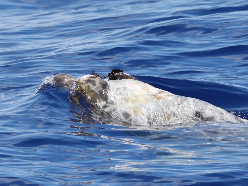
Kaua‘i field project - August 2026
August 25, 2026
Researchers from Cascadia Research Collective are conducting a 9-day field session off Kaua'i to deploy LIMPET satellite tags on odontocete cetaceans prior to a Submarine Command Course (SCC) to be able to examine their behavior before, during, and after the training event. Click on the image below to see daily updates from the field.
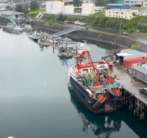
Killer Whale Ecotype Study (KWEST) kicks off
July 27, 2026
Research scientists from the University of Washington and NOAA recently departed from Kodiak, AK aboard the R/V Aquila for a 2-month research cruise focused on distinct groups of killer whales, or ecotypes, that hunt different prey and travel in different parts of the Gulf of Alaska.
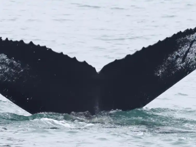
Happy Whale Humpback Happenings
June 22, 2026
A few interesting matches have come out of our Mid-Atlantic Humpback Whale Catalog efforts and partnership with Happy Whale!
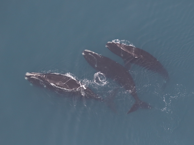
2024-2025 Large Whale Season Summary
March 24, 2025
We have two separate efforts focusing on cetaceans off the coast of Virginia. The first is our Offshore (Outer Continental Shelf) Cetacean Study, which focuses primarily on deep diving odontocetes like sperm whales. The second effort is our Nearshore and Mid-Shelf Baleen Whale Monitoring Project.
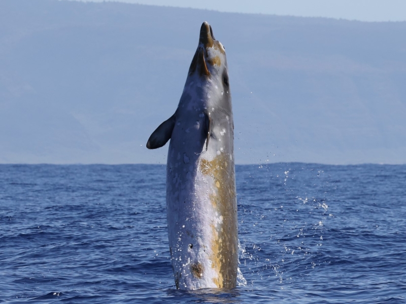
Kaua'i Field Work Updates
February 20, 2025
Scientists from Cascadia Research Collective recently completed a ~9-day field project off Kaua’i that started on February 9th. This project is timed to occur prior to a Submarine Command Course (SCC) training event. The primary goal is to deploy satellite telemetry tags on multiple species of odontocete cetaceans prior to the SCC, to be able to examine their behavior before, during, and after the event. This approach has been very successful in the past as a way of examining how different species respond to Navy training activities including mid-frequency active sonar (MFAS). Click through the picture below to see daily updates.
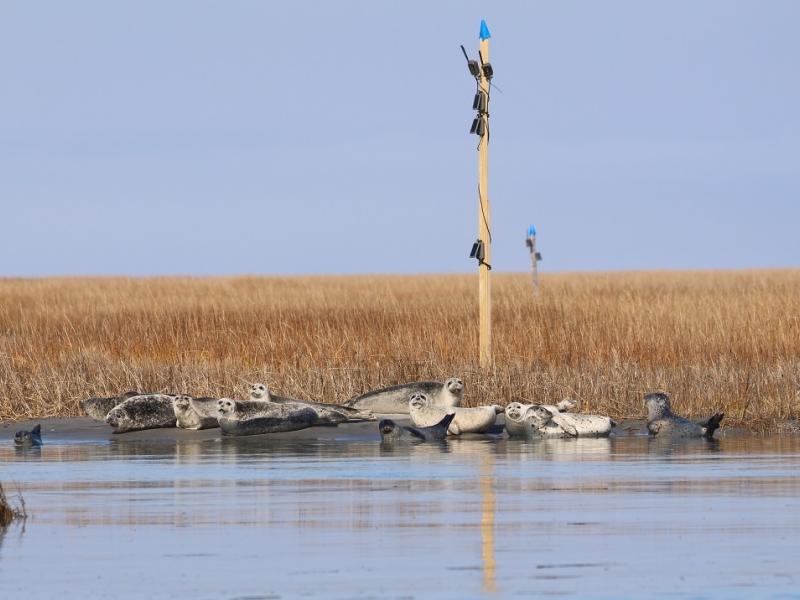
Winter is here in Virginia, and so are the seals!
January 21, 2025
NAVFAC LANT researchers are back at it for the 11th field season of monitoring gray and harbor seals at two major haul-out locations in southeastern Virginia.
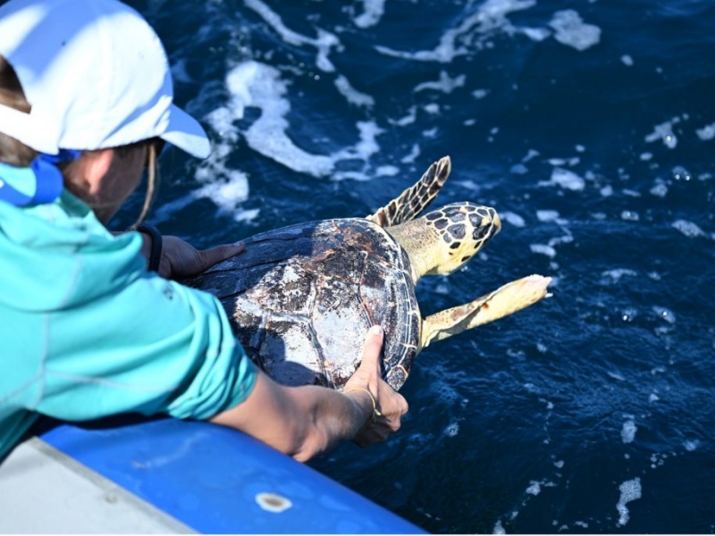
First Satellite Tag Deployments for Atlantic BRS 2024
July 8, 2024
In June 2024, a Duke University team initiated the Atlantic Behavioral Response Study (BRS) by deploying satellite-linked dive recorders on goose-beaked whales (Cuvier's beaked whales) off the coast of North Carolina. These tags collect data on the whales' diving behavior and locations, enhancing understanding of their baseline activities. Additionally, the team released a rehabilitated hawksbill sea turtle named Bagheera back into the Atlantic Ocean.
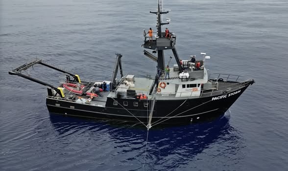
Mesoplodon mysterioso
June 13, 2024
We are thrilled to be part of the "Mystery Mesoplodon Expedition" off the west coast of Baja California searching for an elusive new species of beaked whale. Read about the initial discovery and stay tuned for updates on this exciting expedition!
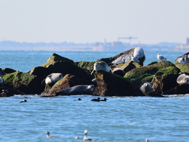
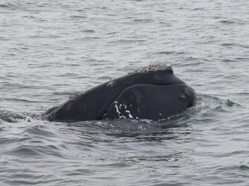
It’s Whale Season in the Mid-Atlantic!
November 20, 2023
Baleen whale season has started in the mid-Atlantic and we have several projects in the region studying their occurrence and behavior.
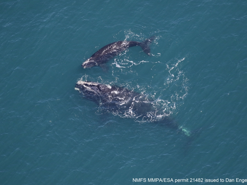
Coming full circle – right whale mom returns with calf
March 15, 2023
Previously CATS tagged Right whale "Smoke" is sighted again in VA with a calf.
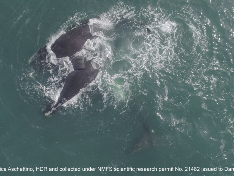
Right Whale Party in the Mid-Atlantic
February 4, 2023
A Surface Active Group of North Atlantic right whales off the coast of Virginia.
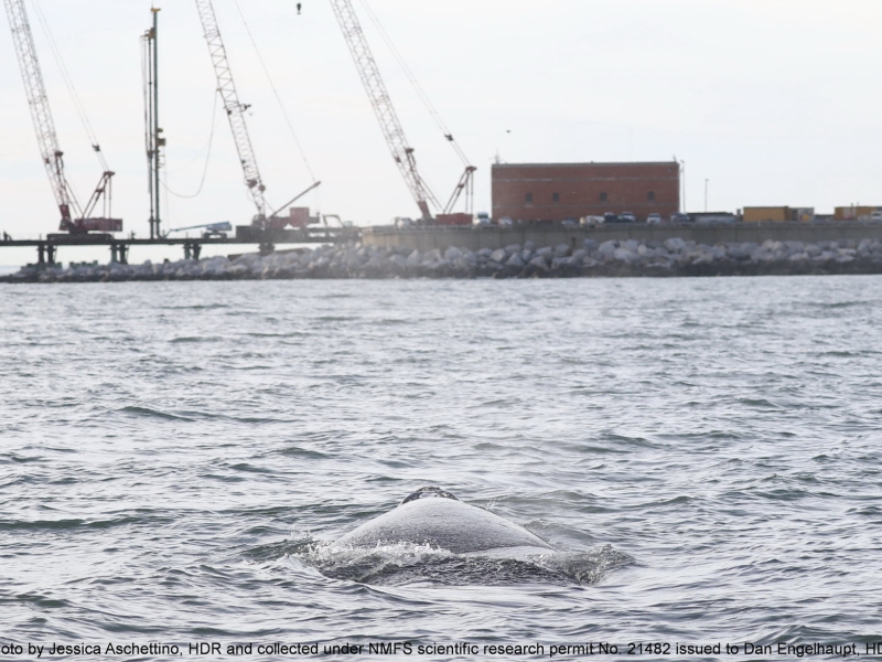
An Urban Whale
February 3, 2023
A juvenile North Atlantic right whale finds itself in a busy area.
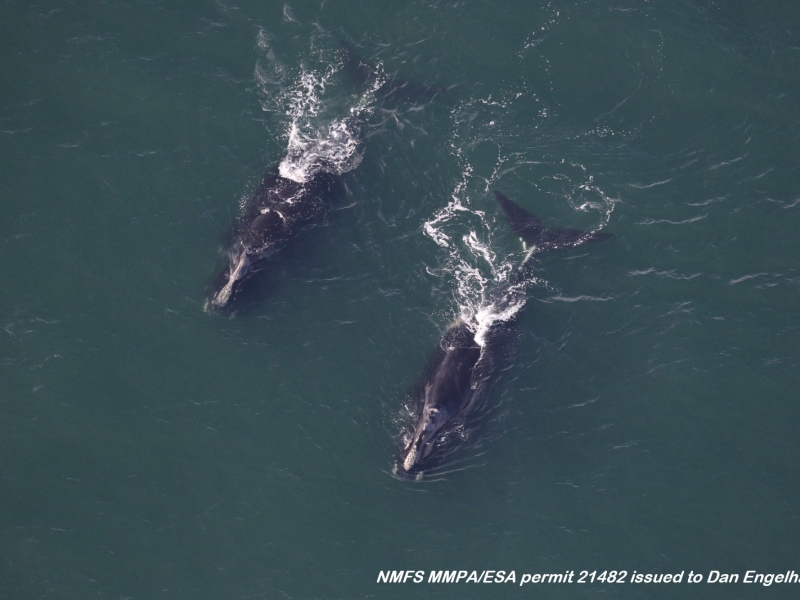
Right whales are on the move!
November 23, 2022
Two female right whales were sighted off Virginia during their southbound migration.
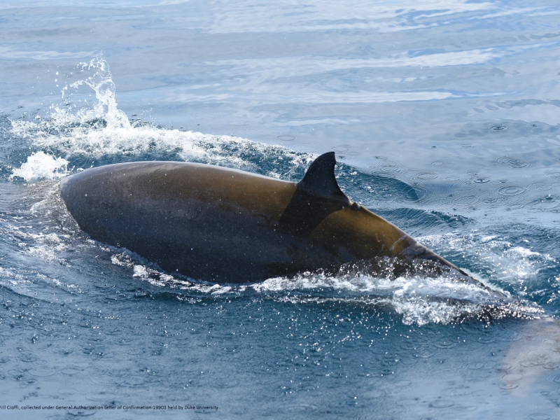
Cuvier's from Cape to Canyon
September 16, 2022
Photo ID match of a Goose-beaked whale between Cape Hatteras and Virginia Beach after two years.
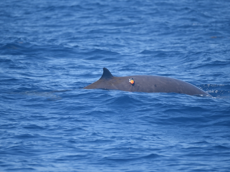
Atlantic BRS – 2022 CEE with the USS Farragut
August 26, 2022
A controlled exposure success story using a Navy ship.
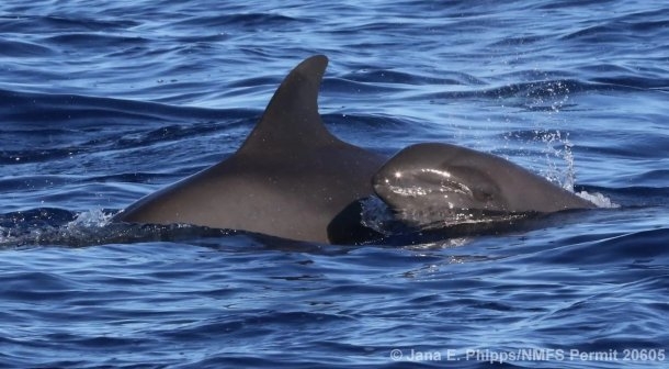
August 2022 Kaua‘i Field Project
August 18, 2022
Cascadia Research Collective began an 8-10 day field project off Kaua’i starting on August 16th. This project is timed to occur prior to a Submarine Command Course (SCC). Their primary goal is to deploy LIMPET satellite tags on one or more species of odontocete cetaceans prior to the SCC, to be able to examine their behavior before, during, and after the SCC. This approach has been very successful in the past as a way of examining how different species respond to Navy training activities including mid-frequency active sonar.
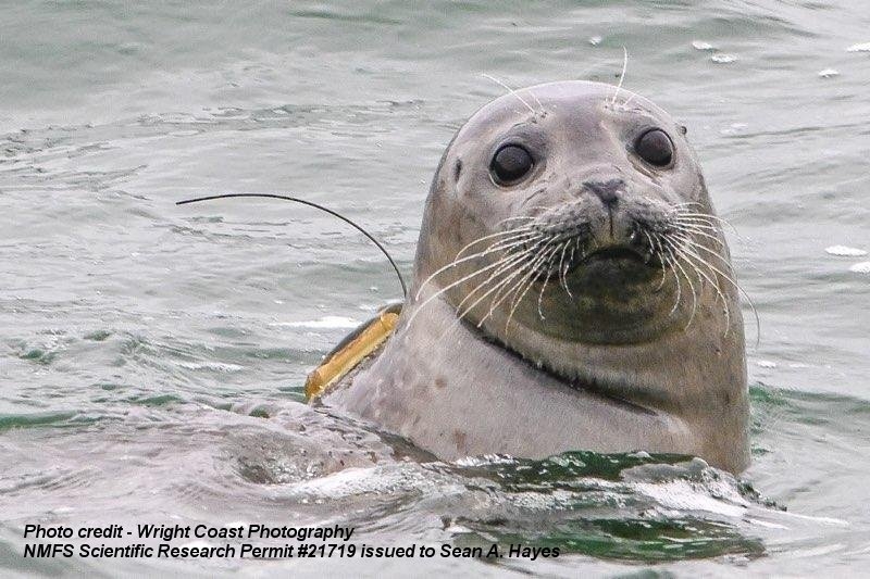
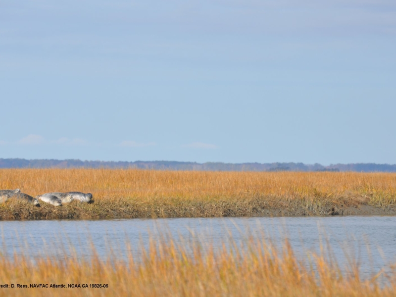
Pinniped season has begun in SE Virginia
October 27, 2021
Camera traps have been installed to track seals in Virginia.
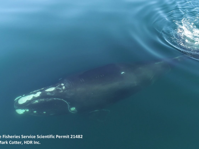
Tracking an endangered North Atlantic right whale
March 15, 2021
A yearling right whale was tagged off the coast of VA and tracked for 12 days.
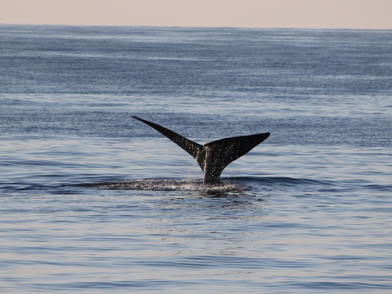
Fantastic video of an encounter with North Atlantic right whales off the coast of Virginia Beach
January 27, 2021
Footage of three right whales off Virginia.
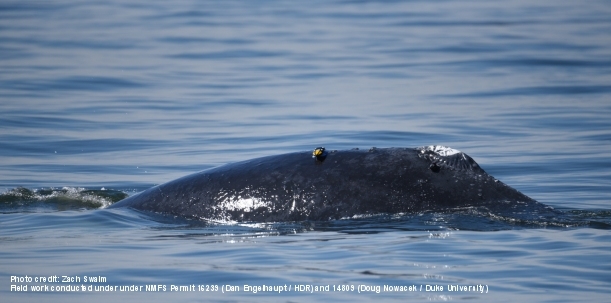
One whale tagged twice.
March 8, 2019
D-tag and limpet tag on a humpback whale.
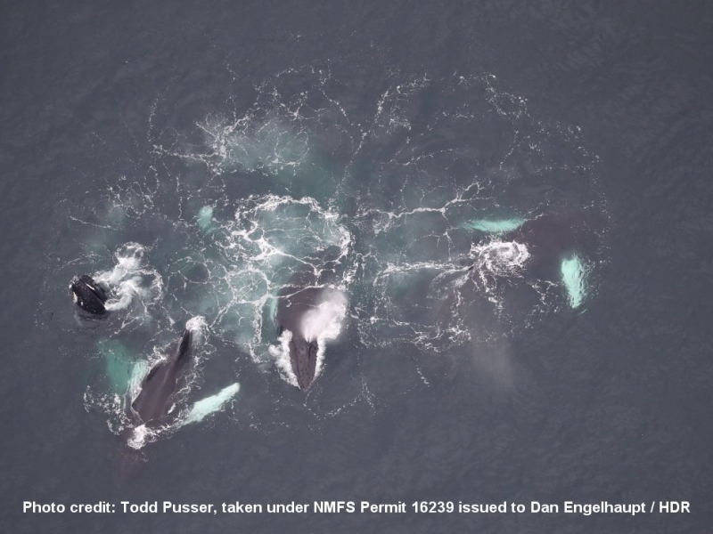
Blue whales and sei whales and right whales - OH MY!!!
April 18, 2018
A spring aggregation of endangered whales offshore.
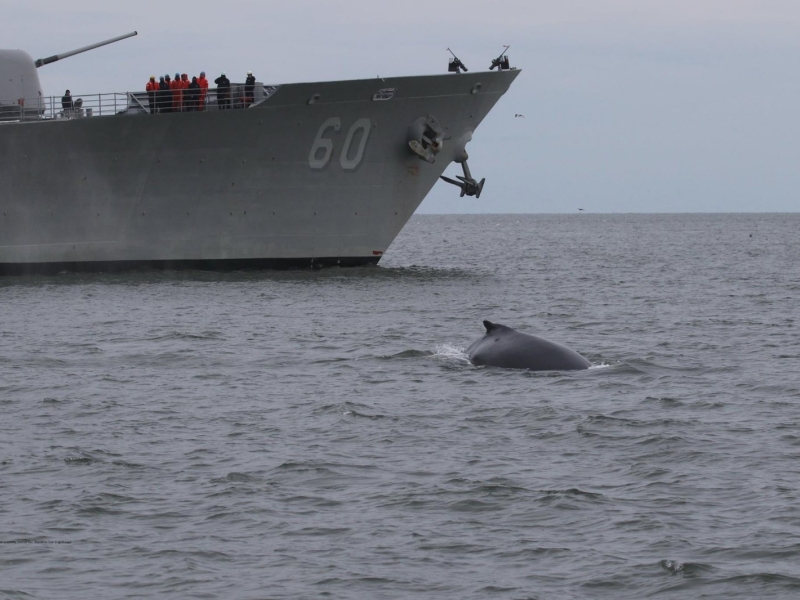
Repeat tagging customers to humpback monitoring project
January 30, 2018
Some interesting notes on site fidelity in Humpack whales.
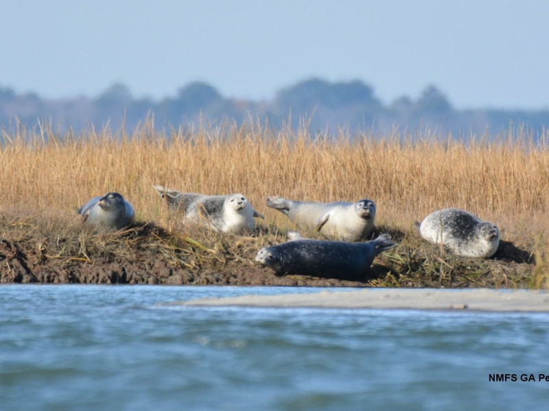
First Harbor Seal Haul-Out Survey of the Season in Virginia
December 19, 2017
Seals have arrived in Virginia
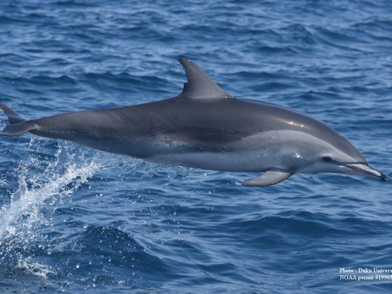
Banner day tagging odontocetes at Hatteras!
June 1, 2016
A busy field day in NC.
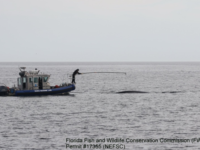
Tagging North Atlantic Right Whales
May 9, 2016
Southeast US tagging project has successful season.
Seals of Rhode Island and Virginia
February 17, 2016
Two projects studying harbor seals on the east coast.
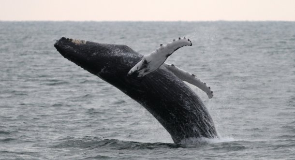
Tagging Atlantic Humpbacks
January 8, 2016
Year two of our Chesapeake Bay humpback whale project has begun!
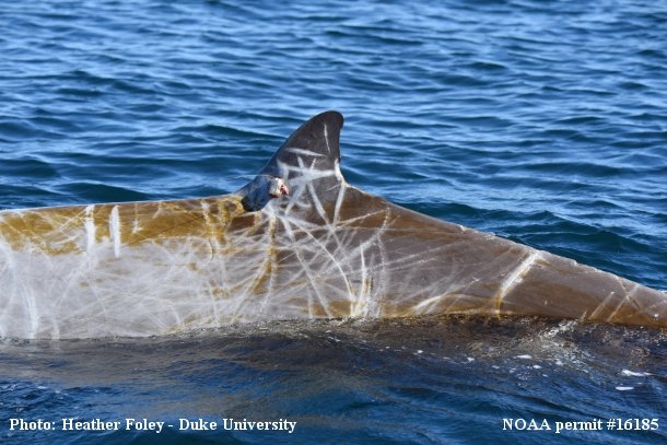
Hatteras tagging wraps up for 2015
November 10, 2015
The finale of a successful field season.
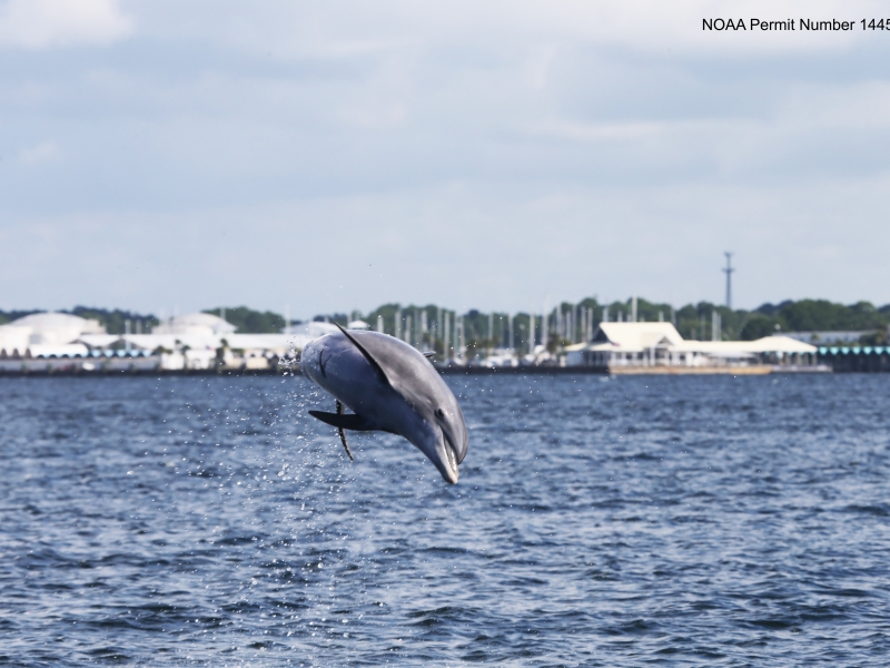
Panama City Dolphin Survey Complete!
August 12, 2015
Bottlenose dolphin photo ID efforts in Florida
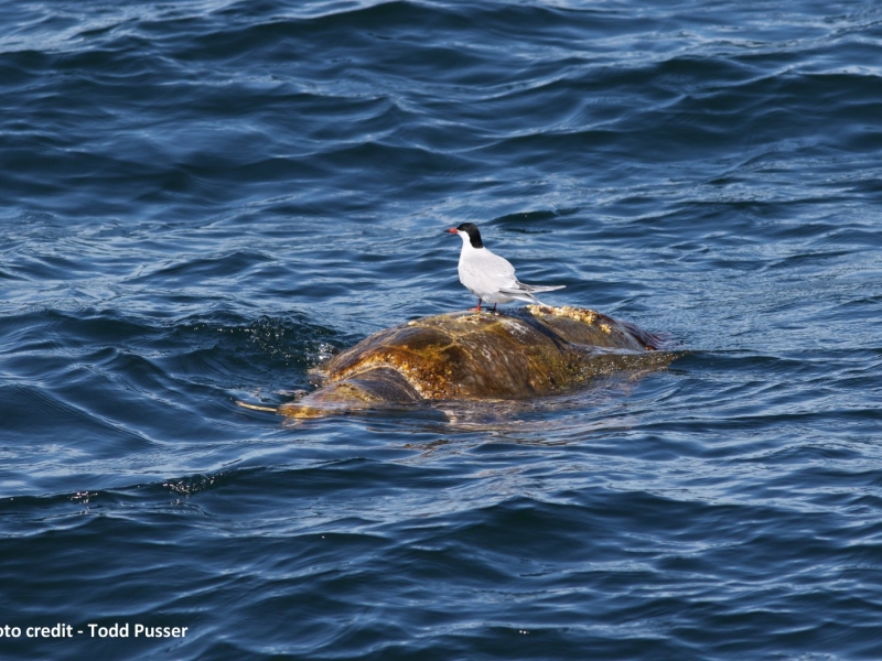
Great Day for a Mid-Atlantic Offshore Survey
April 20, 2015
Pelagic cetaceans and sea turtle sightings.
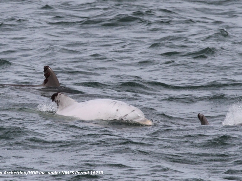
White “Leucistic” Bottlenose Dolphin Seen on Marine Mammal Survey
October 30, 2014
Leucism, like albinism, is a genetic condition that results in a lack of pigmentation in the skin.
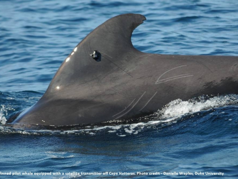
Tagging Deep Diving Odontocetes Off Cape Hatteras - Part 3
September 26, 2014
Details on the 3rd field session for the year.
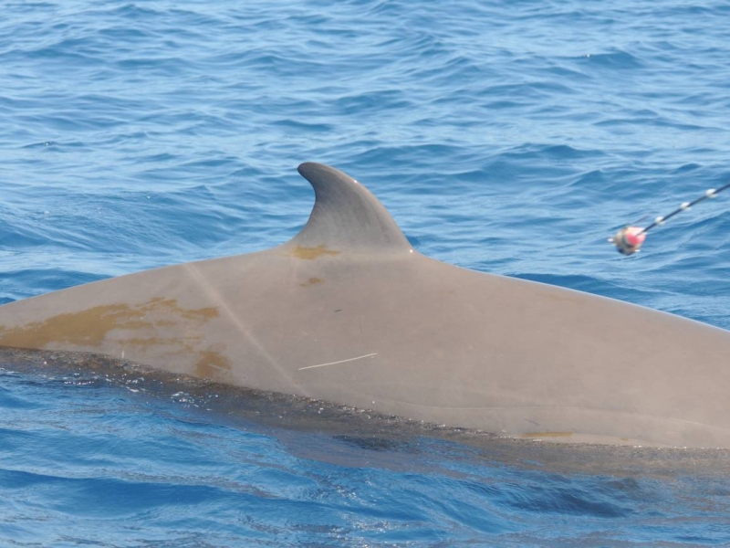
Tagging Whales Off Cape Hatteras
May 21, 2014
Learning about the movements of odontocetes.
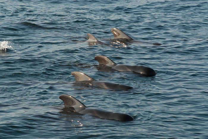
Cape Hatteras Field Work Update
October 28, 2013
Calm days at sea off NC.
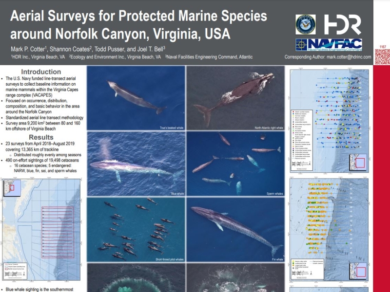
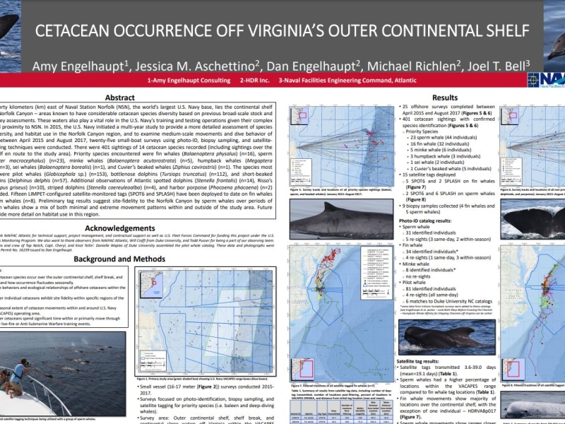
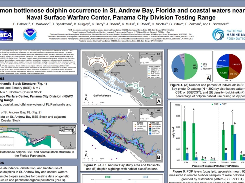
The goals of this study were to determine seasonal abundance, habitat use, and distribution patterns of dolphins in St. Andrew Bay and adjacent coastal waters.
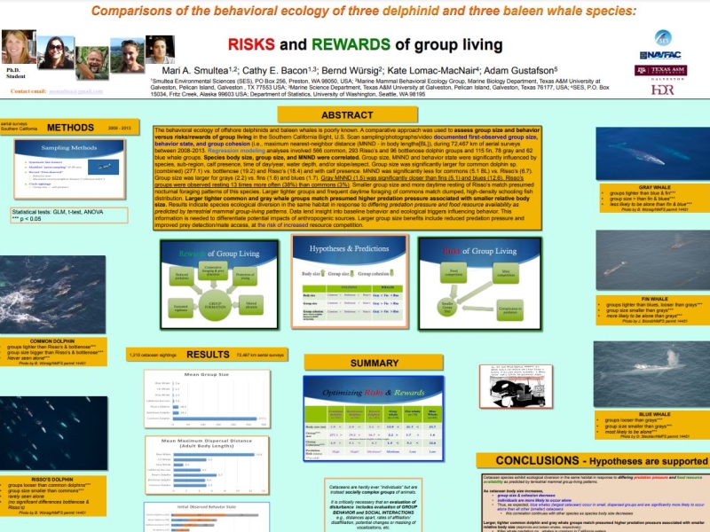
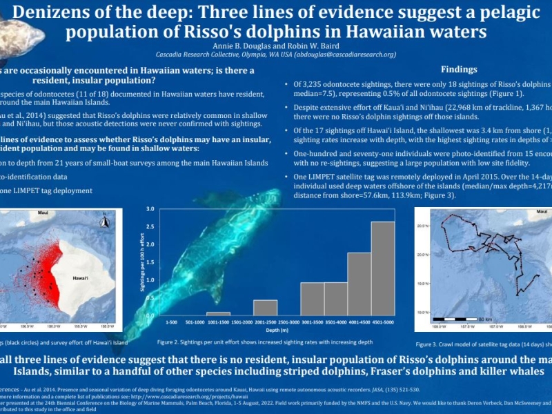
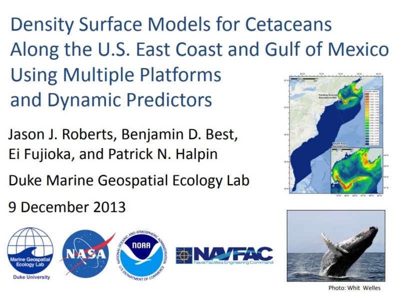
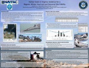
Harbor seal distribution along the United States (U.S.) Atlantic coast appears to be expanding. During the fall of 2014, we began an investigation of harbor seal presence in the lower Chesapeake Bay, VA (Figure 1). The study is ongoing
in 2017-2018…